Drones in Vietnam
Drone Rules in Vietnam for Travellers (2026): Permits, No‑Fly Zones, Mini Drones & Fines
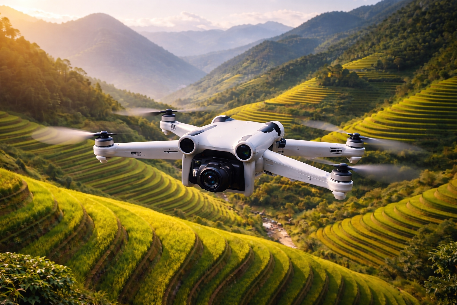
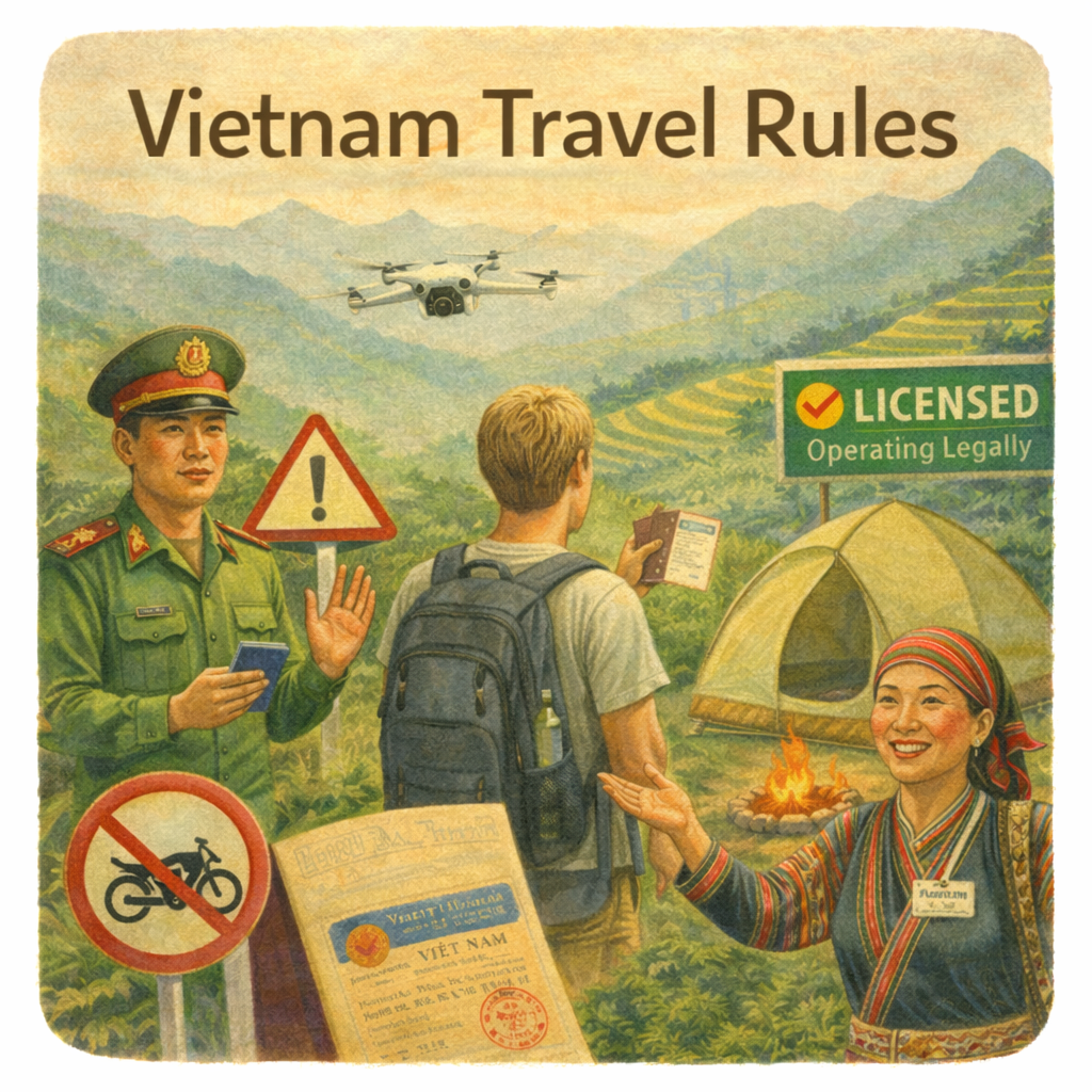
Flying a drone in Vietnam can be an incredible way to capture mountains, cities, and coastlines. If you’re planning to capture the northern mountains, consider joining one of our guided trekking experiences in Sapa to explore responsibly with local hosts. However, the country has strict aviation and defence regulations, and most flights require permission. This guide explains the key rules for travellers in 2026 in clear, practical terms.
Quick answer: can I fly a sub-250g drone in Vietnam?
Vietnam classifies drones by weight. The most important threshold for travellers is under 0.25kg (250g).
A recreational drone under 250g may be exempt from needing a flight permit if it is operated outside restricted or prohibited areas. However, you may still need to notify local authorities if the flight could affect aviation or military activity.
Drones weighing 250g and above require a permit. This is the standard compliance route for most travellers.
The official no-fly and restricted map
Vietnam publishes official no-fly and restricted flight areas through a government map portal. These zones can include military areas, borders, major infrastructure, and other sensitive locations. Travellers exploring the border regions of northern Vietnam should be especially careful, as many areas are sensitive and may require special permissions.
Travellers should always check the official map before flying. Some restricted coordinates are not openly published, so the official portal or permit application process is the best way to confirm whether a location is allowed.
If the map cannot be accessed, travellers should verify through official channels before operating.
https://cambay.mod.gov.vn/ is the official Vietnamese government map portal that shows drone no-fly and restricted airspace zones across the country.
Here’s what it is in simple terms:
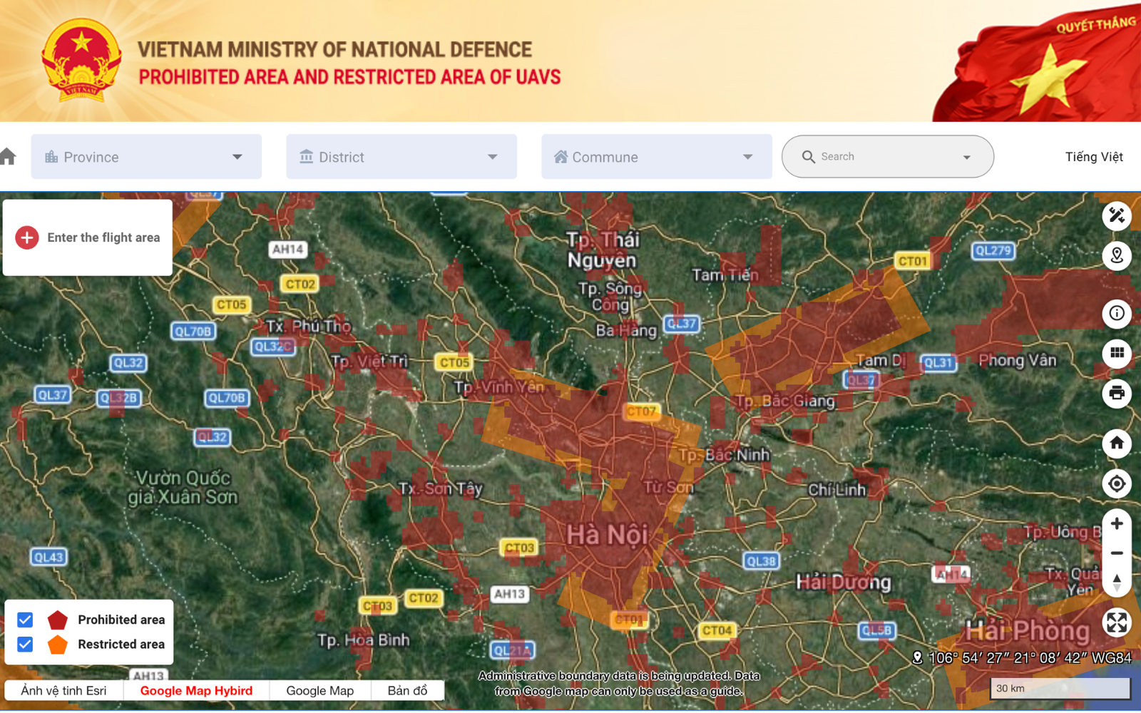
What the site is
It’s an online map run by Vietnam’s Ministry of National Defence.
It displays areas where drones (UAVs/flycams) are:
Completely prohibited
Restricted
Sensitive and require permission
It was publicly launched in June 2025 to help people check where drones can legally fly.
Why it exists
The government created it so:
Pilots, travellers, and companies can check flight locations before flying
Authorities can manage and monitor drone activity
People can avoid flying in military zones, airports, and security areas
What you can do on the site
On the map, you can:
Search by location or province
View no-fly and restricted zones
Draw or upload coordinates to check if your planned flight area is allowed
See details like altitude limits and boundaries
How it’s used in practice
Before flying a drone in Vietnam, you’re expected to:
Open the map
Check your exact flight location
See if it’s in a restricted or prohibited zone
Apply for a permit if needed
The database is officially maintained and updated periodically as part of national airspace management.
In short
It’s basically Vietnam’s official “Can I fly my drone here?” map — the main tool authorities expect you to check before flying.
When you need a flight permit
As a baseline rule, Vietnam requires permission for most drone flights unless clearly exempt.
You will typically need a permit if:
Your drone weighs 250g or more
You plan to film or conduct commercial work
You want to fly in a restricted area
Your flight could affect aviation or security
Permits are mission-specific. They include approved coordinates, altitude limits, dates, and purpose.
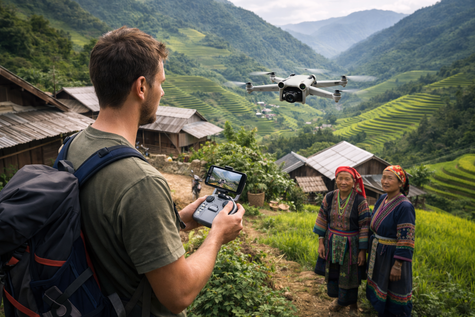
How foreigners can apply
Foreign travellers operating drones in Vietnam must usually have a Vietnamese sponsor or guarantor. This can be an organisation or a Vietnamese individual.
To apply for a permit, prepare:
Operator identity details
Drone specifications and photos
Flight area coordinates
Purpose and dates
Submit the application at least 7 working days before the flight. If the operation requires a NOTAM (aviation notice), apply at least 12 working days in advance.
Applications are typically handled through the National Public Service Portal and the military operations authority.
When working with local hosts and guides, it is important to ensure all filming permissions are arranged in advance.
Altitude and airspace safety in practice
Permits define altitude limits and operating conditions.
Key practical triggers include:
Flights at 50m or higher may require advance coordination with authorities
Flights above 200m may require additional monitoring
Restricted airspace concepts include limits around 120m in sensitive zones
Always follow the altitude specified in your permit and avoid flying higher without approval.
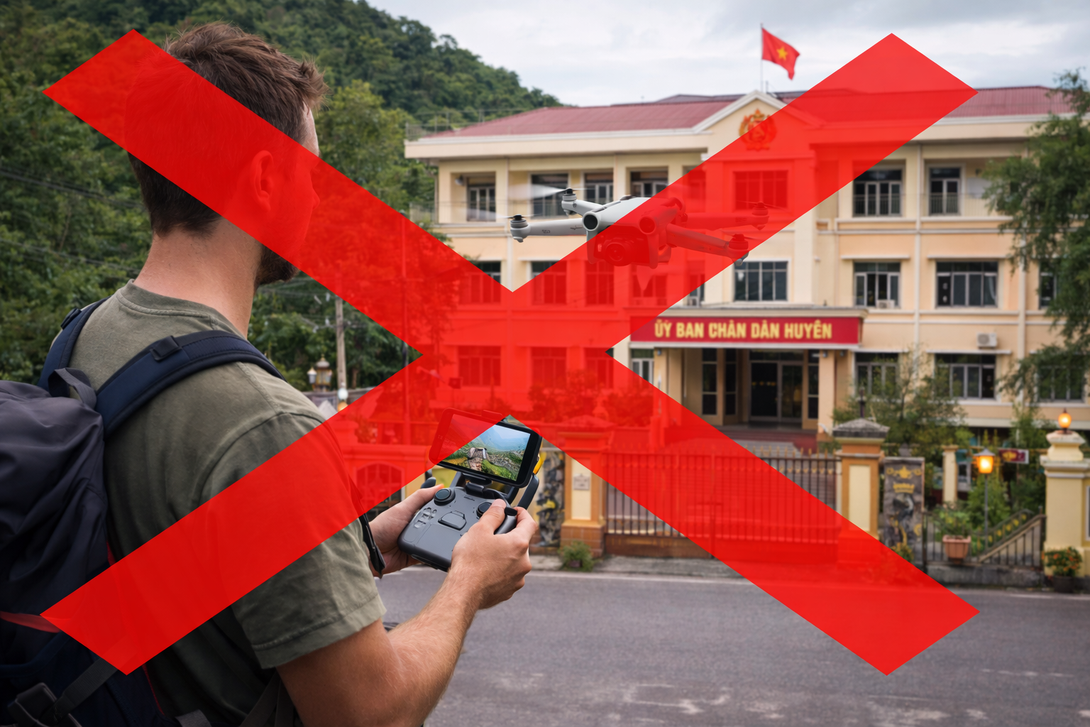
Airports, borders, and sensitive locations
Certain areas are especially sensitive and strictly controlled. These include:
Airports and surrounding zones
Border regions
Military installations
Government and critical infrastructure sites
From 1 July 2026, illegal drone use at airports and adjacent areas is explicitly treated as a prohibited aviation act under amended civil aviation law.
Penalties and what can happen if you get it wrong
Vietnam enforces drone laws through administrative fines and other measures. Examples include:
Filming or photographing from the air without permission: about 8–9 million VND fine
Flying outside permit conditions (time, place, or altitude): about 9–12 million VND fine
Operating without a required permit: about 20–30 million VND fine
Authorities may also confiscate equipment in certain cases.
Responsible flying in Vietnam
Many of our community-based cultural experiences in Sapa take place in sacred landscapes, so we always encourage visitors to ask permission before flying. Beyond legal compliance, travellers should follow responsible flying practices:
Respect privacy and local communities
Avoid crowds and sacred sites
Protect wildlife and nature
Keep a safe distance from people and buildings
Low-impact, respectful flying helps ensure visitors can continue to enjoy drone photography in Vietnam.

Important 2026 dates to know
Two major regulatory changes take effect on 1st July 2026:
Additional operator licence conditions may apply to drones weighing 250g or more
Stronger aviation law enforcement around airports and nearby areas
Travellers with heavier drones should plan ahead and expect stricter compliance requirements.
If you’re visiting Sapa or the northern highlands and would like to experience the region respectfully, ETHOS Spirit offers small-group, community-led treks and cultural journeys. We prioritise low-impact travel and deep cultural understanding in every experience.
Click here to read more about essential travel tips and regulations for travelling in Vietnam.