Insights and Stories from Sapa and the Northern Borderbelt provinces of Vietnam.

Riding Vietnam’s Remote North-West: Lai Chau, Dien Bien Phu and Son La by Motorbike
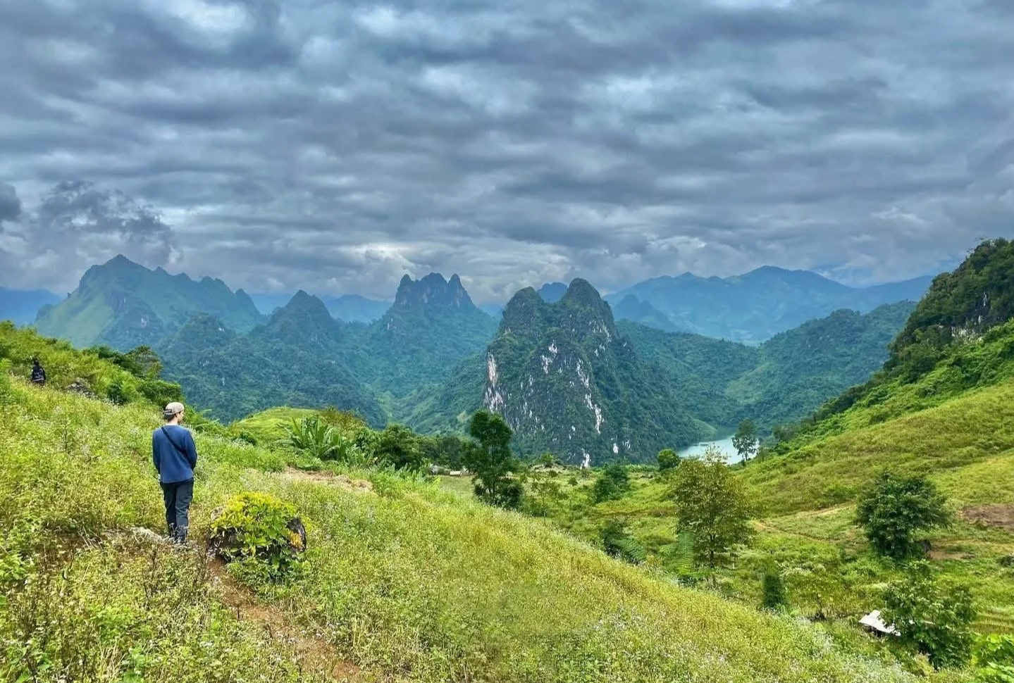
Explore Vietnam’s remote north-west by motorbike, riding through Lai Chau, Dien Bien Phu and Son La where roads are quieter, terrain is more demanding, and travel moves at a different pace. This is a region shaped by distance and real riding conditions, offering an alternative to the crowded Ha Giang Loop for those seeking a more grounded and responsible journey.
Beyond Sapa: Where the Roads Become the Journey
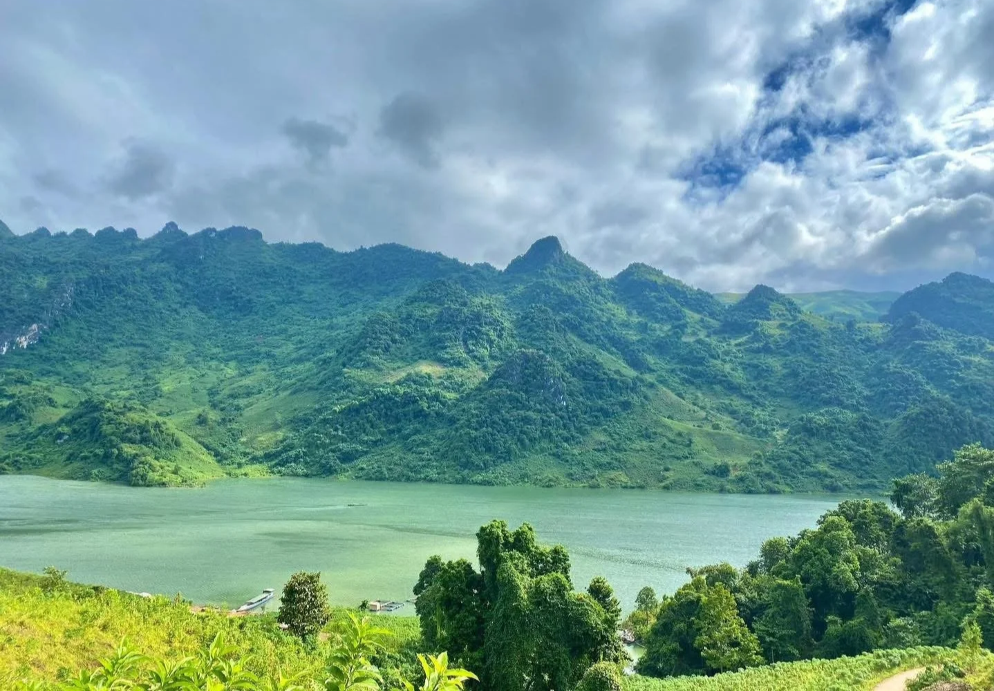
Once you leave the orbit of Sapa and head west, the nature of travel changes quickly. The provinces of Lai Chau, Dien Bien Phu, and Son La are defined not by viewpoints or fixed routes, but by the road itself. Green tea plantations dominate before giving way to rubber trees, karst peaks and great lakes.
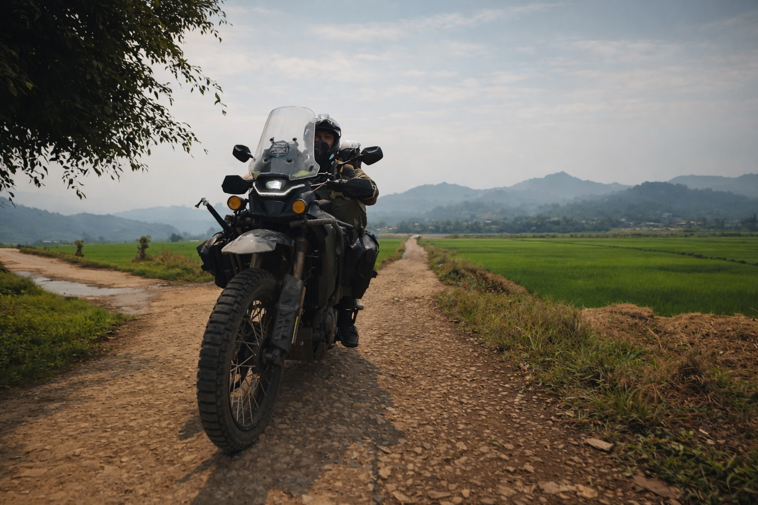
In this part of northern Vietnam, the motorbike is not a novelty, but the dominant form of transport, used daily across both cities and rural areas. there are still many villages that cannot be reached by any orher mode of transport and that is why around 87% of households own a motorbike. The motorcycle remains the most practical way to move through mountainous terrain where public transport is limited or absent. The more remote you go, that reality becomes even more apparent. Without a bike, access is restricted. With one, the landscape opens fully, but only if you are prepared to ride it properly.
Riding a motorbike in North Vietnam is not passive travel. Instead, the weather and roads dictate the pace, and the terrain requires constant attention.
Before going further, it is worth taking a moment to consider what kind of riding experience you are looking for. The north-west is not designed for quick routes or high-volume travel. It rewards preparation, patience, and a willingness to adapt to conditions as they are. For those wanting to understand how we approach riding in this region, our motorbike journeys are shaped around these same principles, with routes and pace built around the landscape rather than fixed expectations.
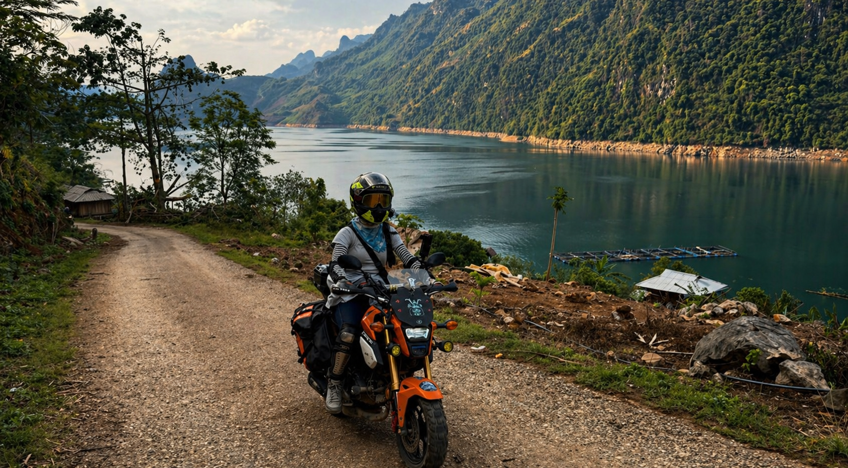
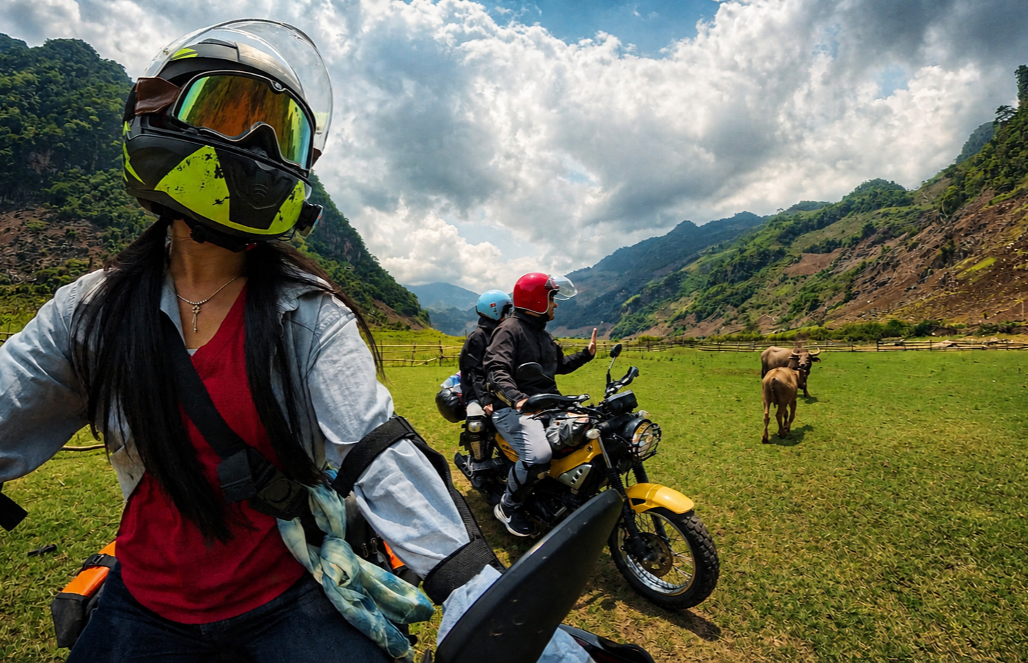
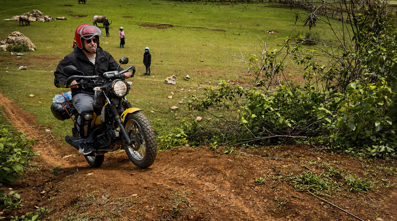
Adventure Riding in Son La Province
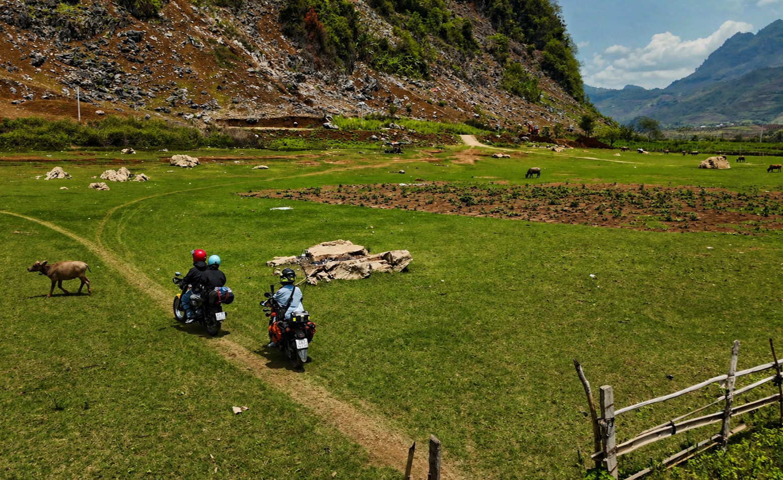
Choosing the trails in rural Lai Chau
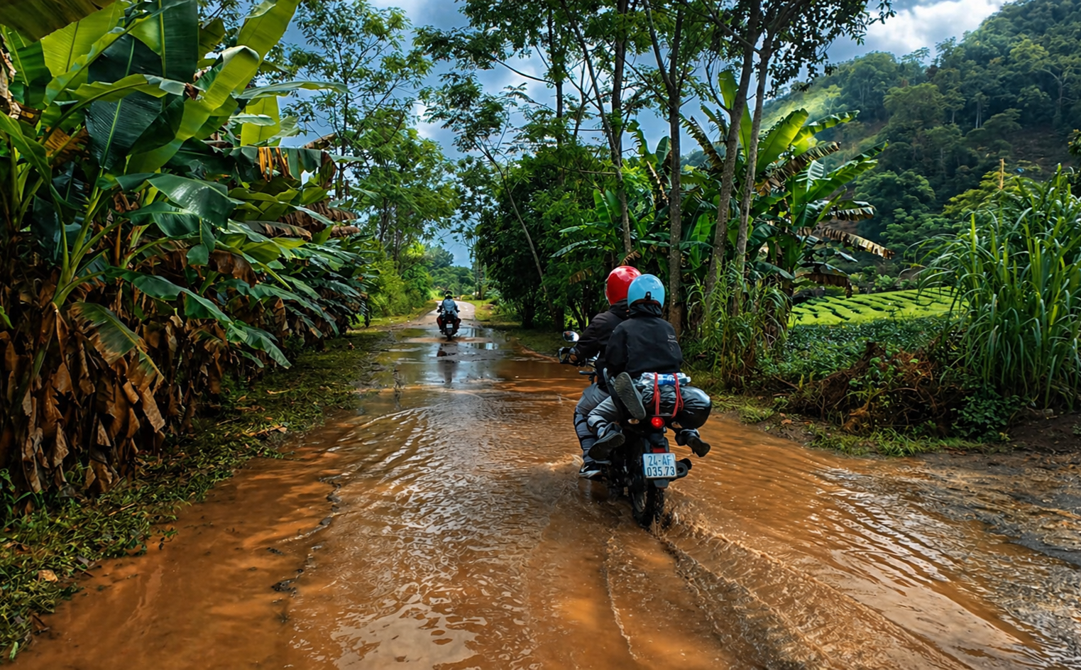
Flooded road sections after seasonal rains in Son La Province.
Why These Provinces Remain Rarely Visited by Riders
Lai Chau, Dien Bien, and Son La are rarely visited, not because they are hidden, but because they demand more from anyone travelling through them. Distances are significant, and road conditions reduce average speeds to a level that makes even short routes time-consuming. Surfaces vary constantly, fuel stops are irregular, and mechanical support is limited outside larger towns.
Navigation cannot be fully outsourced to a device. Mapping is inconsistent, signage is minimal, and routes often depend on current local conditions rather than fixed directions. Weather adds another layer of complexity, particularly during the wet season when landslides, mud, and reduced visibility can change a route within hours. In many regions, there is little to no English spoken, while in some really remote areas, there might not be spoken Vietnamese either. Accomodation is few and far between, meaning camping and local homes are often the only option. These are not barriers in themselves, but they are filters. They shape who comes, and how they travel. They are also reasons why visiting with an experienced guide team assures travellers get the most out of the area.
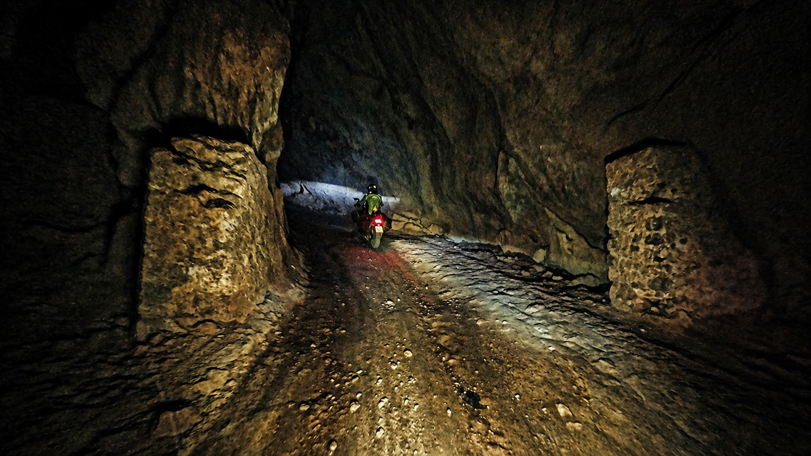
Road through underground road system
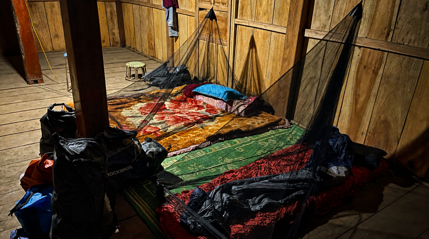
Basic homestay accomodation in Dien Bien
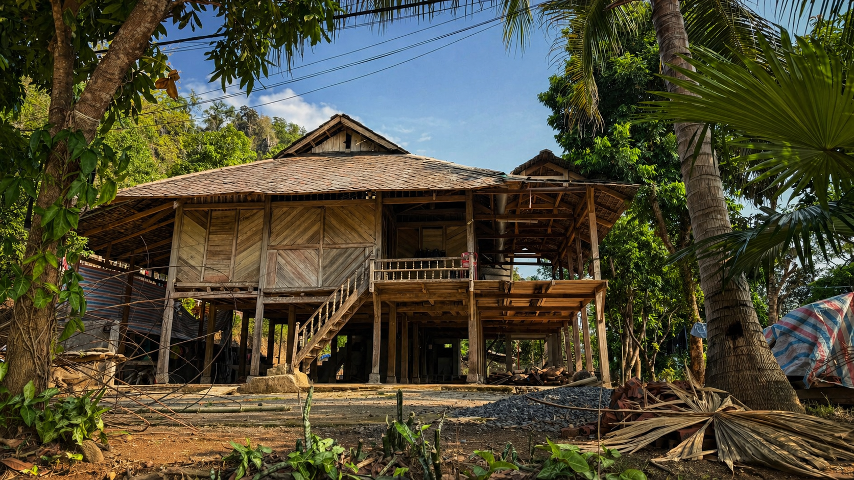
ETHOS homestay in Lai Chau
A Different Riding Ethos to Ha Giang
The contrast with Ha Giang is important, because it highlights what this region is not becoming.
Ha Giang has seen rapid growth in motorbike tourism, driven by short loop itineraries and high-volume operators. The result is a concentration of riders moving through the same routes, often within tight timeframes. The roads themselves remain technically challenging, yet the riding environment has shifted due to the volume and behaviour of traffic. Large groups, inconsistent riding ability, and a growing party-driven travel culture have introduced unnecessary risk into an already demanding landscape. This has also begun to affect local communities, where noise, alcohol, and unmanaged tourism activity can disrupt daily life.
Lai Chau, Dien Bien Phu, and Son La have not followed this pattern. There is no simplified loop, no standardised three-day circuit, and no infrastructure built around volume. Travel here is more dispersed, less predictable, and harder to scale. All of this creates a totally different kind of riding environment. Roads are quieter and primarily used for local movement rather than tourism flow. Riders are fewer, groups are smaller, and the pace is set by conditions rather than expectation.
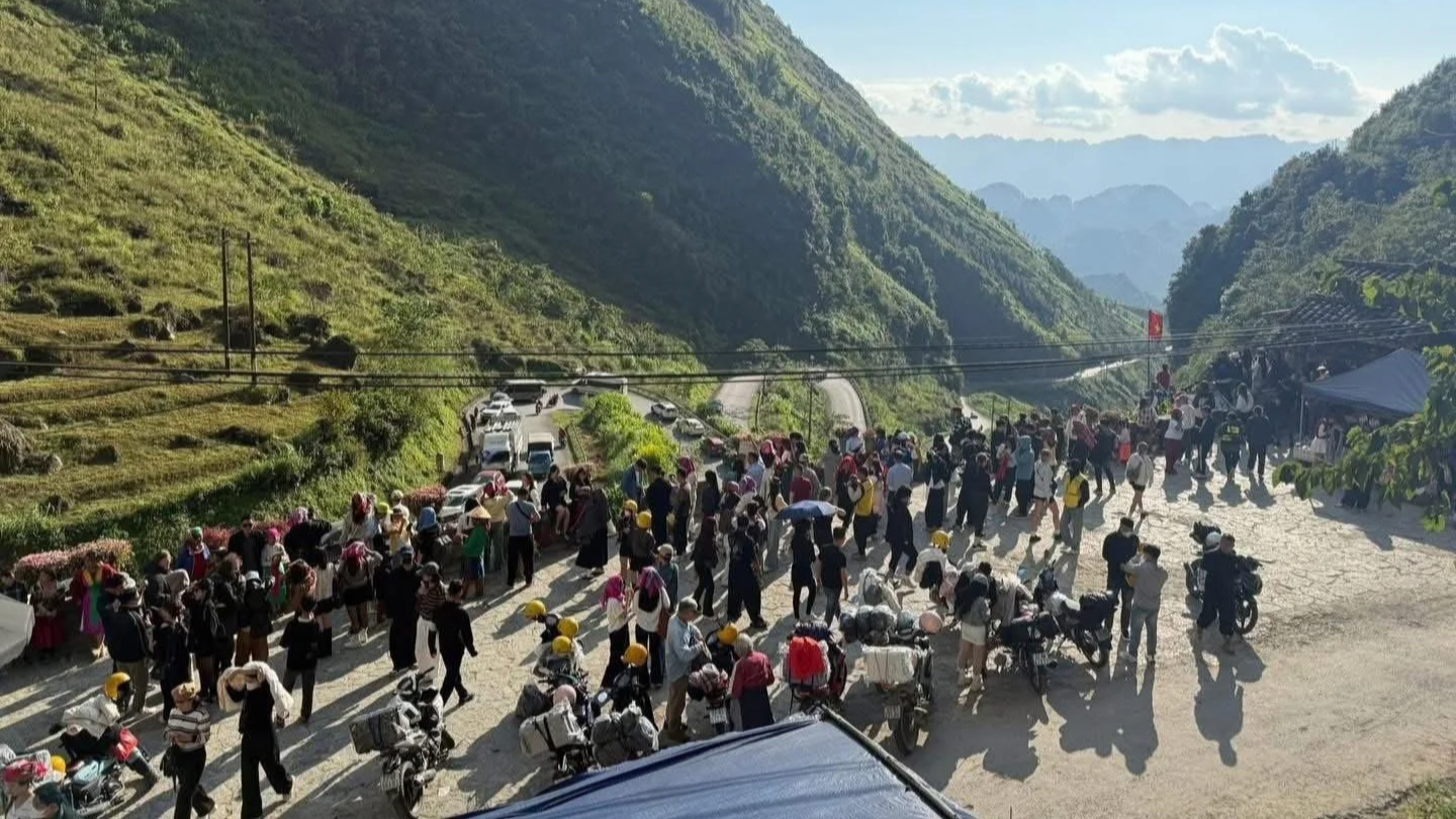
Large group tours quickly turn to crowds in Ha Giang
Quiet roads in Dien Bien Province
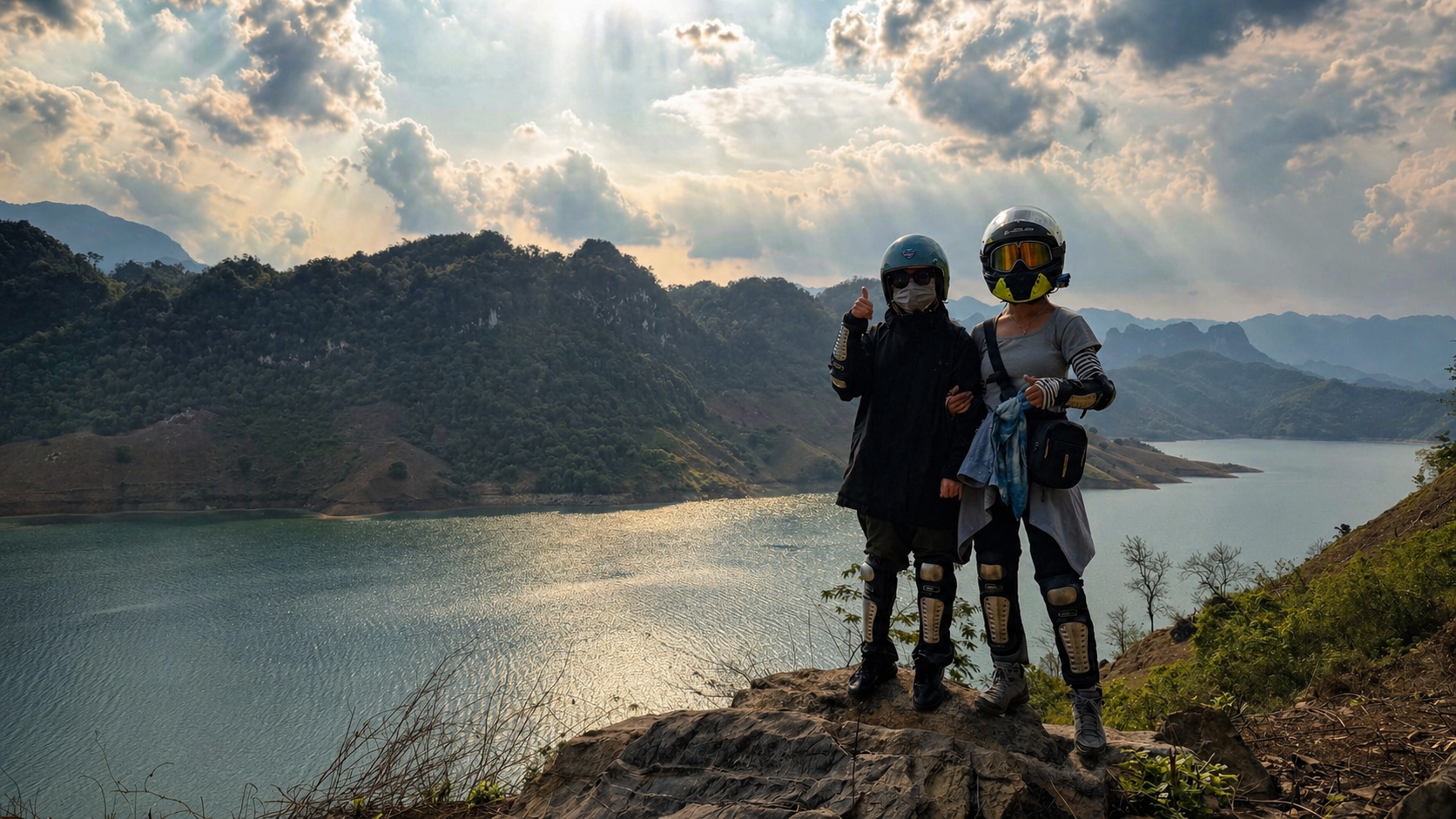
Scenery without crowds on a multi-day road trip.
Riding Conditions Across the Region
The riding across these provinces is defined by constant variation. Surfaces move between smooth asphalt, broken tarmac, gravel, and compacted dirt, often within a single stretch of road. Corners are tight and frequent, with steep gradients and limited protection in many areas.
Lai Chau presents high mountain passes and long exposed sections where traffic is minimal and conditions can change rapidly. Routes into and out of Dien Bien Phu involve sustained climbs and descents, while Son La combines wider valley roads with narrower mountain links between smaller settlements.
Average speeds remain low. Riding here is not about covering distance efficiently, it is about maintaining control and responding to the terrain as it unfolds. The scenery is varied, spectacular and undoubtedly some of the best anywhere in Vietnam.
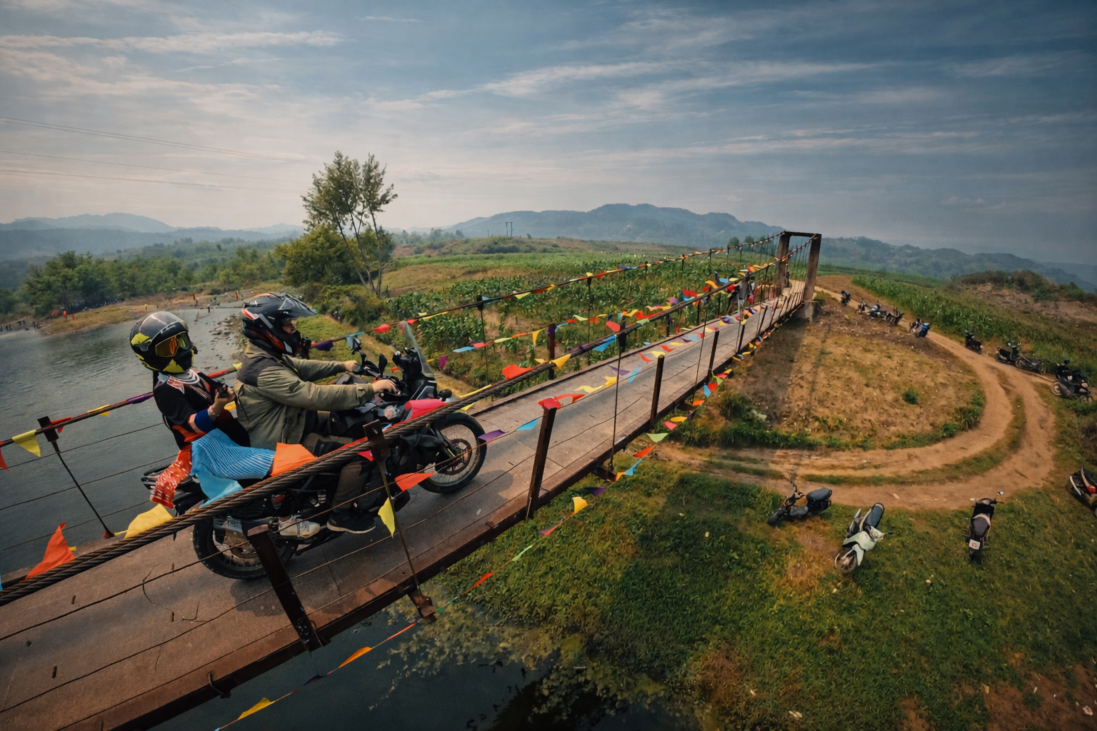
Suspension bridge crossing in Lai Chau.
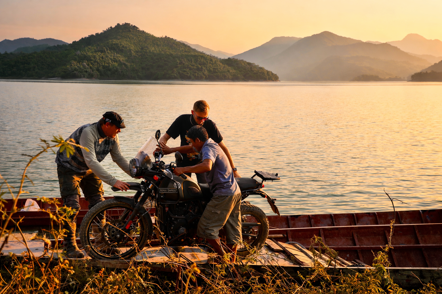
Navigating the region frequently requires local ferries.
Off-road riding in Son La
Cultural Landscapes Seen from the Saddle
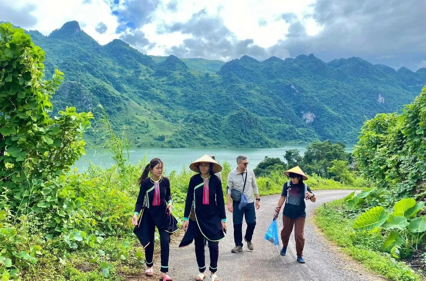
Motorbiking through this region means moving through working environments rather than designated destinations. Roads pass through farmland, villages, and shared community spaces. Livestock, children, agricultural vehicles, and pedestrians all form part of the road environment.
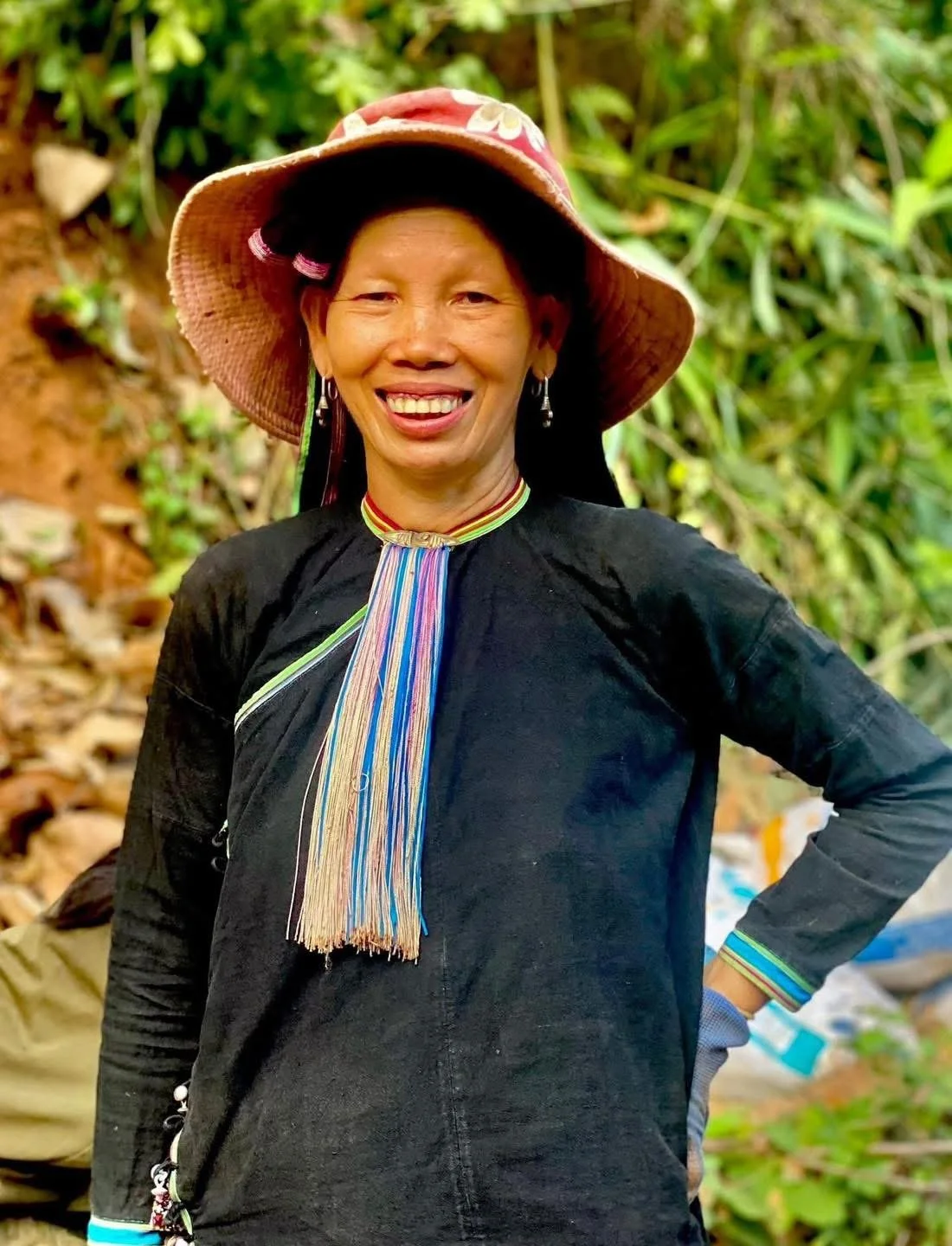
The region is home to diverse ethnic communities including Hmong, Dao, and Thai groups. Settlements vary in structure and layout, but all are closely tied to the land around them.
Stops are not staged experiences. They happen when needed, for fuel, food, or rest, and often bring riders into direct contact with local households or small roadside businesses. Interaction is practical and unstructured, shaped by the moment rather than planned in advance.

Thai women in Son La

Lan Tien girl in Dien Bien Phu Province
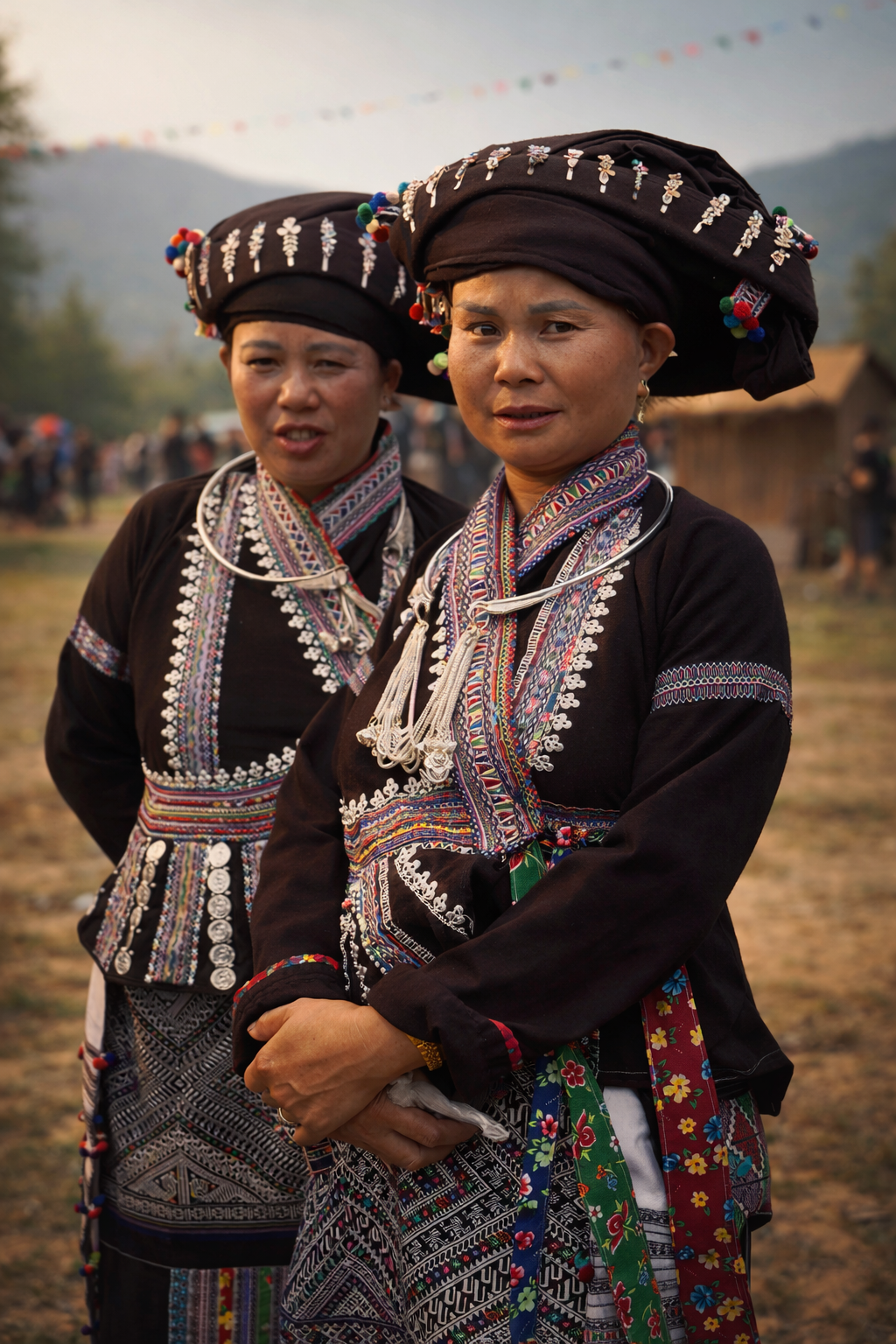
Lao women in Lai Chau
Why This Region Suits Experienced Riders
This is a demanding riding environment that requires both technical skill and awareness. Riders need to be comfortable with mixed surfaces, steep descents, and unpredictable hazards. Braking control, line selection, and the ability to read terrain quickly are essential.
Motorbiking in northern Vietnam is often described as exhilarating, yet it is equally about restraint. We emphasise that this kind of travel is not about chasing speed or adrenaline, but about trusting the terrain and riding within it. In the north-west, that balance becomes critical.
Mechanical awareness is also necessary as a practical requirement. Minor issues can escalate quickly in remote areas, and riders need to manage their bike with a degree of independence. Travelling with a knowlege of how to field repair is very useful.
How ETHOS Motorbike Adventures Work
ETHOS approaches motorbike travel as a combination of riding, local knowledge, and community connection. Journeys are developed in collaboration with local partners, including Hmong and other ethnic community members, ensuring that routes are both viable and respectful. Groups are intentionally small. Each ride is led by experienced guides and supported by local riders who understand the terrain, the conditions, and the communities along the route.
The structure of each day reflects the realities of the environment. Riding is steady and controlled, with flexibility built in to adapt to weather and road conditions. Stops are purposeful, allowing time within villages or with local families where appropriate, rather than treating the landscape as something to pass through quickly.
Accommodation is arranged in small homestays or camping depending on location. Facilities are simple, but they provide what is needed for recovery and continuation. This approach reflects a broader philosophy. Motorbiking is not treated as an isolated activity, but as part of a wider cultural and environmental context.
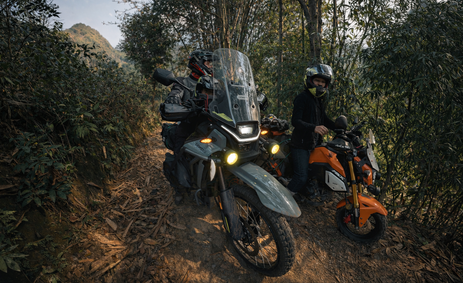
Off Road riding in Son La
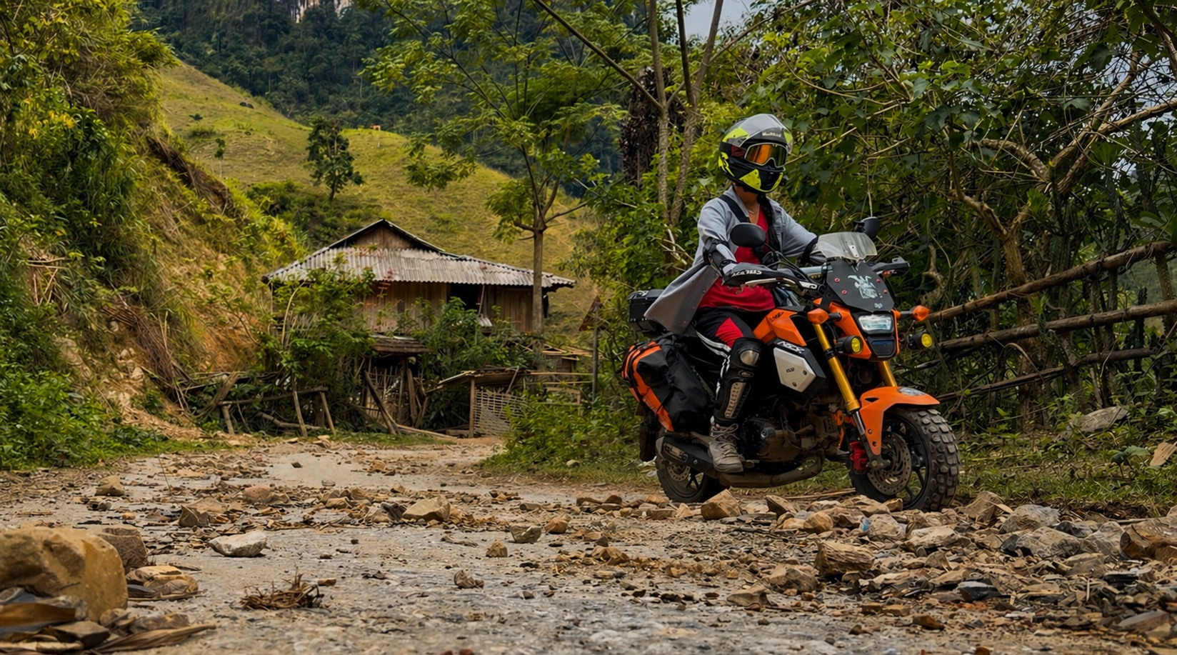
Mixed road conditions in Lai Chau
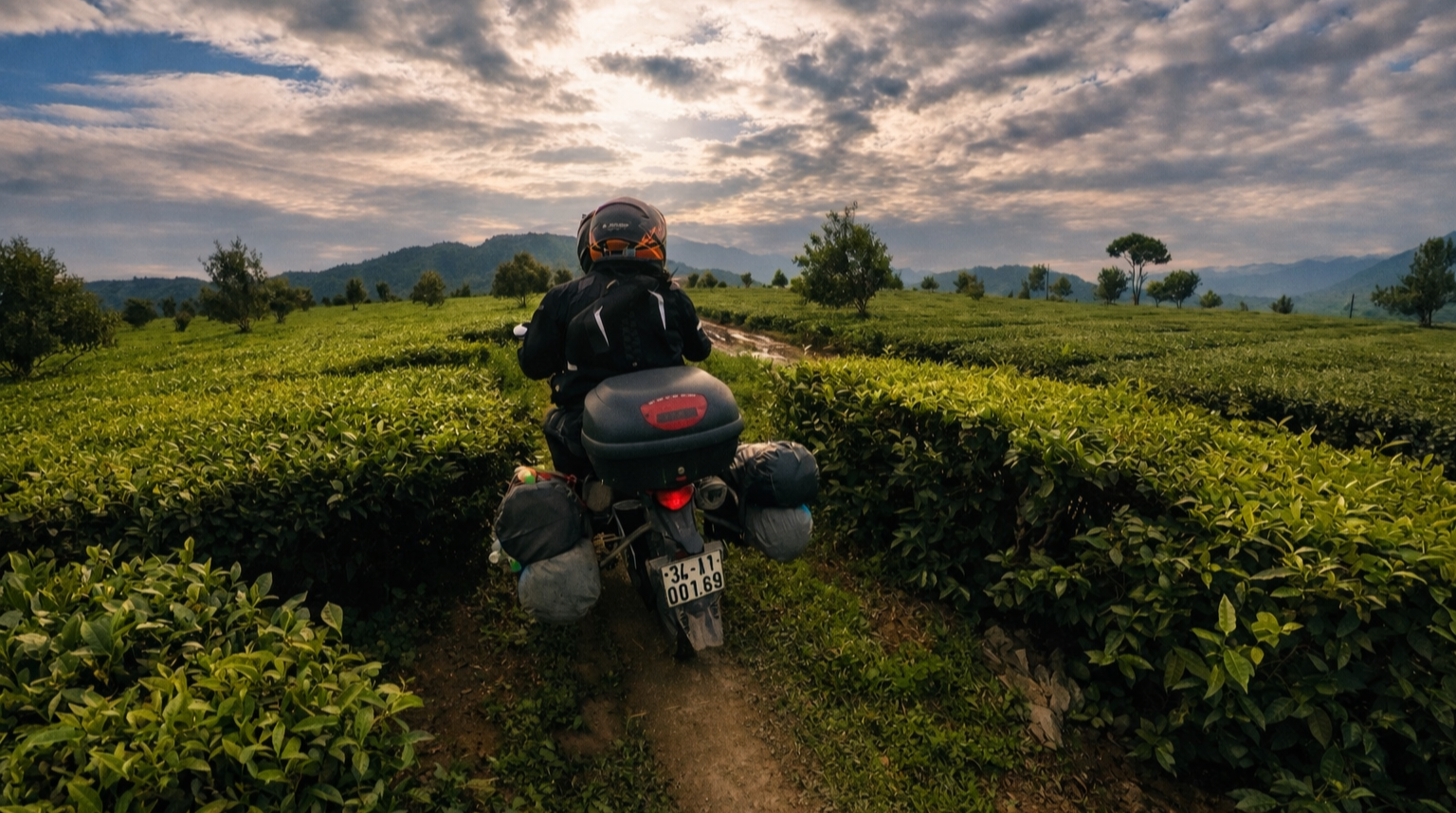
Lai Chau green tea plantations
Route Length: Four to Seven Days on the Road
Travelling through Lai Chau, Dien Bien Phu, and Son La requires time. A four-day route allows for entry into the region and traversal of key roads, though it involves longer days and less flexibility. Five to seven days is a more effective timeframe. It allows for epic riding days, better adaptation to conditions, and the ability to move further into remote areas without unnecessary pressure.
Longer routes also reduce the need to rush, which is particularly important in a region where conditions can change quickly and where riding well matters more than covering distance.
Riding Legally and Responsibly in Vietnam’s North-West
Motorbiking in Vietnam is often presented as informal or loosely regulated, yet the legal framework is clear, and enforcement is increasing, particularly in northern regions. Riders travelling through Lai Chau, Dien Bien Phu, and Son La should approach the journey with a full understanding of what is required.
A valid motorbike licence from your home country is not sufficient on its own. You must hold either a Vietnamese licence or a valid International Driving Permit that corresponds to the correct motorbike category. Without this, you are not legally permitted to ride, and insurance coverage is unlikely to apply in the event of an incident.
Helmet use is mandatory, and standards matter. Basic or low-quality helmets, often provided with rental bikes, may not offer meaningful protection. Riders should ensure they are using properly fitted, certified helmets suitable for long-distance riding.
Traffic laws in Vietnam are actively enforced, including speed limits, drink-driving regulations, and documentation checks. In more remote provinces, enforcement can be less visible, yet this should not be interpreted as flexibility. Riding within legal limits and maintaining full documentation is essential, particularly given the distances involved and the limited access to assistance if something goes wrong.
Road conditions themselves demand a disciplined approach. Overtaking on blind corners, excessive speed on descents, or riding beyond your level of control introduces significant risk, not only to the rider but to others using the road. In rural areas, the road is shared space, used by pedestrians, livestock, and local vehicles that operate according to different rhythms and expectations.
ETHOS operates within these realities. All riders are briefed clearly before departure, documentation is checked, and expectations are set around safe and lawful riding. There is no tolerance for alcohol while riding, and no pressure to keep pace beyond individual ability. The focus is on control, awareness, and consistency rather than performance.
This approach reflects a simple principle. Riding in Vietnam’s north-west is a privilege that depends on respect, for the law, for the road, and for the communities who live alongside it. Maintaining that respect is what allows access to remain open and meaningful over time.

Vietnam’s Hidden Tectonic Power: Faults, Fire and Rising Mountains
Northern Vietnam’s dramatic landscapes around Sapa and Mount Fansipan were shaped by the powerful Ailao Shan Red River Fault. This article explains how the fault formed, why hot springs exist in Lai Châu Province, and what geological risks the region faces today.
High above the rice terraces and mist filled valleys of Sapa rises Mount Fansipan, the tallest peak in Vietnam. Its dramatic slopes and rugged skyline are not the product of volcanic fire, but of immense tectonic forces that reshaped Southeast Asia millions of years ago. Beneath the beauty of northern Vietnam lies the Ailao Shan Red River Fault, a vast fracture in the Earth’s crust born from the collision of continents. This deep geological engine lifted ancient rocks into the sky, fractured the mountains and created the conditions for earthquakes and natural hot springs that still define the region today.
The Ailao Shan Red River Fault, Sapa and Mount Fansipan
Northern Vietnam is home to some of the most spectacular mountain scenery in Southeast Asia. The landscapes around Sapa, the towering summit of Mount Fansipan and the scattered hot springs of Lai Châu Province all share a common origin. They are products of the Ailao Shan Red River Fault, one of the most important tectonic structures in the region.
Understanding this fault helps explain not only the dramatic topography of the Hoàng Liên Sơn range, but also the level of earthquake risk and geothermal activity found across northern Vietnam.
If you are planning a trip to the region, you may also want to read our guide to Things to Do in Sapa and our detailed overview of Northern Vietnam Travel Planning.
What Is the Ailao Shan Red River Fault?
A fault is a fracture in the Earth’s crust along which movement has occurred. That movement is caused by tectonic forces, meaning forces related to the movement and interaction of lithospheric plates. The Ailao Shan Red River Fault, often called the Song Hong Fault in Vietnam, is a major strike slip fault system that runs from eastern Tibet through Yunnan in China and into northern Vietnam before extending towards the Gulf of Tonkin. It trends roughly northwest to southeast and marks a deep zone of crustal weakness.
The fault developed during the collision between the Indian and Eurasian plates, a process that began around 50 million years ago. Between about 30 and 15 million years ago, enormous sideways movement occurred along this zone, shifting blocks of crust by hundreds of kilometres. Although movement today is much slower, the fault remains active and continues to accommodate gradual crustal deformation.
Where Does the Fault Run in Relation to Sapa?
Sapa lies within the Hoàng Liên Sơn mountain range in Lào Cai Province, near the border with China. It does not sit directly on the main strand of the Red River Fault, but it lies within the broader shear zone associated with it. This deformation belt is tens of kilometres wide and contains numerous secondary faults and fractures.
These smaller structures are important because they control both earthquake activity and groundwater flow. The wider region, including Lai Châu and Điện Biên provinces, experiences occasional moderate earthquakes, typically in the magnitude 4 to 5 range. Larger events are possible but far less common than along major global plate boundaries.
If you are considering trekking in the region, our Sapa Trekking Guide explains the terrain, elevation and landscape in more detail.
Why Are There Hot Springs Around Sapa and Lai Châu?
One of the most intriguing features of the region is the presence of hot springs in and around Sapa and across Lai Châu Province. These springs are not volcanic in origin. Instead, they are controlled by fault related hydrothermal circulation.
Rainwater from the high mountains infiltrates fractured bedrock and travels downwards along fault planes. As it descends several kilometres into the crust, temperatures increase naturally with depth. Northern Vietnam has a moderately elevated geothermal gradient due to crustal thickening during the India Asia collision. The heated water then rises back to the surface along permeable fault zones and emerges as hot springs.
This process depends on fractured rock and deep circulation, not on active magma chambers. There is no evidence of present day volcanic systems beneath Sapa.
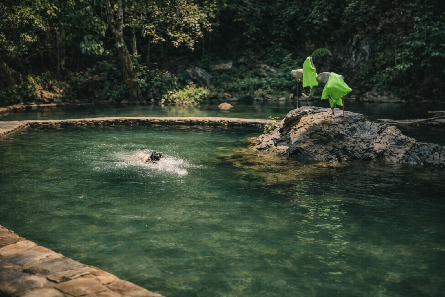
If you are interested in experiencing the geothermal hot springs and cave networks, there are opportunities to visit these locations while on some of our multiday exclusive Motorbike Adventure Loops.
How Mount Fansipan Was Formed
At 3,143 metres, Mount Fansipan is the highest peak in Vietnam. It is not a volcano but an uplifted block of ancient metamorphic and granitic rocks that formed deep within the Earth’s crust hundreds of millions of years ago.
During the India Asia collision, parts of Southeast Asia were squeezed and displaced sideways. The Red River Fault acted as a major structural boundary that allowed crustal blocks to move and, in some areas, to rise. The Hoàng Liên Sơn range, including Fansipan, was uplifted along this tectonic system.
Over millions of years, intense monsoon rainfall, river erosion and landslides sculpted the uplifted block into the steep ridges and valleys seen today. Fansipan’s height reflects crustal thickening and tectonic uplift rather than volcanic construction.
The Wider Geological Setting of Vietnam
Vietnam lies away from a direct plate boundary. The nearest major active boundaries are the Himalayan collision zone far to the west and subduction systems beneath parts of the western Pacific. Northern Vietnam therefore experiences intraplate deformation rather than direct plate boundary activity.
This distinction is important when assessing geological risk. Intraplate faults such as the Red River system typically move more slowly and release energy less dramatically than subduction zones or major transform boundaries like those found in Japan or Indonesia.
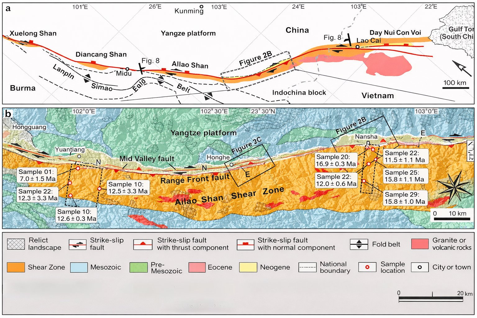
Simplified geologic map of the Ailao Shan-Red River fault (after Harrison et al. [1996] and P. L. Wang et al. [1998]).
What Risks Does the Fault Pose?
The primary geological risks in northern Vietnam are moderate earthquakes and landslides, particularly in steep mountainous terrain around Sapa and Lai Châu. While damaging earthquakes are possible, the likelihood of extremely large magnitude 8 or 9 events is far lower than in regions located directly on major plate boundaries.
Fault systems like the Ailao Shan Red River Fault are generally considered less hazardous than active subduction zones because they accumulate strain at slower rates and over broader areas. That said, they are not risk free. Infrastructure, hillside development and road networks in mountainous areas can be vulnerable to shaking and slope failure.
A Landscape Shaped by Deep Time
The mountains around Sapa, the summit of Mount Fansipan and the region’s hot springs all trace back to the same tectonic engine. The Ailao Shan Red River Fault reshaped the crust of Southeast Asia during the aftermath of the India Asia collision, uplifted ancient rocks and left behind a fractured landscape that still channels heated groundwater to the surface.
Today the region is tectonically alive but comparatively subdued. Its geology offers both natural beauty and manageable geological risk, shaped by millions of years of slow but powerful crustal movement beneath northern Vietnam.

Ready to Explore Sapa?
If this geological story has inspired you, start planning your trip today.
👉 Read our complete Sapa Travel Guide
👉 Discover the best Sapa Trekking Routes
👉 Prepare for your climb with our Mount Fansipan Hiking Guide
Understanding the landscape makes visiting it even more rewarding. Explore wisely, travel prepared and experience one of Vietnam’s most fascinating mountain regions.
Riding the Backroads of Dien Bien Phu
Join us on a four-day motorbike journey through the quiet valleys and hidden trails of Dien Bien Phu. Along the way, we shared meals, stories and moments of connection with the land and its people.
A Journey Beyond the Beaten Path
Over four days we travelled by motorbike through the upland plateaus and quiet valleys west of Sapa. The route led us ast calm lakes, terraced hillsides and small farming communities where life follows the rhythm of the seasons. It was a journey into the heart of the mountains, where every bend in the road revealed something new and beautiful.
Learning from the Land
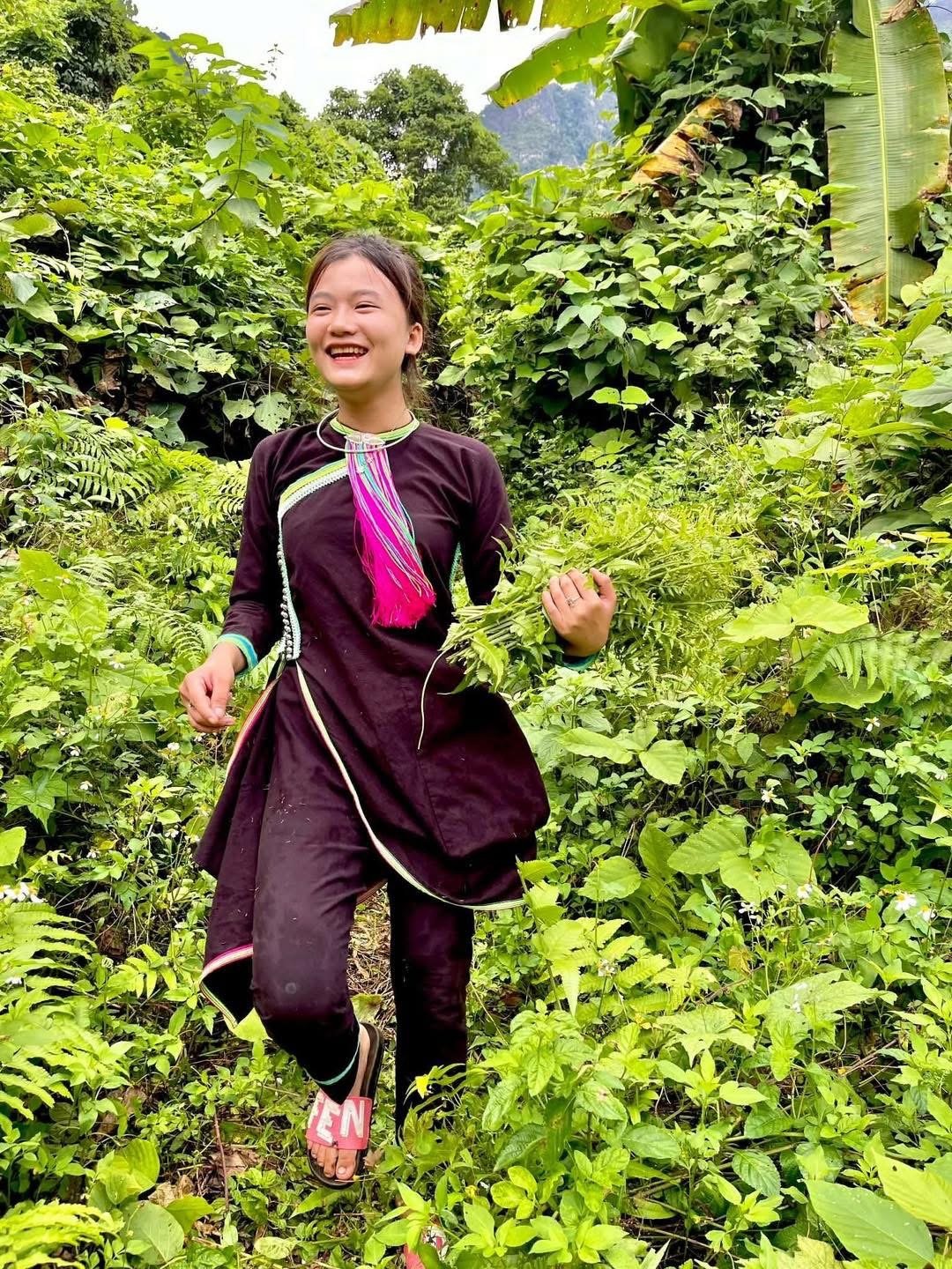
Our local hosts guided us with warmth and patience, stopping often to walk, share food and talk about the land. They showed us how to forage for wild herbs, edible shoots and mountain mushrooms. Each stop uncovered another layer of local knowledge, passed down through generations and shaped by a deep relationship with the forest and fields.
Evenings by the Fire
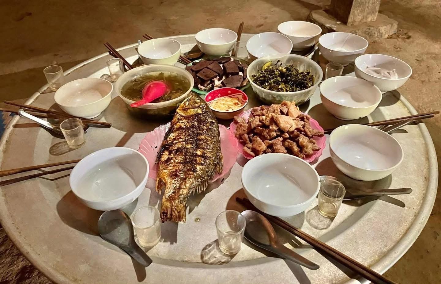
When the day’s riding was done, we gathered beside small fires to share bowls of rice and stories. Conversations flowed in a gentle mix of Hmong, Vietnamese and English. The nights were filled with laughter, soft music and the quiet comfort of companionship under a sky full of stars.
Through the Backroads of Dien Bien Phu
These photographs capture the beginning of that journey through the backroads of Dien Bien Phu. Each image tells a part of the story — of movement, discovery and connection with a landscape that holds both history and peace.
A Smile Across the Mountains
In the misted highlands of Vietnam, two La Hù sisters spent sixteen years apart, their reunion arriving not in person but through a single photograph. This is a story of memory, resilience and love that travelled further than any road.
The Sisters Who Waited for Time to Catch Up
Though separated by less than five miles of steep terrain, sisters Lý Ca Su and Lý Lỳ Chí had not seen one another for over sixteen years. Their final years unfolded in quiet solitude, filled with longing, memory, and the ache of distance. The eldest sister had long since passed away, lost to hunger during a time of great scarcity; a sorrow that lingered in every conversation that followed.
The sisters belonged to the La Hủ ethnic group, one of Vietnam’s smallest and most secluded communities, numbering fewer than ten thousand. For generations, the La Hủ lived as semi-nomadic hunters, following the forest’s rhythm across the misted highlands of the far northwest. Change came suddenly in 1996, when hydroelectric projects and government reforms encouraged the community to settle permanently. The forest paths gave way to villages and fields. The transition was uneasy, as traditions adapted and some, quietly, faded.
A Life Divided by Mountains
Lý Lỳ Chí left her childhood home at seventeen. She married early and settled in a neighbouring valley. For many years, the two sisters would make the long, arduous trek along a narrow mountain path to visit each other, their journeys a thread of connection between ridges. But time is unrelenting. Age weakened their steps, and the trail grew quiet. Sixteen years passed without reunion.
By ninety-three, Lý Ca Su had gone completely blind. Her younger sister, at one hundred and three, could still see, but her hearing had faded almost entirely. With no literacy, there were no letters. With no electricity, no phones. The silence between them stretched impossibly wide.
Progress Arrives Too Late
In 2019, a new road was completed linking their villages. What had once taken days could now be done in two hours. Yet for the sisters, it changed nothing. Neither could ride a motorcycle, and there were no cars or buses. Even electricity remained a rumour. The distance was only five miles, but it might as well have been a hundred.
And still, life has its small mercies.
The Photograph That Crossed Mountains
Two years earlier, photographer Réhahn had taken a portrait of Lý Ca Su. Her face, deeply lined, seemed to hold entire lifetimes. Her smile was gentle; the kind that hums quietly rather than shouts. When ETHOS visited the La Hủ villages, they carried that photograph with them and showed it to Lý Lỳ Chí.
For a brief, trembling moment, her eyes brightened. Recognition flickered. The years fell away. She saw her sister’s face again, if only in an image. Tears came, soft and sudden. There was reunion — not in person, but in spirit.
What Remains
Now both sisters have passed beyond this world, and that single photograph holds what words cannot. A connection unbroken by mountains or silence. A reminder that love, in its simplest form, can travel further than any road.
Sometimes, the distance between two hearts is measured not in miles, but in memory.
Thank you to Rehahn for the wonderful photo. To see this and many other portraits, please considering visiting the Precious Heritage Museum in Hoi An.


Across the River: A Border Story from Northern Vietnam
A chance meeting with a 68 year old woman near the Vietnam China border reveals how a simple fence can separate families and change daily life.
A Chance Meeting on the Road
While riding in the hills of northern Vietnam, I met a lovely lady named Ma Thị Dủa. She is 68 years old, full of warmth and quick to smile. I always enjoy stopping to talk with local people, so I asked her about her life and what she used to do.
Her story stayed with me.
A Village Divided by a River
She told me that her village sits right beside the Chinese border. The only thing separating the two lands is a small river. In the past, people would cross it freely. Villagers from both sides, including different ethnic groups, would walk across to visit markets in China and vice versa. Villagers would frequently cross both ways.
She described it with shining eyes. The market was always lively and full of colour. Fabrics hung in long bright rows. Spices and fresh food filled the air with their scent. People spoke different languages yet somehow understood one another. It was not just a place to buy and sell. It was where people met friends, shared news and reconnected with relatives.
A Walk Across the Border
She herself used to walk around 4km to reach her nearest market. Her daughter had married a Hmong man in China, so the market trips were not only for shopping. They were a chance to see family, hold her grandchildren and laugh over tea.
Those journeys were part of her life for many years.
Then the Border Closed
After Covid, everything changed. The Chinese side built a fence along the river. The crossing that was once open became blocked by metal.
Now, if she wants to go to a market on her side, she must walk 9km each way. What used to be a simple stroll has become an 18km round trip, and worse than that, she can no longer visit her daughter or her family across the border.
The river is still there, quiet and unchanged. Yet now it divides rather than connects.
A Quiet Reminder of How Borders Shape Lives
Meeting her was a powerful reminder that borders are not just lines on a map. They are real for the people who live beside them. They can carry joy, connection and freedom. They can also bring distance, silence and longing.
All of this came from one gentle conversation on a mountain road. Stories like hers deserve to be heard.
