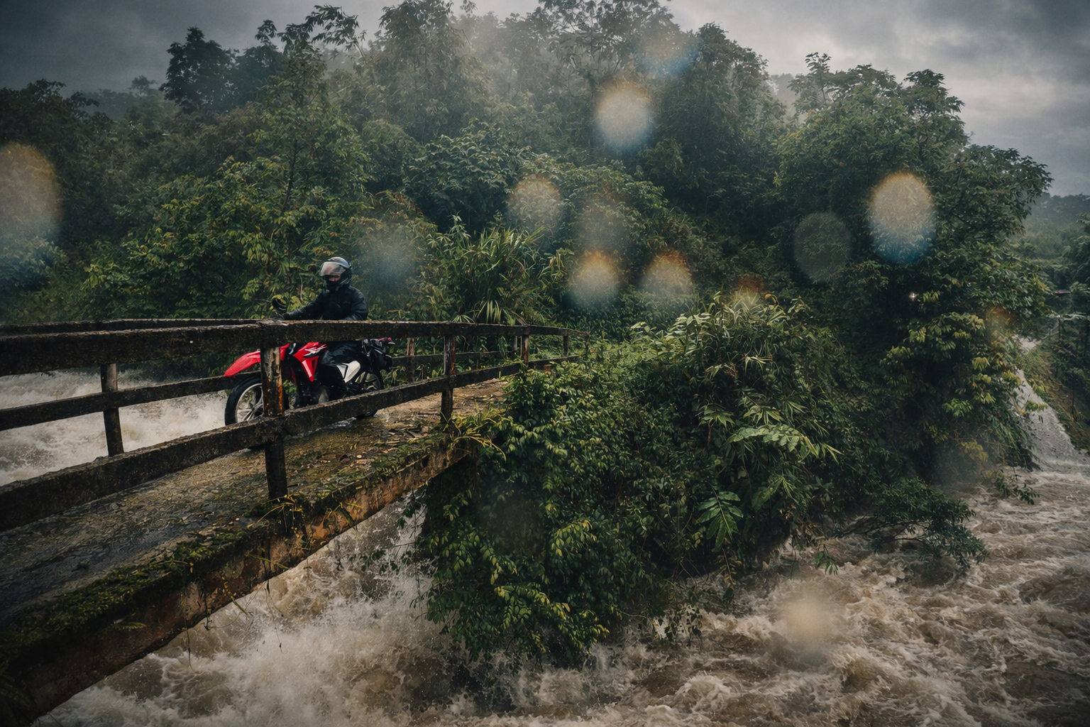
Insights and Stories from Sapa and the Northern Borderbelt provinces of Vietnam.


Vietnam Weather by Region: Best Time to Visit North, Central and South Vietnam
Vietnam’s weather is far more complex than many travellers expect. Stretching over 1,600 kilometres from north to south, the country experiences distinct regional climates, seasonal shifts and weather patterns that can vary dramatically at the same time of year. This guide explains Vietnam’s weather month by month and region by region, helping you choose the best time to travel and plan a journey that works with the seasons rather than against them.
When is the best time to visit Vietnam?
North Vietnam: March-June and August-October
Central Vietnam: March-August
South Vietnam: December-April
Best trekking months in Sapa: March-June and August-October
• • Highest typhoon risk: August-November, especially Central Vietnam
Why the weather feels so different from one end of the country to the other
From our home in Sapa, weather never feels like a small practical detail that sits politely at the edge of the journey, because it shapes the colour of the rice terraces, the clarity of the mountain ridges, the warmth of the hearth in a homestay kitchen, the condition of a forest trail underfoot, and even the rhythm of conversation as rain gathers over a valley and then passes on.
Vietnam is long, narrow and topographically complex. If its outline is superimposed on a map of Europe, it stretches from the Netherlands and Belgium, through France and into Italy, with a north-to-south span approaching the distance between northern Europe and the Mediterranean coast of North Africa. Latitude alone creates several distinct climate zones. Add mountains, dramatic changes in elevation, monsoon systems and sea breezes, and the picture becomes far more complex.
All of this determines that any weather in Vietnam does not move through the country in one neat wave, and travellers who imagine one national climate usually arrive to find three very different seasonal stories unfolding at once. Official tourism guidance and 1991 to 2020 climatological normals show a clear pattern, with the north shifting between a cool winter and a hot wet summer, the central coast staying comparatively favourable through much of spring and summer before a sharp late-year rainy season, and the south remaining hot throughout the year with a simpler dry-season and wet-season split.
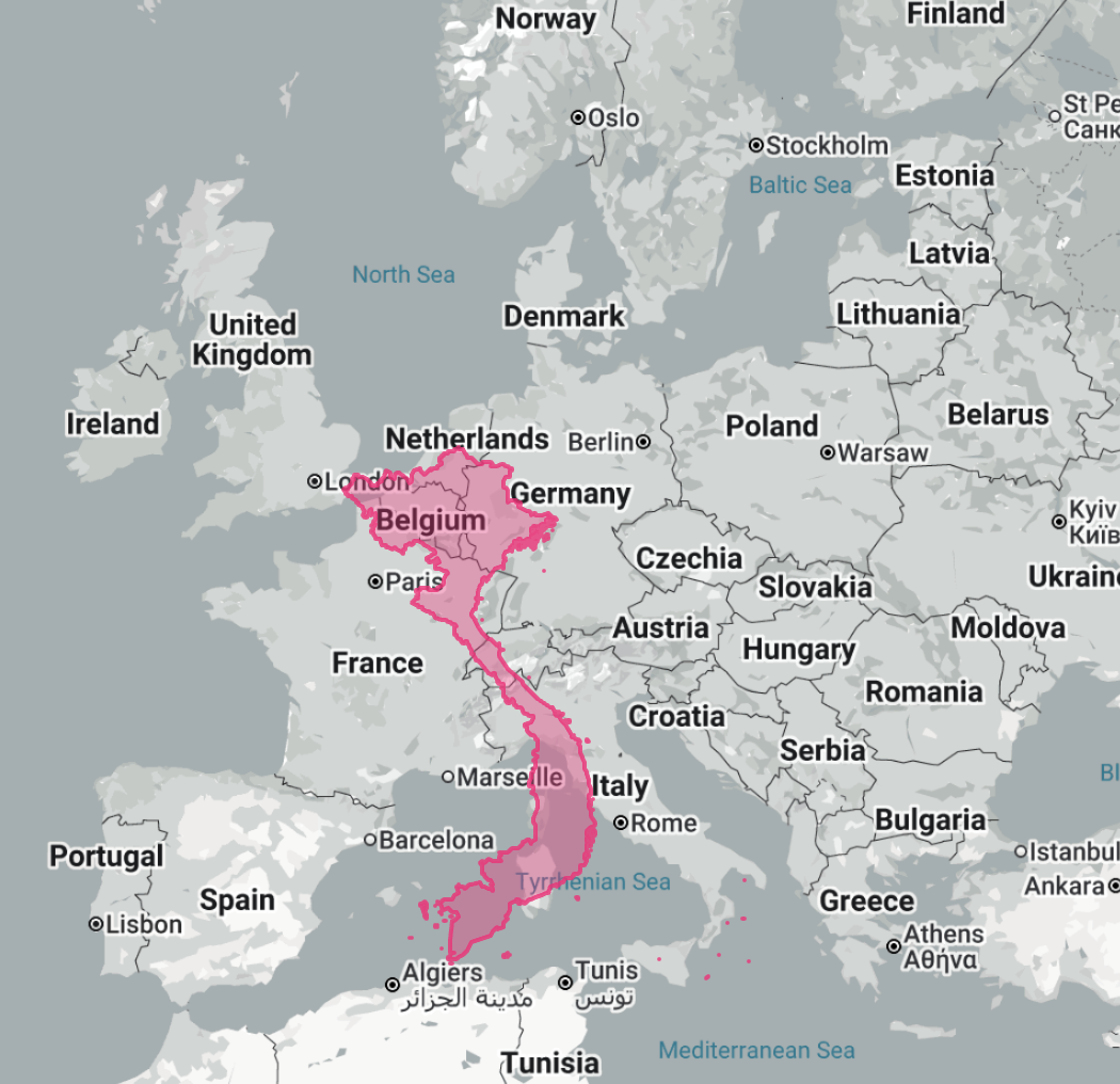
Grapical Represtation comparing Vietnam size with Europe
For ETHOS travellers, that distinction matters because weather is not only about comfort, it is about how a place is felt. Mist in the northern mountains can make a village path feel hushed and intimate, while a clear October day can open the whole horizon and reveal layers of blue ridges running to the frontier. A bright June spell on the central coast invites salt air and long sea-coloured afternoons, while a September storm can turn the same coastline into a place of dramatic skies, rough water and changed plans. In the south, rain often arrives not as an all-day blanket, but as a sudden tropical release near the end of a hot day, after which the streets steam and the air softens again.
North Vietnam month by month
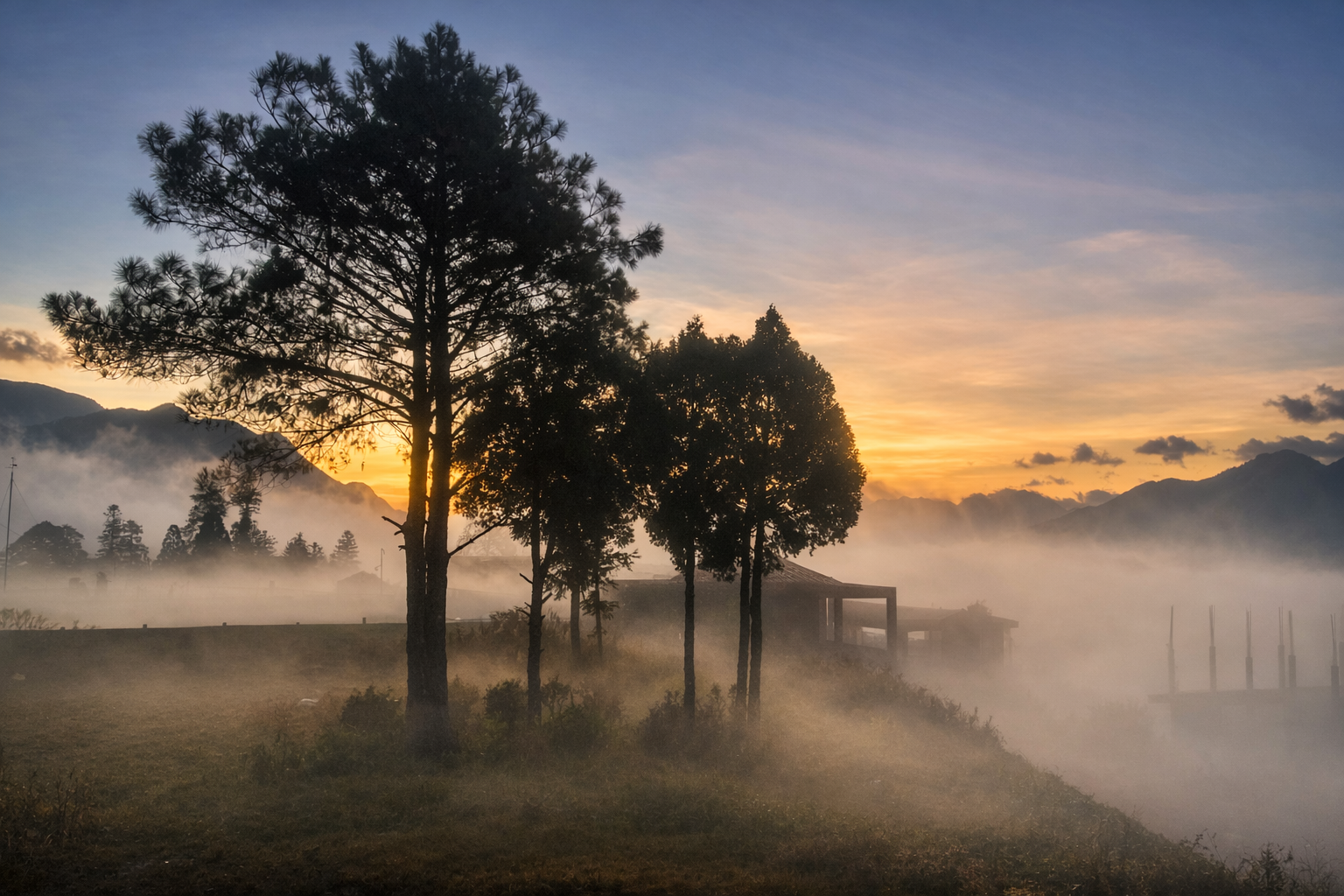
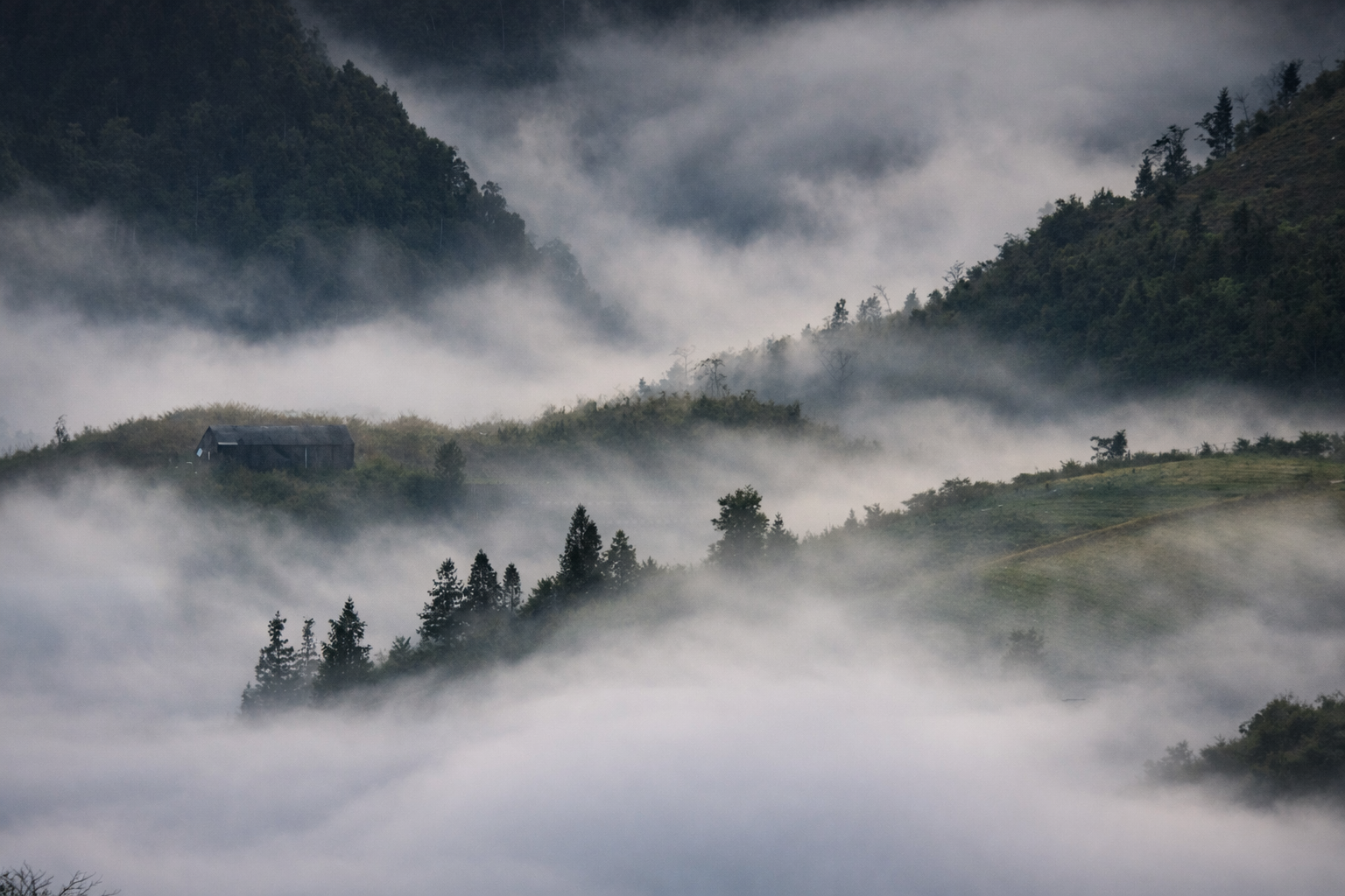
North Vietnam is the region with the clearest sense of seasonal change, and it is also the region where altitude matters most. The lowlands around Hanoi can feel cool in winter and intensely (often uncomfortably) hot and humid in midsummer, while the mountain belt around Sapa and the wider borderlands can turn genuinely cold, misty and damp in the year’s first quarter, especially in the mornings and after dark. Official guidance describes December to February as the coolest period in the north, and the climate normals for Hanoi support that strongly, with much lower winter temperatures and far less rainfall than the peak summer months.
January in the north feels wintry by Vietnamese standards, and for travellers it is often a month of silver light, low cloud, smoky kitchens and thick jackets rather than sunlit terrace views. December to February are the months you are most likely to see snow in the highlands and although relatively rare, frost and ice are annual occurances. February remains cool and often humid, with the sort of clinging damp that settles into clothes and lingers in the valleys. March begins to loosen winter’s grip, though it can still be overcast and mist-heavy, especially in the mountains where visibility is part of the travel experience and not merely a matter for photographs. Those three months can be deeply atmospheric for homestays, food, fireside conversation and slower cultural travel, though they are less dependable for big panoramas and long, dry trekking days.
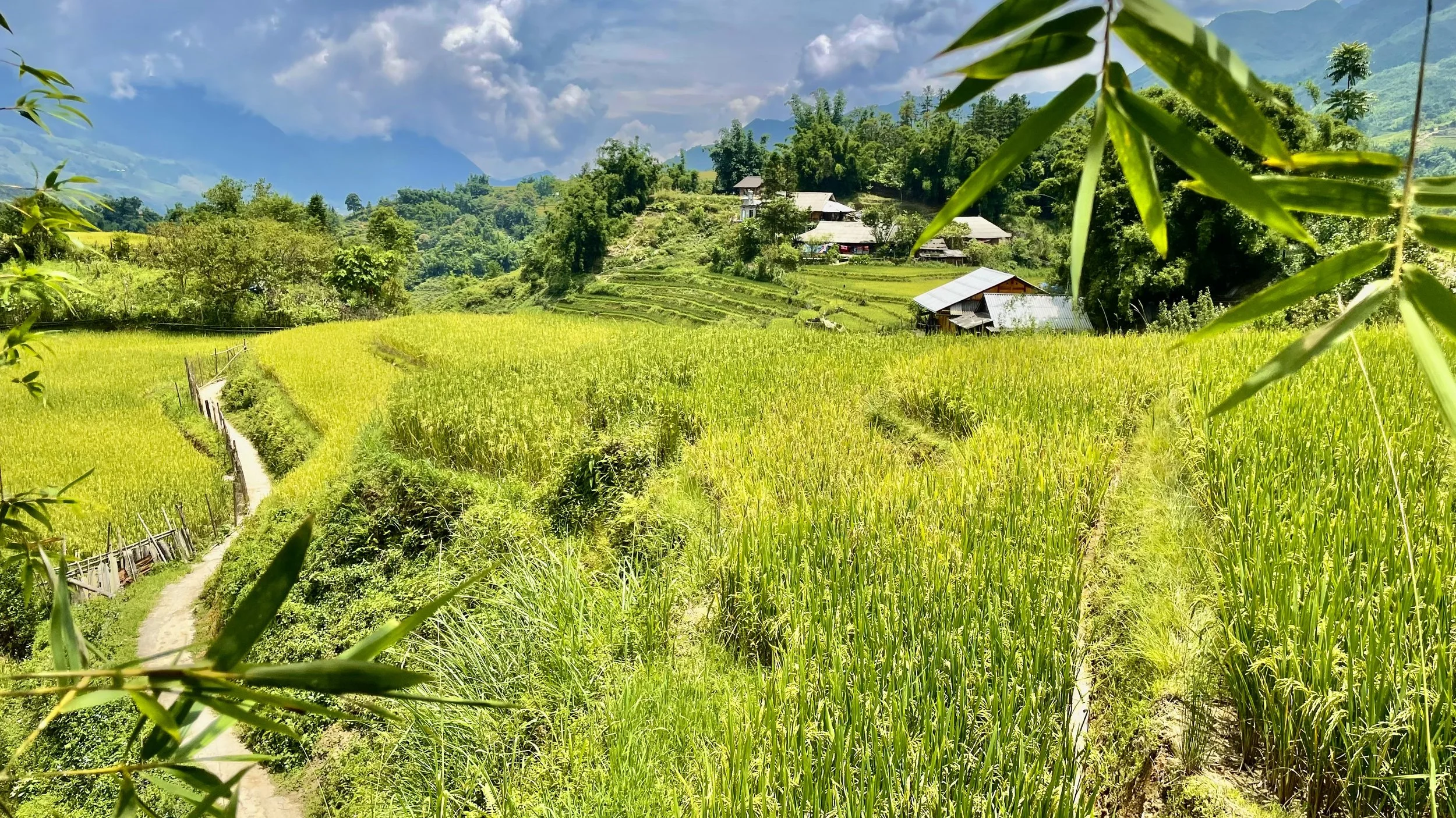
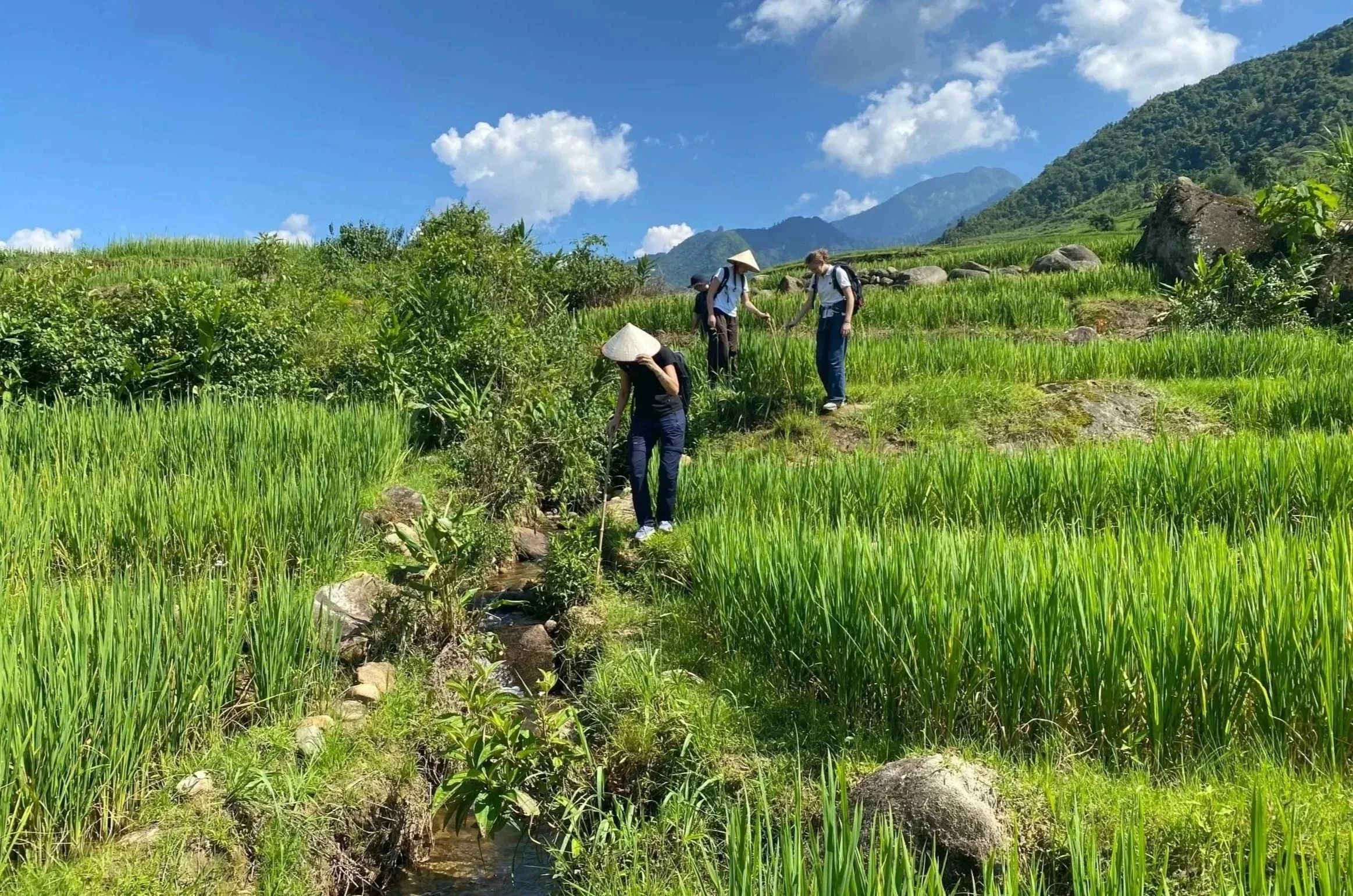
April is when the north often begins to feel open and generous again, because the cold recedes, the light strengthens and the land starts to glow with fresh growth. May keeps that lushness, although the heat begins to build and afternoons feel heavier. May is also rice planting season for many of Vietnams upland areas above 1100 metres in elevation. June marks the clear beginning of the hot, humid, rainier stretch, and this is the point at which mountain walking, road travel and outdoor experiences are still very rewarding, though they increasingly depend on good timing, early starts and a willingness to work with the day rather than against it. The rains also assure the most picturesque and verdent rice terrces. In practical terms, north Vietnam in late spring and early summer can be beautiful and fertile, though it is not the crisp, open weather that many travellers imagine when they picture mountain travel.
July is one of the most demanding months in the north, because heat, humidity and rainfall combine in a way that can make both trekking and transport feel more strenuous, and the official normals for Hanoi show just how dramatic that summer peak becomes compared with winter. Sticking to elevations above 1200 metres is the best way of escaping the summer heat and this is why mountain towns like Sapa remain popular for hikers throughout the year. August often behaves similarly, with heavy rain still very much part of the picture, even if there are vivid green landscapes and occasional windows of clear weather between showers. September begins to shift the mood again with rice harvesting and golden paddy fields an annual highlight in upland areas. Although it is still warm, the atmosphere often becomes easier, less oppressive and more travel-friendly as the month progresses. For people drawn to trekking, village walks, mountain roads and a stronger chance of expansive views, September can feel like the country taking a longer breath after the pressure of summer.
October is one of the north’s loveliest months, with cooler air, better visibility and a more settled balance between warmth and freshness. sapa is much drier and awash with beautiful meadow flowers and plentiful wilf fruits that makes it an ideal month for foraging. November often continues that pattern and is one of the easiest months for travellers who want to walk, photograph, ride and linger outdoors without constantly negotiating heat or downpours. December brings the first clear return of winter, although it usually feels drier and cleaner than the mist-soaked late winter weeks that follow in January and February. For ETHOS, this is the broad truth we live with year after year, namely that the north tends to be at its most comfortable for immersive travel in spring and again in autumn, while winter suits slower, more intimate journeys and midsummer asks for flexibility, resilience and respect for the mountain weather.

Snow in Sapa
Central Vietnam month by month
Central Vietnam is the part of the country that most often surprises travellers, because it does not obey the same calendar as the north or south. The central coast around Da Nang, Hue and Hoi An tends to hold on to good beach and heritage-travel weather through much of spring and summer, then turns sharply wetter and more flood-prone later in the year. The south-central coast around Nha Trang follows a slightly different rhythm again, which is why a blanket statement about “central Vietnam weather” can be useful only up to a point. The official normals make that late-year central spike unmistakable, especially in Da Nang, where autumn is far rainier than spring and early summer.
January on the central coast can still be cool, grey and unsettled, especially in the Hue to Hoi An zone where the wet season does not disappear neatly with the new year. February is often an improving shoulder month, though not always a fully settled one. March is when central Vietnam usually becomes much easier to recommend without hesitation, because the air grows warmer, the skies brighten and the region’s blend of old towns, coastline and cultural sites comes into its own. Travellers who want a more relaxed marriage of sea light, wandering and heritage often find March one of the sweetest months in the whole country.
April brings stronger heat and a more summery feel, while still remaining highly attractive for most coastal itineraries. May leans further into beach weather, with brighter skies and warmer sea conditions, though midday heat becomes more assertive. June is broadly excellent for central coastal travel if your idea of good weather includes sunshine, warmth and long outdoor days, though it does ask for a slower pace during the hottest hours. This is the part of the year when central Vietnam often feels expansive and easy, especially for travellers who want swimming, walking, architecture and sea air in a single trip.
July generally stays favourable along much of the coast, and August often does as well, although late-summer caution becomes wiser as the season edges closer to the stormier part of the year. September is the point at which the region begins to feel less dependable, particularly around the central coast where rain risk and tropical weather disruption rise. That shift is important because the central region commonly looks attractive on paper in early autumn, yet in reality it can move quickly from beach-friendly brightness to heavy rain, high water and interrupted transport. The central coast rewards good timing more than almost any other part of the country.
October is the central coast’s hardest month in broad travel terms, and the official normals for Da Nang show why, with an especially dramatic rainfall peak at exactly the time many travellers elsewhere in Asia expect dry-season improvements to begin. November remains difficult in many years, particularly for the Hue to Hoi An stretch, where flooding and persistent rain can affect both comfort and logistics. December is more mixed than many people anticipate, because parts of the central coast may still be rainy and cool rather than quietly festive and dry. For travellers, the essential central lesson is simple and worth remembering, namely that spring and summer are often the region’s most rewarding months, while autumn demands much more caution than the same months do in the north.
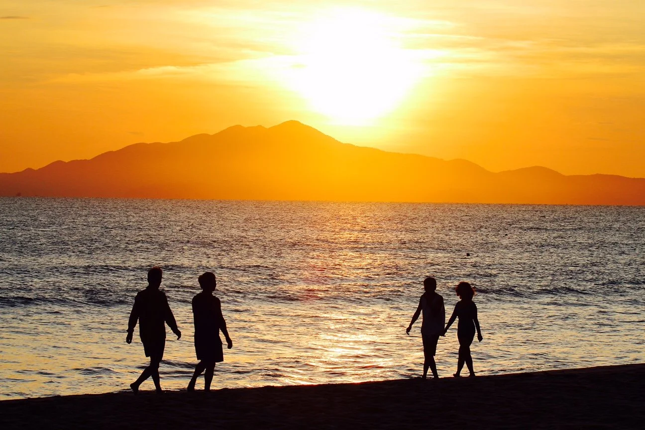
Sunrise on the beach in Hoi An
South Vietnam month by month
South Vietnam is the most straightforward region to read climatically, though that does not mean it is weatherless or uniform. The south remains warm to hot through the year, and the main distinction is between the drier months and the wetter months rather than between summer and winter in the northern sense. Around Ho Chi Minh City, the official normals show relatively modest temperature variation compared with Hanoi, while rainfall patterns trace a much clearer wet-season arc from late spring into autumn.
January is one of the south’s easiest months, with drier air, plenty of sun and the kind of general reliability that makes city breaks, river trips and beach extensions feel uncomplicated. February keeps that ease, although the heat starts to gather a little. March remains one of the strongest months for sunshine seekers, though by now the warmth is more insistent and the afternoons can feel distinctly tropical. Travellers who enjoy brightness and don’t mind heat often find this one of the south’s most rewarding stretches.
April often feels like the hottest hinge between the two seasons, because the dry weather still lingers while the atmosphere grows heavier and more expectant. May is usually when the wetter pattern begins to establish itself, not as endless rain but as a rhythm of gathering cloud and regular downpours. June settles more firmly into that mode, with mornings that can still be bright and energetic followed by showers that break the heat later in the day. For many travellers, the surprise of the south is that the wet season is often more manageable than feared, provided you do not require uninterrupted sun from breakfast until evening.
July and August continue that humid, rain-marked pattern, and September is commonly among the wetter points in the southern year. Mainland travel can still work very well during these months if you accept a more flexible tempo, though island plans become more weather-sensitive because sea conditions matter as much as rainfall totals. Places such as Phu Quoc can feel far less predictable in the rougher, rainier part of the year than they do in the dry months, even when the rain itself comes in bursts rather than all-day sheets. The south in late summer is often vibrant, green and atmospheric, though it favours adaptable itineraries over rigid ones.
October may still feel rainy, though the season is beginning to tip. November often behaves like a transition month in which the air starts to clear and the intervals of dry weather lengthen. December brings back the south’s classic easy season, when heat, light and lower rainfall combine to make both urban and coastal travel far simpler. If the north asks you to think in terms of four moods and the central coast asks you to think in terms of timing, the south asks you mainly to understand a dry half and a wet half, each with its own charm and each rewarding a different kind of traveller.
Typhoon season and the shape of weather risk
Typhoon season is best understood not as one rigid block of dates, but as a period of heightened tropical-weather risk that shifts in emphasis across the country. World Bank climate-risk material notes that tropical cyclones account for a very large share of disasters affecting Vietnam, and that the country faces high exposure to both flooding and tropical cyclones. The same body of material, looking across historical landfalls, indicates that the north receives a substantial share of storm strikes, while the central coast remains the place where travellers most often feel the practical consequences of storms in the form of intense rainfall, river flooding, rough seas and transport disruption, especially from early autumn onward.
For practical travel planning, the key point is that the risk profile shifts through the year. The north is more vulnerable earlier in the broader storm season, while the central coast becomes the more concerning region for many travellers later in the year, when its already wet season can overlap with tropical systems and magnify disruption. The official normals for Da Nang, together with official tourism guidance, make plain why autumn requires particular care there, and recent WMO reporting on heavy December rain in Vietnam is a reminder that “late season” is not a theoretical idea but a real one.
There is also a bigger climate context to keep in mind. WMO’s regional climate assessment for Asia describes record-high sea-surface temperatures, marked marine heatwaves and more extreme rainfall across the region, while World Bank material citing Vietnamese government sources points to mounting evidence of greater frequency of high-intensity typhoons in recent years. That does not mean every season will behave dramatically, though it does mean travellers should treat old rules of thumb with caution and check forecasts closely, especially when travelling to the coast or through mountainous terrain during the wetter months.
Monsoon rains in the mountains
The El Niño Effect: Why Some Years Feel Completely Different
While Vietnam's geography creates the foundation for its weather patterns, large-scale climate cycles can dramatically influence conditions from one year to the next. The most significant of these is El Niño, a naturally occurring warming of the tropical Pacific Ocean that can alter rainfall, temperatures and seasonal weather across much of Southeast Asia.
During El Niño years, many parts of Vietnam experience hotter and drier conditions than normal, increasing the risk of drought, water shortages and forest fires. The opposite phase, La Niña, often brings cooler temperatures and above-average rainfall. These events can strengthen, weaken or shift the usual seasonal patterns that travellers and local communities have come to expect.
Because El Niño and La Niña can have such a significant impact on Vietnam's weather, we have explored the subject in much greater detail in our separate guide: El Niño and Vietnam's Weather: What Travellers Need to Know.
What this means for an ETHOS journey
For travellers coming to northern Vietnam with ETHOS, the broadest weather truth is also the simplest one, namely that the mountains reward those who travel with the season rather than against it. February to October and November are often the most comfortable months for walking, village stays, conversation-rich homestays and days that move between field, trail, workshop and table without the weather dominating every decision. December and January can be deeply beautiful if you are drawn to mist, firelight, textiles, slower pacing and the intimacy of mountain life in colder weather. June through August will be lush and can still be rewarding, though they call for more flexibility, better rain preparation and a serious respect for road and trail conditions.
Preparing for Your Trekking Adventure. For a guide ofwhat to pack for a trek in Sapa, you can read more here.
Across the wider country, the broadest planning windows remain fairly clear. North Vietnam is usually easiest in spring and autumn. The central coast is often at its best from roughly March into August, while autumn is the season to watch most carefully there. South Vietnam is typically easiest from December to April, while the wetter months remain very possible for travellers who do not mind tropical rain and are willing to keep their plans a little looser. For the kind of journeys ETHOS believes in, where connection matters more than rushing and experience matters more than ticking boxes, the weather is never simply a background condition. It is the atmosphere in which people farm, weave, forage, cook, guide, remember and welcome, and understanding it well is one of the most respectful ways to arrive.
What is the best month for trekking in Sapa?
Every season reveals a different Vietnam. Misty mountain mornings, golden harvest terraces, quiet coastal spring days or lush summer landscapes all offer their own rewards.
If you’d like help choosing the best season for your interests, our team can help design a journey around weather, culture, local events and community experiences.
Explore our tailored experiences and start planning your Vietnam journey.
FAQ’s
Q. When is the best time to visit Sapa? See our comprehensive month by month guide.
Q. When is the rainy season in Vietnam? It differs from north to south.
Q. When is typhoon season in Vietnam? Autumn
Q. Does Sapa get snow? YES - Read more here
Q. Is July a good time to visit Sapa? YES - Watch more here
El Niño 2026 in Vietnam: Heat, Storms, and What Travellers Need to Know Before Exploring the North
Northern Vietnam is entering an increasingly unpredictable climate era as El Niño conditions strengthen across the Pacific. Though forecasts suggest hotter temperatures, weaker monsoon rains, and fewer tropical storms overall, scientists also warn that extreme weather events may become more erratic and more intense when they do occur. From landslide risks in Hà Giang and Sapa to heatwaves in Hanoi and shifting storm patterns in Ha Long Bay, this guide explores what travellers should understand before visiting Vietnam in 2026, and why flexibility, local knowledge, and ethical travel matter more than ever.

Infographic describing the possible impacts of El Nino 2026 on northern Vietnam
Northern Vietnam Is Entering a More Unpredictable Climate Era
Across the mountains of northern Vietnam, weather has always shaped daily life. Rice terraces depend upon carefully guided water flowing down steep hillsides. Forests provide herbs, medicines, fibres, dyes, and food gathered according to seasonal rhythms passed through generations. Families plan planting, harvesting, market days, weddings, and journeys according to changing skies and shifting winds.
For many travellers, weather is something checked briefly on a phone before departure. For the Hmong, Dao, Giáy, and other ethnic communities we work alongside at ETHOS, weather is inseparable from life itself. Climate change means that relationship is becoming increasingly uncertain.
Vietnam’s National Center for Hydro-Meteorological Forecasting has warned that El Niño conditions have an 80–90% chance of developing between June and August 2026, with a growing possibility that conditions could intensify into a “super” El Niño lasting into 2027. Researchers across Asia and the Pacific are watching developments closely as global ocean temperatures continue to break records and climate systems become increasingly unstable.
Though El Niño is a naturally occurring climate cycle, climate change is intensifying many of its effects. Across Vietnam, forecasters are warning of prolonged heatwaves, delayed monsoon rains, severe thunderstorms, flash floods, landslides, drought conditions, and increasingly erratic weather patterns.
For travellers planning journeys through Hanoi, Sapa, Hà Giang, Ninh Bình, or Ha Long Bay, understanding these changes matters deeply. Not because northern Vietnam should be avoided, though because travelling here increasingly requires flexibility, patience, humility, and respect for the landscapes and communities already living through these changes.
The Growing Concern Around a Potential “Super” El Niño
Climate researchers are increasingly discussing the possibility that 2026 could develop into a “super” El Niño, a rare and exceptionally intense event capable of reshaping weather patterns across huge parts of the world.
Comparisons have already been drawn with the devastating 1877–1878 El Niño, widely regarded as one of the most destructive climate disasters in recorded human history. Historians estimate that the wider droughts and famines associated with that event contributed to the deaths of more than 50 million people across India, China, Brazil, and other regions, representing roughly 3–4% of the world’s population at the time.
Researchers later described the event as potentially “the worst environmental disaster ever to hit humanity”.
The devastation did not happen suddenly. Drought conditions spread gradually through tropical and subtropical regions before intensifying as multiple oceanic and atmospheric systems aligned with the extreme El Niño event. Though modern forecasting systems, communications, infrastructure, and disaster planning make direct comparisons difficult today, scientists remain deeply concerned about how stronger El Niño cycles may interact with historically warm oceans and rising global temperatures.
Vietnam sits directly within many of those intersecting pressures.
What El Niño Usually Means for Vietnam
In simple terms, El Niño often brings hotter and drier conditions to much of Vietnam overall, particularly across the north and central regions. Summer monsoon rainfall tends to weaken or arrive later than normal while heatwaves become longer, more intense, and more physically exhausting. Though the reality is far more complicated than simply “hot and dry”.
One of the defining contradictions of El Niño years is that rainfall often becomes less frequent but more extreme. Instead of weeks of steady monsoon rain, storms may arrive suddenly and violently, releasing enormous amounts of water within very short periods of time. This pattern creates especially dangerous conditions across northern Vietnam’s mountains, where steep terrain and unstable roads are highly vulnerable to landslides and flash flooding.
Studies of previous strong El Niño periods consistently showed hotter temperatures, delayed monsoon activity, significant rainfall reductions, increased drought conditions, fewer tropical cyclones overall, and heightened risks of severe storms and rapid flooding events. For travellers, this often means longer stretches of beautiful stable weather interrupted by abrupt and sometimes dangerous weather events.
Hanoi: Heavy Heat and Violent Afternoon Storms
Longer, More Exhausting Heatwaves
Hanoi already experiences intense summer heat, though El Niño years tend to push temperatures into longer and harsher extremes. Climate studies suggest average summer temperatures may rise by around 0.5–1°C above normal, though the lived experience often feels far more dramatic once humidity, traffic, and urban density are factored in.
Between June and August 2026, visitors should expect prolonged stretches of oppressive heat, particularly during late mornings and afternoons when the city radiates warmth from concrete streets and glass buildings long after sunset. Hanoi has always lived with summer heat, though El Niño years tend to intensify it significantly. During June, July, and August, the city often feels physically exhausting long before temperatures reach their daily peak.
Concrete streets radiate trapped heat well into the evening while traffic fumes linger in stagnant air. Sidewalk vendors retreat beneath umbrellas while locals gather around iced tea stalls and shaded courtyards waiting for temperatures to soften after sunset.
Climate forecasts suggest average summer temperatures could rise around 0.5–1°C above seasonal norms during El Niño conditions. Though in practice, dense humidity and urban heat retention frequently make conditions feel far harsher than statistics alone suggest. The most unstable periods may arrive during seasonal transitions between March and May and again between September and October. Thunderstorms often build rapidly during late afternoons, bringing sudden lightning, hail, squalls, and flash flooding across low-lying streets.
For travellers, slower pacing becomes essential. Early mornings are increasingly the best time to explore Hanoi’s lakes, temples, old alleyways, and street markets before the heat becomes overwhelming.
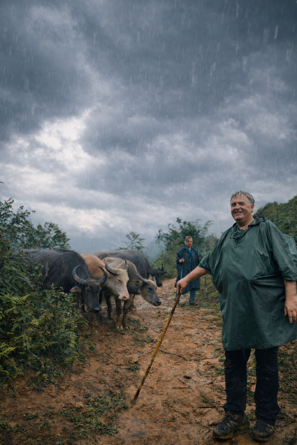
Sapa: Mountain Beauty and Growing Fragility
In Sapa and the wider Hoàng Liên mountains, weather shapes everything. Terraced rice fields are sustained through complex water systems developed over generations by Indigenous farming communities. Forests provide food, medicine, dyes, fibres, and materials gathered according to deeply rooted environmental knowledge. Sudden changes in rainfall patterns ripple through every part of daily life. Under El Niño conditions, Sapa may experience longer dry periods punctuated by violent storms capable of triggering landslides, swollen rivers, and dangerous trekking conditions.
Travellers often imagine mountain weather as gentle mist and cool rain drifting quietly through valleys. The reality can change astonishingly quickly. A clear morning may become a dangerous afternoon storm within hours. Trails become slippery almost instantly while mudslides occasionally cut roads between villages and town centres.
Though the mountains remain extraordinarily beautiful during unstable weather. Waterfalls surge through terraces after rain while clouds roll dramatically through valleys and forests fill with the scent of wet earth, woodsmoke, and medicinal plants gathered by local families. This is why flexibility matters so deeply in the mountains.
At ETHOS, trekking routes are never treated as fixed products. Our local partners continuously adapt journeys according to trail conditions, river levels, storms, ceremonies, planting cycles, and community needs. Trained local guide make informed decisions based upon environmental knowledge developed over decades of living within these landscapes.
Trekkers in Sapa embracing the summer rains

Enjoying a muddy trek in Sapa
Exploring the Sapa rice terraces in the rainy season.
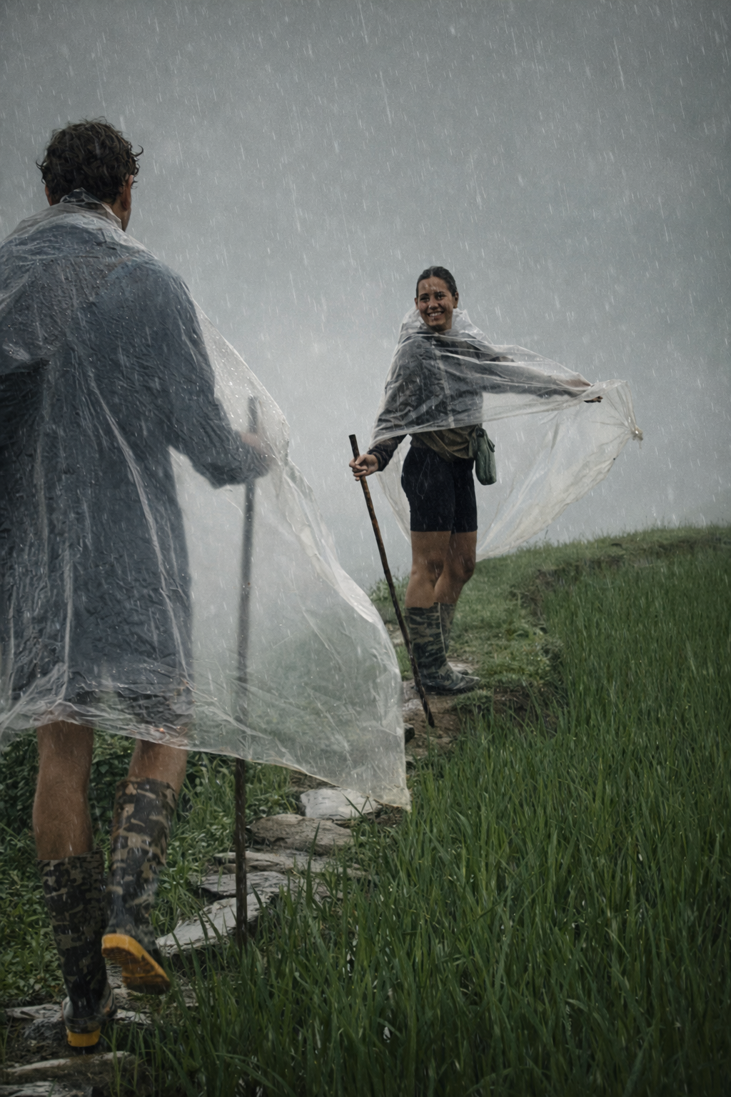
Trekking Conditions Can Change Very Quickly
Travellers often imagine mountain weather as soft mist and gentle rain, though reality during unstable periods can be far more serious. Trails become dangerously slippery within minutes. Minor streams swell into difficult crossings. Landslides occasionally cut roads connecting villages to town centres.
Summer trekking conditions may become particularly difficult during June to August, when heavy cloudbursts can trigger flash flooding and mudslides on steep paths. That said, some of the mountains’ most extraordinary moments also emerge during the wet season and after rain. Waterfalls surge through valleys. Rice terraces glow vivid green beneath drifting cloud. Forests feel alive with movement and scent.
For this reason, flexibility matters enormously. Travellers willing to adapt routes, shift timings, or spend additional nights in villages often experience the mountains far more meaningfully than those following rigid schedules.
At ETHOS, our routes are constantly adjusted in collaboration with local partners who know these valleys through lived experience rather than online forecasts alone.
Well prepared trekkers in Sapa embracing the summer monsoon.
Hà Giang: Dramatic Roads Beneath Increasingly Extreme Skies
Few journeys in Southeast Asia feel as visually overwhelming as Hà Giang. Limestone mountains rise sharply above deep valleys while roads twist through cliff edges, high passes, and isolated communities near the Chinese border. Morning mist drifts through stone villages while terraced fields cling impossibly to steep hillsides shaped by generations of Hmong, Dao, and Lô Lô farming families. Though these same landscapes are becoming increasingly vulnerable to weather instability.
Strong El Niño years often produce fewer rainy days overall across northern Vietnam, though rainfall becomes concentrated into shorter and more violent cloudbursts. In Hà Giang, this creates serious landslide risks across mountain roads already weakened by erosion, construction, and increasing tourism traffic.
Periods of prolonged heat can dry and destabilise hillsides before intense rain suddenly triggers collapses. Flooding in narrow valleys occasionally isolates communities and blocks major routes entirely. Fog, loose rock, heavy runoff, and collapsing roadside edges can transform beautiful mountain roads into genuinely dangerous terrain within a matter of hours. This concern becomes even more important when considering the rapid growth of commercial motorbike tourism across the region.
Many highly profit-driven Hà Giang “tour companies” continue operating tours in almost any weather conditions, including during periods of heavy rainfall, severe storm warnings, landslide alerts, and typhoon activity. Risk assessments are often superficial or poorly communicated to travellers, while weather mitigation plans frequently prioritise maintaining schedules and avoiding cancellations over genuine safety considerations. As climate conditions become increasingly unstable during 2026, this issue is likely to become even more serious.
Travellers should never assume that because a tour is continuing, conditions are automatically safe. Many operators are under intense commercial pressure to avoid refunds, maintain group schedules, and maximise high-season revenue. That reality must be considered honestly when choosing who to travel with in the mountains.
Doing your own due diligence is essential.
Ask how operators assess weather risks. Ask what conditions would trigger route changes or cancellations. Ask whether guides are empowered to stop journeys if mountain conditions deteriorate suddenly. Ask how often itineraries are adapted around landslide forecasts or local warnings rather than social media expectations. The mountains do not care about schedules, content creation, or booking calendars.
Responsible travel in Hà Giang increasingly means choosing operators who understand that flexibility, caution, and local environmental knowledge are not weaknesses within an itinerary. They are signs of professionalism, care, and respect for both guests and local communities.
At ETHOS, weather decisions are never made remotely from an office detached from the realities of the mountains. Routes are adapted continuously alongside local partners who live within these valleys and understand how quickly conditions can change. Delaying a journey, altering a route, or staying longer in one village is sometimes the safest and most responsible decision available.
Some of the most meaningful moments in Hà Giang happen when journeys slow unexpectedly. Storm evenings spent inside wooden homes sharing tea or rice wine beside kitchen fires often leave stronger memories than the roads themselves.
Ha Giang during the monsoon season.
Ninh Bình: Quiet Landscapes and Sudden Floodwaters
Ninh Bình feels gentler than the mountains further north, though its landscapes are equally shaped by water.
Limestone karsts rise above rice fields and winding rivers while small boats drift slowly through caves and flooded valleys. During El Niño conditions, rainfall deficits may lower water levels for periods before sudden storms rapidly reverse them.
Heat and humidity are also expected to intensify significantly during summer months. Cycling beneath open skies during midday can quickly become physically draining, particularly for travellers unaccustomed to tropical heat.
Storms may arrive abruptly during afternoons, transforming calm river landscapes into scenes of intense rainfall and dramatic cloud movement.
For this reason, slower travel rhythms work beautifully here. Dawn boat rides, shaded village lunches, and flexible daily pacing often become far more rewarding than tightly packed itineraries rushing between attractions.
Ha Long Bay, Typhoons, and the Uncertainty of a Warming Ocean
One of the most misunderstood aspects of El Niño is how it affects Vietnam’s storm season.
Historically, El Niño years have usually reduced the number of tropical storms and typhoons affecting Vietnam directly. Vietnamese meteorological studies show that storm frequency often drops noticeably during strong El Niño phases while monsoon rainfall across much of northern and central Vietnam also weakens significantly.
In practical terms, this often means longer dry periods, delayed monsoon activity, and fewer tropical systems making landfall across the country. Though fewer storms do not necessarily mean lower overall risk.
Climate researchers increasingly warn that while the total number of tropical cyclones may decline globally, the storms that do form are becoming more intense, wetter, and less predictable as ocean temperatures continue to rise. Recent long-term studies also suggest Vietnam may already be experiencing an increase in landfalling cyclones compared with other parts of East Asia, despite the historical El Niño relationship with lower storm numbers. For travellers, this creates an increasingly uncertain picture.
A strong El Niño year may still bring long periods of dry and stable weather across northern Vietnam, particularly during early and mid-summer. Though isolated storms arriving later in the season may carry more moisture, stronger winds, and more destructive rainfall than travellers expect after weeks of dry conditions.
This kind of “hydrological whiplash” is becoming increasingly important across Southeast Asia. Landscapes stressed by prolonged heat and drought often struggle to absorb sudden intense rainfall once storms finally arrive, increasing flash flood and landslide risks in mountain regions such as Sapa and Hà Giang.
For Ha Long Bay, this uncertainty matters enormously. Conditions may remain calm for extended periods before changing rapidly. Cruise cancellations, sudden squalls, and late-season storms may become increasingly difficult to predict cleanly using historical travel patterns alone.
Travelling Responsibly During El Niño 2026
Northern Vietnam remains an extraordinary place to travel during changing climate conditions, though journeys here increasingly benefit from a slower and more attentive approach.
Travellers should allow additional flexibility within itineraries wherever possible. Roads may temporarily close after storms while trekking routes may need adjusting and cruises may occasionally be delayed or cancelled entirely for safety reasons.
Morning travel is becoming increasingly valuable during hotter years. Trekking, cycling, city walks, and motorbike journeys are generally far more comfortable before midday heat intensifies and afternoon storms begin to build.
Preparing properly for both heat and rain is essential. Lightweight waterproof layers, sturdy footwear, sun protection, electrolyte supplements, and quick-dry clothing are increasingly important across northern Vietnam’s shifting weather patterns.
Vietnam’s recently launched KTTV weather application now provides hyper-local weather alerts and real-time warnings for thunderstorms, landslides, and flash floods using thousands of monitoring stations nationwide. Local forecasting tools are often far more useful in mountain regions than generic global weather apps.
Most importantly, travellers should listen carefully to local advice.
Communities in northern Vietnam have adapted to environmental uncertainty for generations. Local guides, farmers, and hosts often recognise dangerous conditions long before official forecasts fully reflect them.
Travelling With Greater Awareness
At ETHOS, we believe meaningful travel begins with paying attention.
Paying attention to changing weather. Paying attention to local knowledge. Paying attention to the realities communities are already navigating as climate patterns shift around them.
Northern Vietnam’s beauty has never existed separately from its vulnerability. Rice terraces require immense labour and ecological understanding to sustain. Mountain forests remain deeply connected to community survival. Rivers, rainfall, and seasonal rhythms continue to shape everyday life across the region.
Though despite growing uncertainty, the mountains remain full of warmth, resilience, creativity, and extraordinary hospitality.
Families still gather around kitchen fires while rain moves through valleys outside. Indigo cloth still dries beside terraced fields after storms pass. Forest herbs are still gathered carefully from mountain slopes by hands that know every season intimately.
Travelling here may increasingly require patience and adaptability, though those qualities often create the deepest and most human experiences of all.
Practical Travel Advice for Vietnam During El Niño 2026
Keep Your Itinerary Flexible
Mountain roads may temporarily close. Cruises may be delayed. Trekking routes may change unexpectedly.
Travellers who leave room for adjustments generally experience far less stress than those attempting to follow rigid schedules.
Travel Earlier in the Day
Morning hours are becoming increasingly valuable during hotter years. Trekking, cycling, city walks, and motorbike journeys are all significantly safer and more comfortable before midday temperatures peak.
Afternoons increasingly bring thunderstorm development during transition seasons.
Use Real-Time Local Forecasting Tools
Vietnam recently launched the KTTV weather application, which provides hyper-local forecasts and live alerts for thunderstorms, flash floods, and landslide risks across the country. The system updates frequently using data from thousands of monitoring stations nationwide.
Local forecasting tools are often far more useful in the mountains than generic international weather apps.
Prepare for Both Heat and Rain
Travellers increasingly need to prepare for multiple weather conditions within the same journey. Lightweight waterproof layers, quick-dry clothing, waterproof bags, sturdy footwear with grip, sunscreen, hats, and electrolyte supplements all become essential.
Mountain evenings may still cool significantly despite intense daytime heat.
Choose Ethical Operators Who Prioritise Safety
Responsible travel companies may occasionally change routes, postpone departures, or cancel activities entirely when conditions become unsafe. This is not poor organisation. It is ethical decision-making grounded in care for guests, guides, and local communities alike.
Travelling Thoughtfully in a Time of Climate Uncertainty
El Niño 2026 is not simply a weather event. It reflects a larger reality unfolding across Southeast Asia, where communities are adapting to increasingly unstable environmental conditions while continuing to protect agricultural traditions, cultural heritage, and fragile mountain ecosystems.
Northern Vietnam remains an extraordinary place to travel. Rice terraces will still glow emerald green after rain. Forest herbs will still be gathered from mist-covered hillsides by hands that know every seasonal rhythm. Indigo cloth will still dry outside wooden homes in mountain villages. Families will still welcome travellers into warm kitchens while storms move through valleys outside.
Though travelling here may increasingly require patience, humility, and flexibility, those qualities often lead to deeper and more meaningful experiences in return.
At ETHOS, we believe the future of travel lies not in controlling landscapes or insulating ourselves from uncertainty, but in learning how to move through places more attentively, more respectfully, and more collaboratively with the people who know them best.
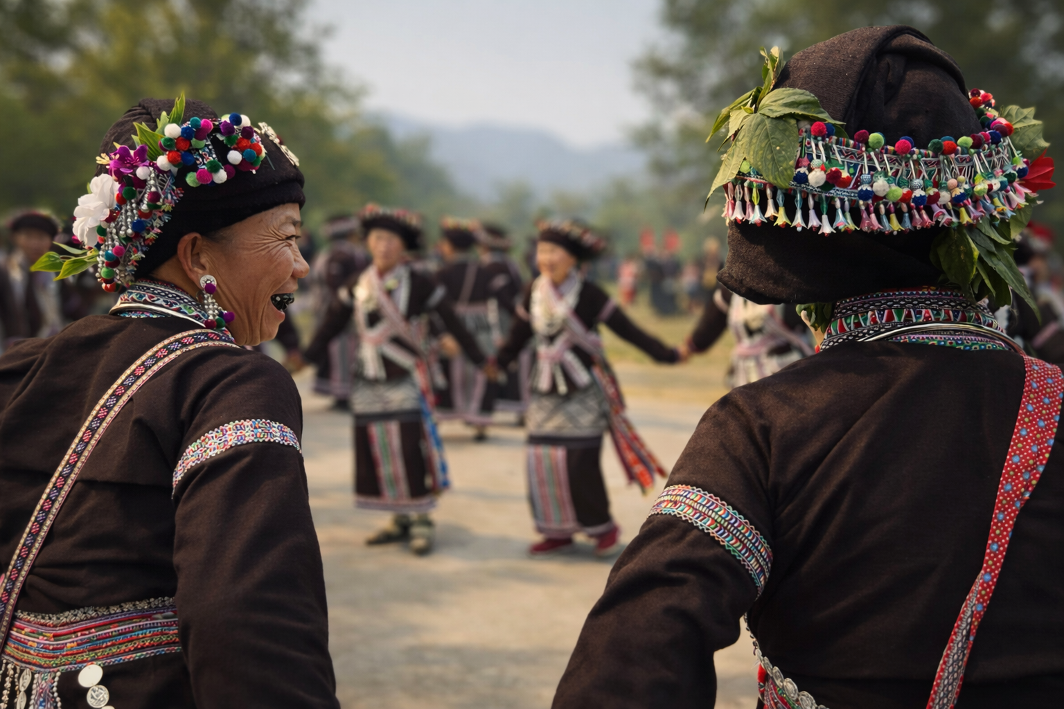
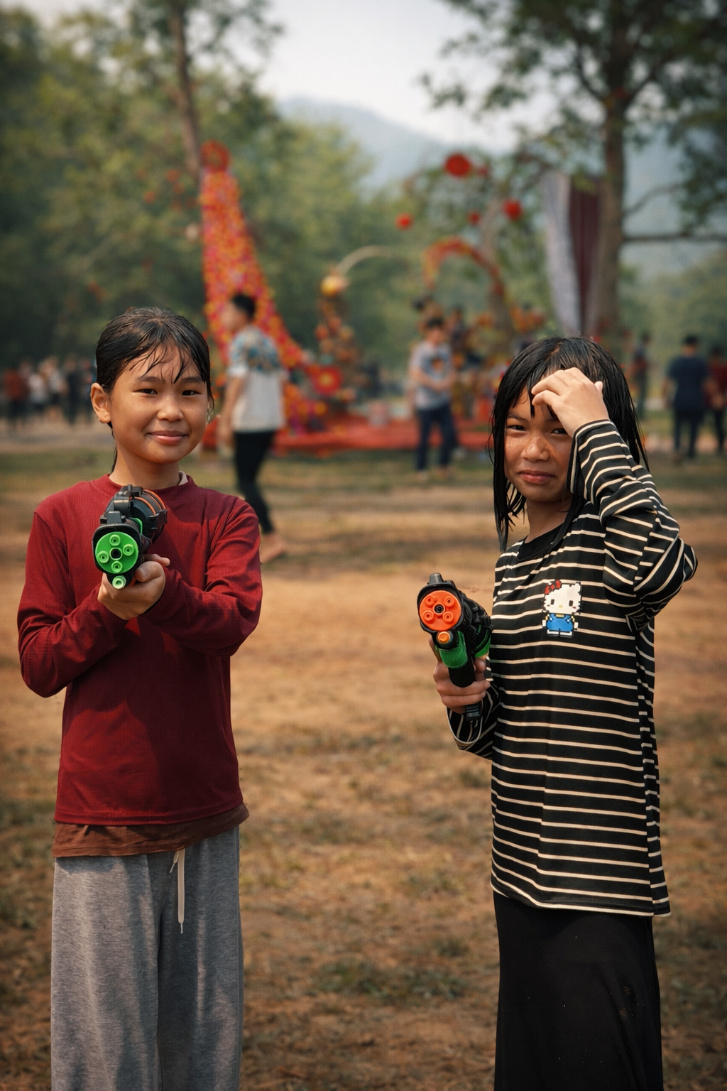
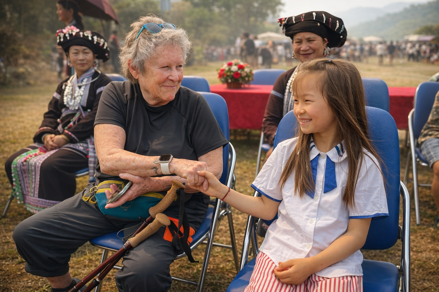
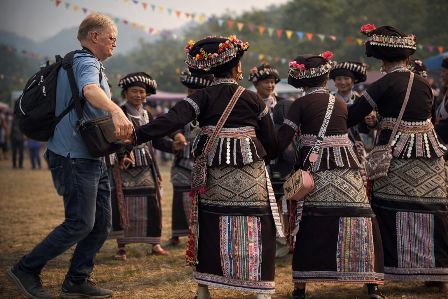
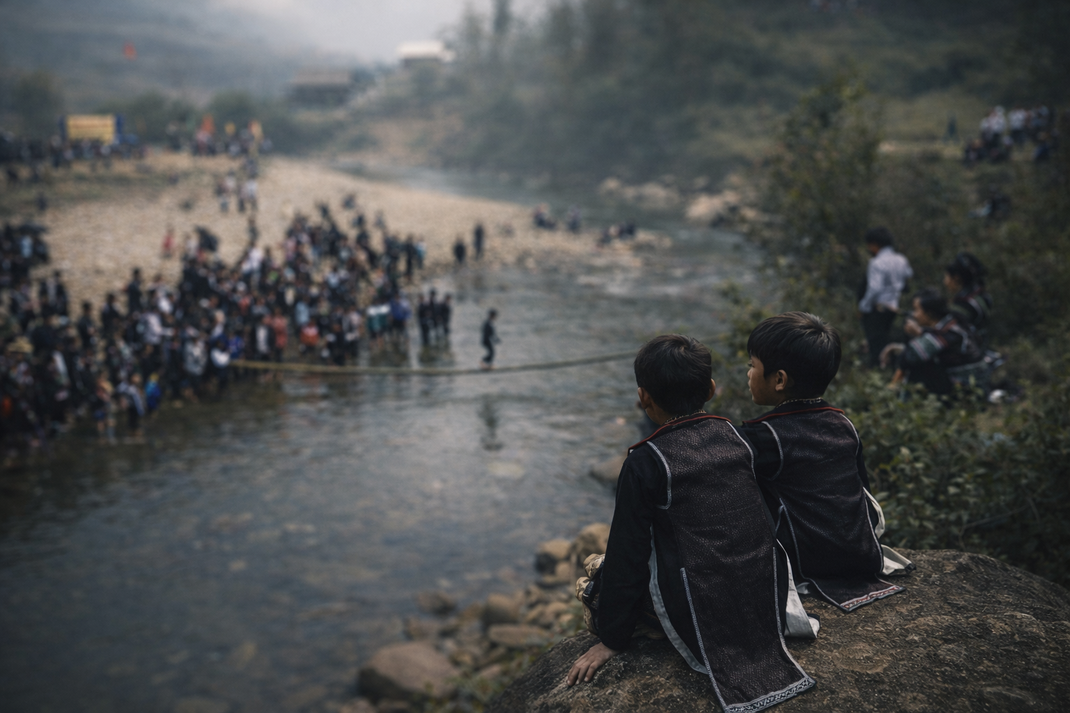
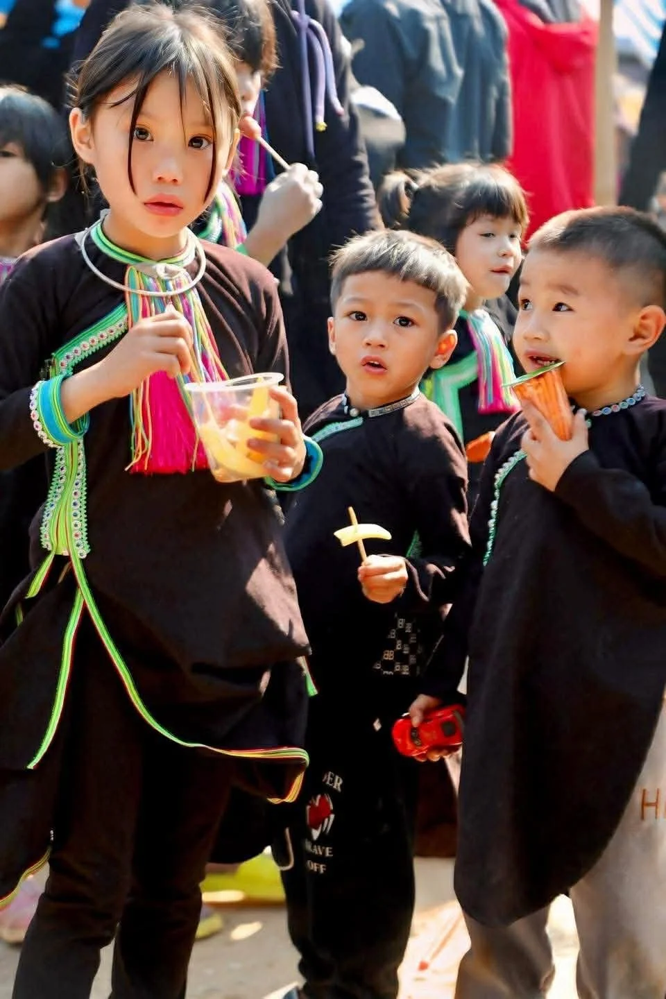
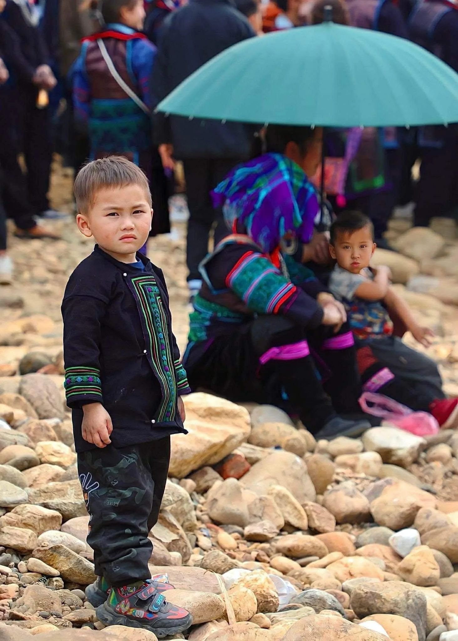
Bun Vốc Nặm - The Living Water Festival of the Lao People
In the mountain valleys of Lai Châu, where streams shape both land and life, the Lao people gather each spring to celebrate Bun Vốc Nặm. This water festival is a joyful expression of renewal, gratitude, and connection, where laughter, ritual, and shared meals bind communities across generations.
In the quiet valleys of northern Vietnam, where rice fields stretch out along winding streams, the Lao ethnic community of Tam Đường lives in close rhythm with water. Here, water is not only a resource but a spirit, a blessing, and a thread that ties together agriculture, ritual, and daily life. Each year, as spring draws to a close and the dry season loosens its grip, villages gather to celebrate Bun Vốc Nặm, a water-splashing festival that embodies renewal, gratitude, and hope for the seasons ahead.
Though the Lao population in Vietnam is small, their cultural life remains deeply rooted and expressive. Bun Vốc Nặm is not simply a festival but a living inheritance, carried forward through gesture, song, and shared memory. It is a time when elders pass down stories, when laughter echoes through bamboo houses, and when water becomes a language of blessing.
A Festival of Renewal and Water
On the first day of Bun Vốc Nặm, the village awakens early, the air still cool with mountain mist. Families gather near streams or communal spaces, dressed in traditional garments, often adorned with handwoven patterns that speak quietly of identity and place. The atmosphere carries a sense of anticipation, of something both playful and sacred.
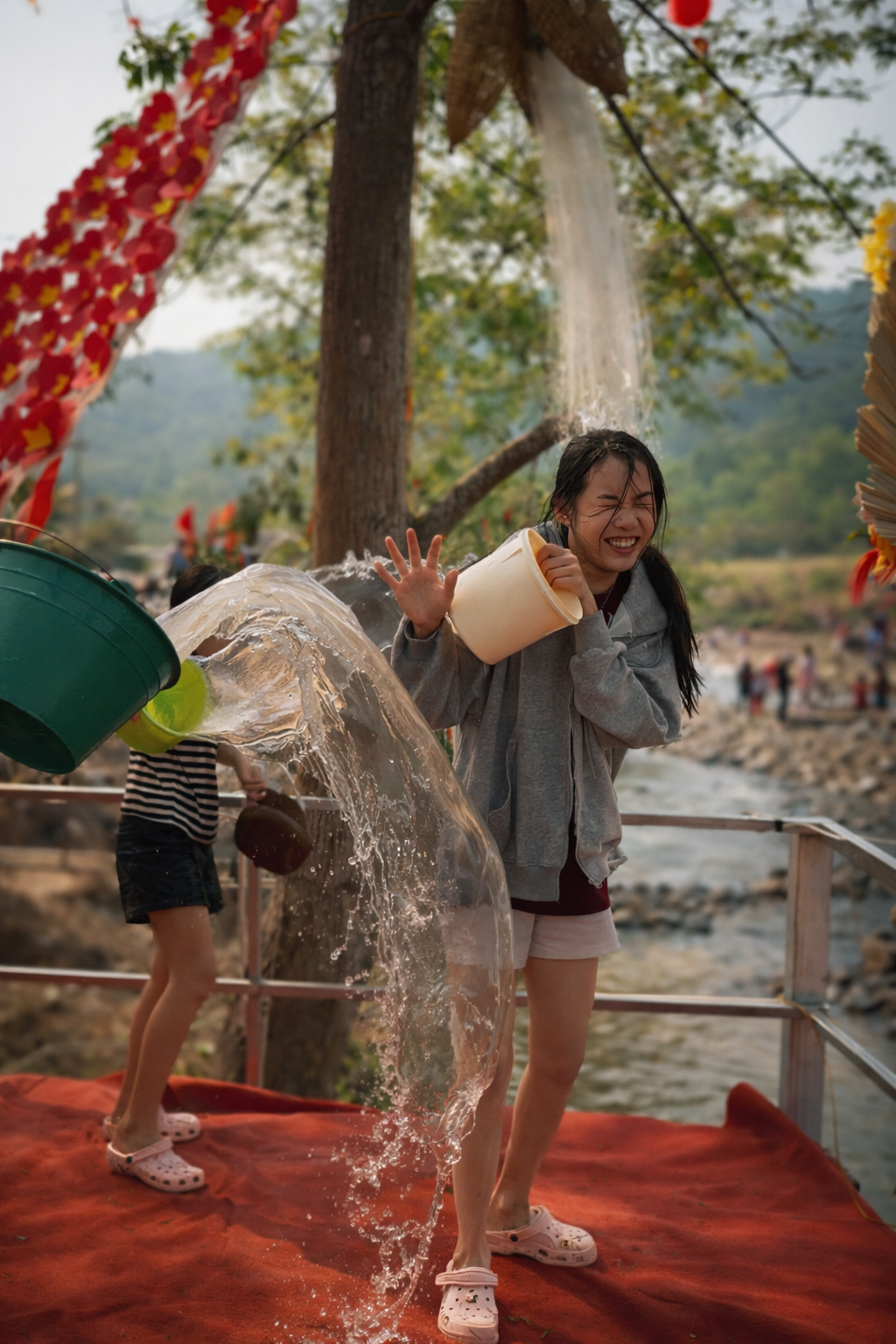
Water splashing begins gently, almost ceremonially, as elders sprinkle water over one another in a gesture of cleansing and goodwill. This act symbolises the washing away of misfortune, illness, and hardship from the past year, making space for prosperity and health. As the morning unfolds, the ritual softens into laughter, and the entire village becomes immersed in joyful chaos, with children darting between adults and friends drenching one another with buckets, bowls, and cupped hands.
The meaning remains rooted in respect, even in the height of the revelry. Water is never thrown carelessly but shared as a blessing, a wish for abundant harvests, favourable weather, and strong community bonds. Each splash carries intention, echoing the Lao belief that water connects the physical and spiritual worlds.
Throughout the day, music flows as steadily as the streams themselves. Traditional songs rise and fall in melodic patterns, accompanied by drums that guide the rhythm of communal dances. Lao dances are fluid and expressive, each movement reflecting harmony with nature. Hands curve like flowing water, feet step in time with unseen currents, and dancers move with a quiet grace that invites participation rather than performance.
Games weave through the celebrations, bringing together generations in friendly competition. Laughter becomes a constant presence, and visitors often find themselves gently drawn into the circle, learning through doing, through shared joy rather than observation.
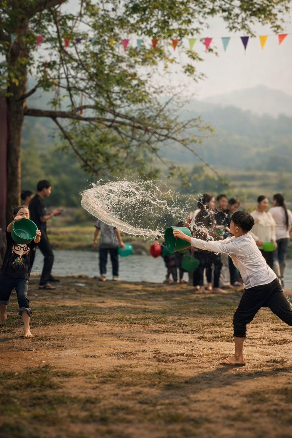
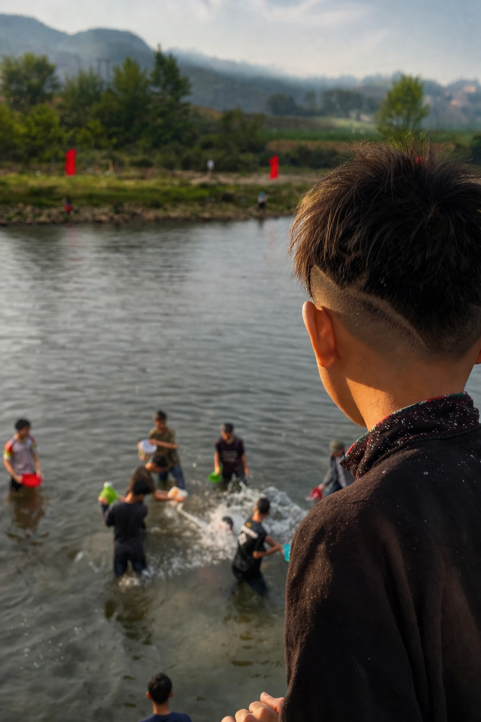
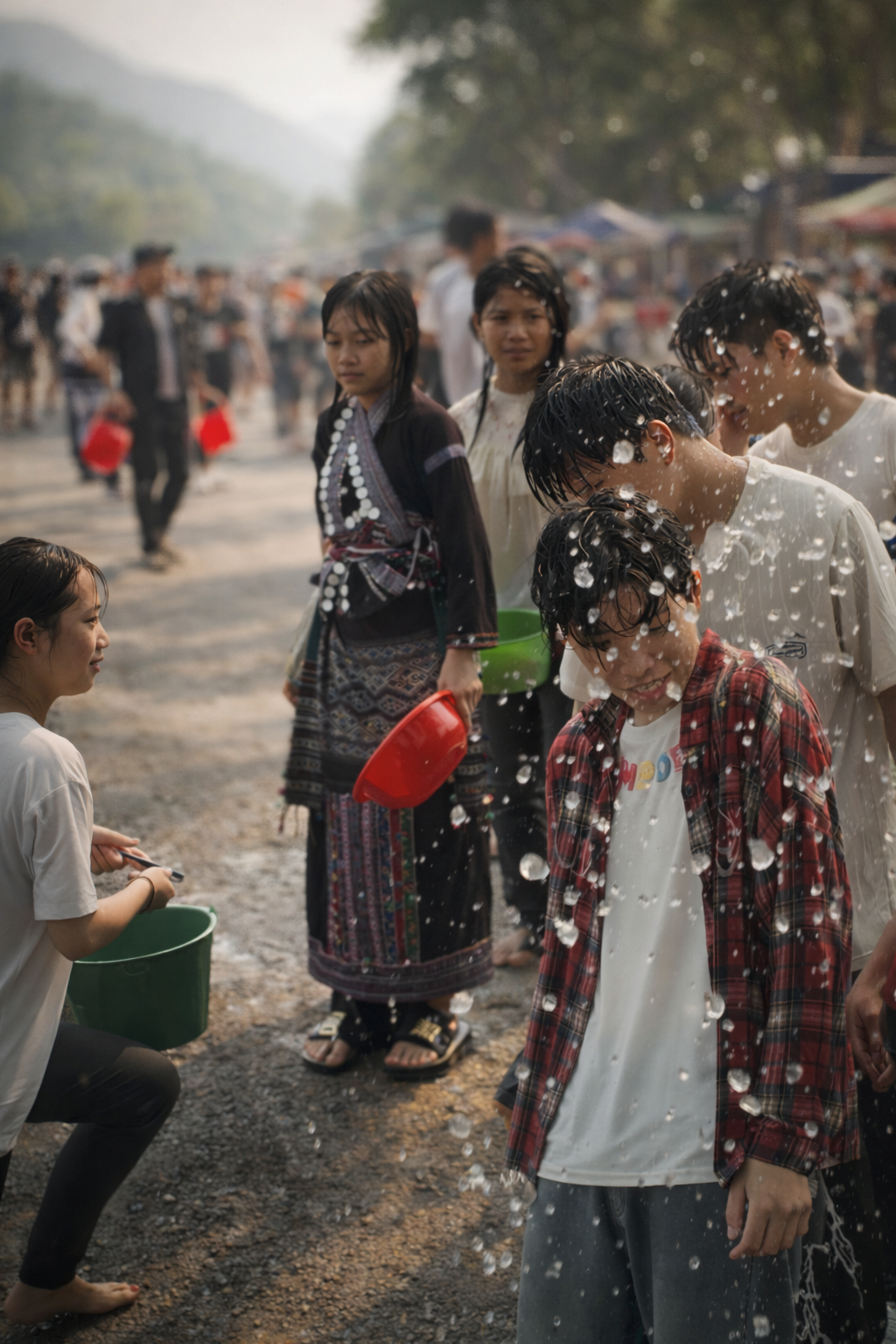
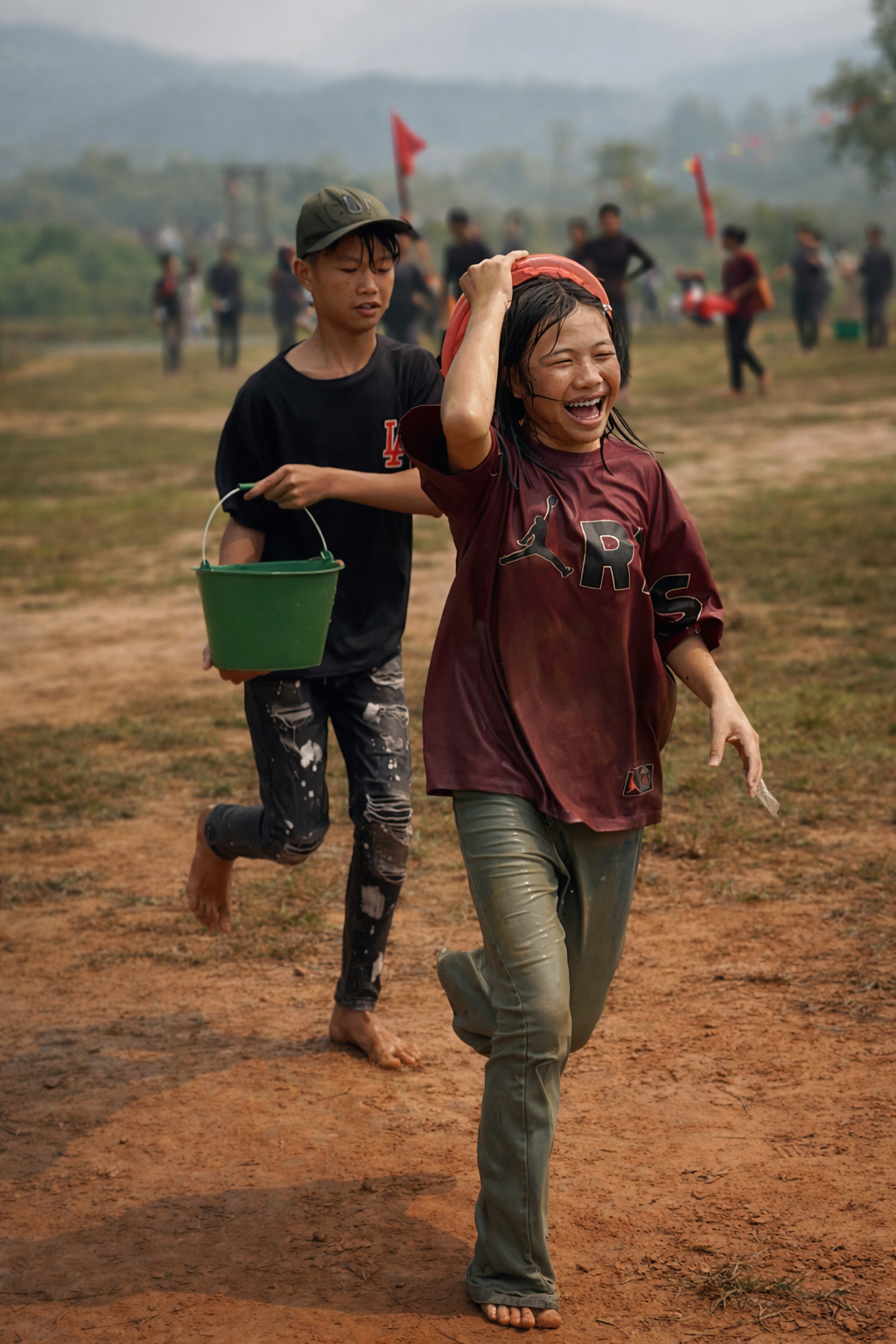
When Water Turns to Play | Youth, Laughter, and Courtship
As the rituals soften into play, the younger generation begins to take centre stage, bringing with them a burst of energy that transforms the atmosphere entirely. Buckets are filled and refilled, water pistols appear from nowhere, and anything that can carry water becomes part of the celebration. What begins as gentle splashing quickly gathers momentum, unfolding into lively, good-natured water battles that ripple through the village. Groups form and dissolve, alliances shift, and laughter rises above the steady rhythm of drums. There is a sense of freedom in these moments, where boundaries blur and everyone, regardless of age or status, is drawn into the joy. Between the splashes, there are quiet exchanges too, glances held a little longer than usual, playful teasing, and the beginnings of flirtation that feel as much a part of the festival as the rituals themselves. Some drift towards the streams to swim, cooling off beneath the mountain sun, while others linger at the edges, watching and waiting for the next playful ambush. It is here, in this shared spontaneity, that the spirit of renewal feels most alive.
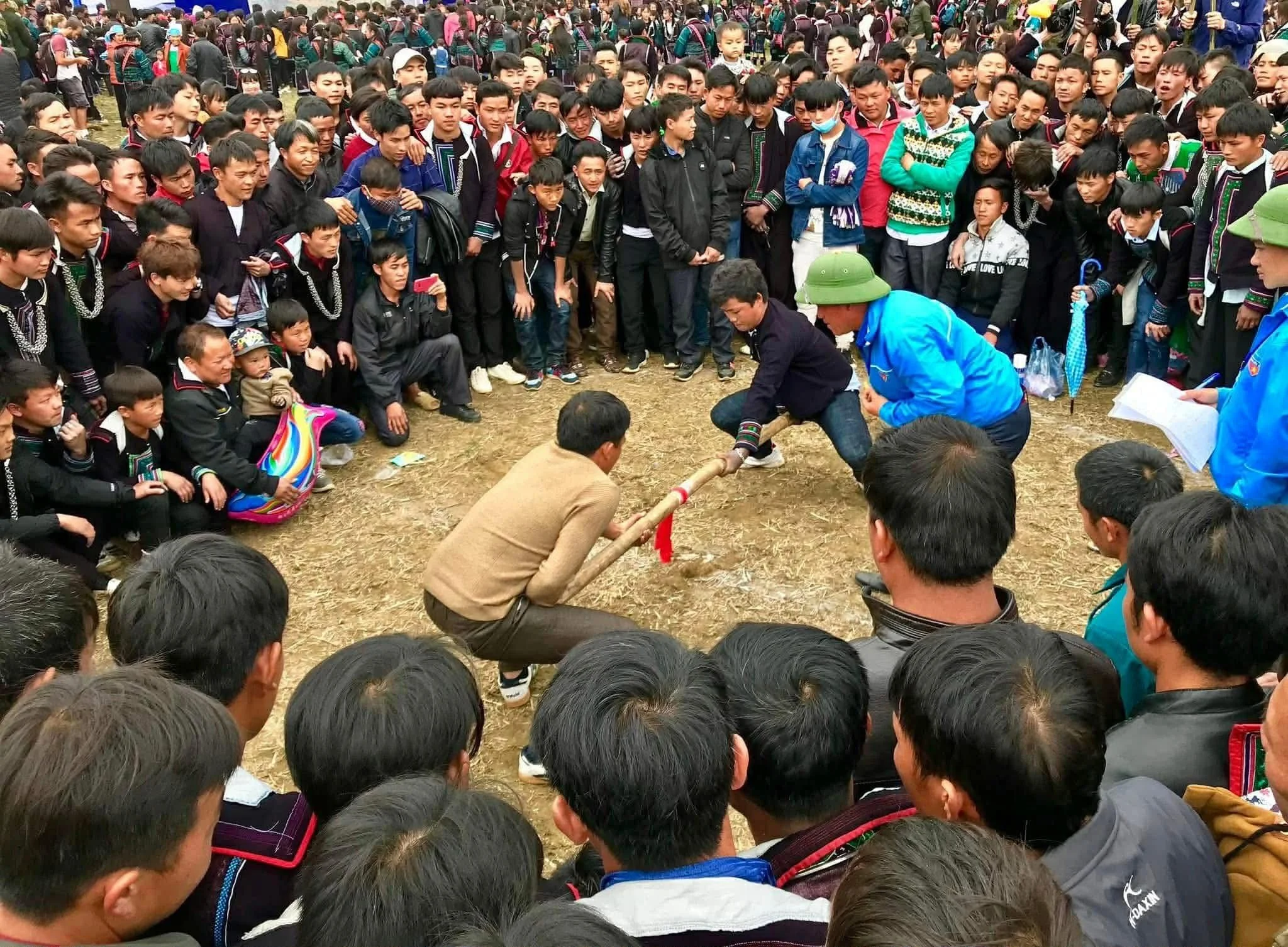
Day Two - Craft, Skill, and the Spirit of Community
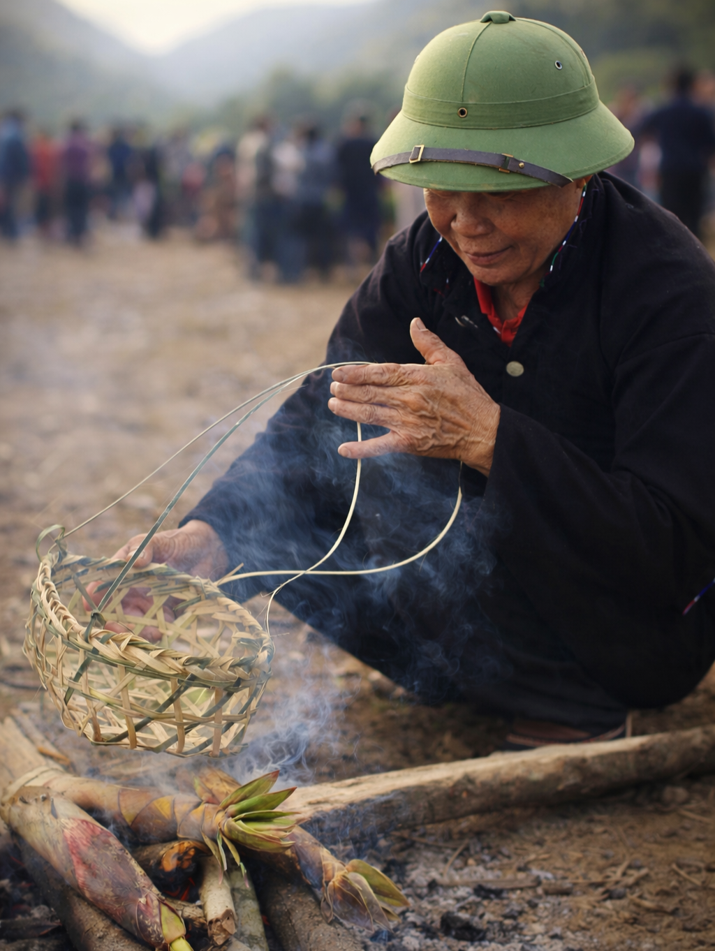
As the second day unfolds, the energy shifts subtly, moving from the playful intimacy of water rituals to a broader celebration of skill, cooperation, and sustenance. Men from across neighbouring villages gather, bringing with them tools, materials, and a deep knowledge of craft that has been shaped over generations.
Basket weaving competitions take centre stage, where participants work swiftly yet with remarkable precision, transforming strips of bamboo into intricate forms. Each basket tells a story of function and artistry, reflecting the rhythms of agricultural life and the ingenuity of those who depend on the forest and fields.
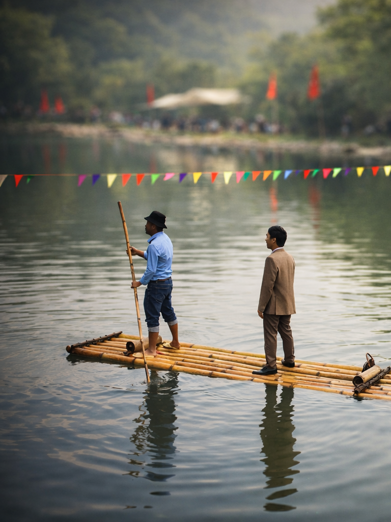
Nearby, rivers and streams come alive with bamboo raft races. Teams balance carefully on handmade rafts, navigating currents with a mixture of strength, coordination, and laughter. The races are as much about community pride as they are about skill, drawing cheers from spectators who line the banks.
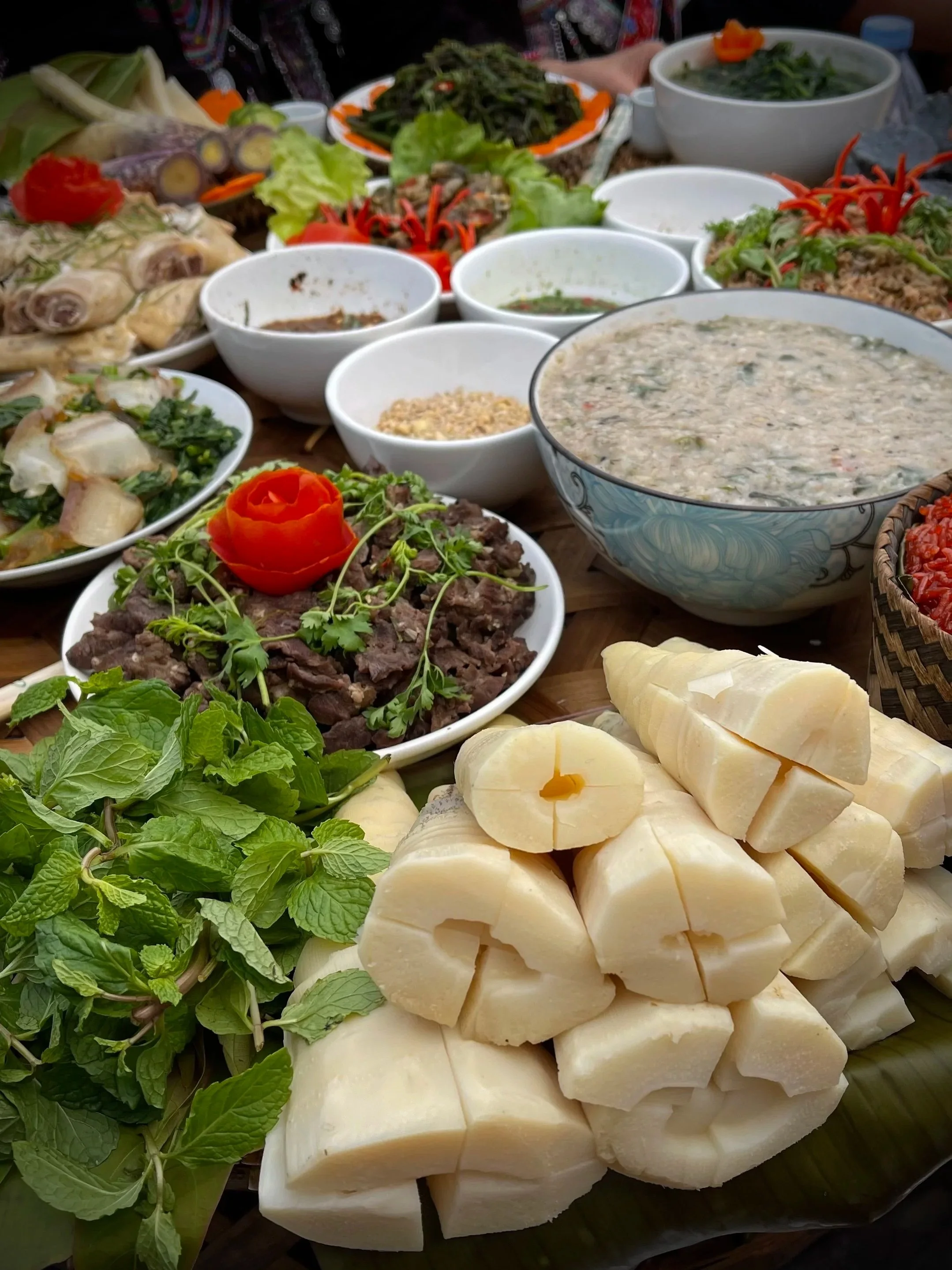
Food becomes a central expression of identity during this second day, particularly through the multi-village cooking competitions. What makes these gatherings remarkable is not only the diversity of dishes but the philosophy behind them. Every ingredient must be sourced locally, either grown in village fields or foraged from surrounding forests and waterways.
Dishes often include river weeds gathered from clear mountain streams, small pond fish caught with traditional methods, aromatic herbs found along forest paths, and even water insects, which are prepared with care and respect. These foods are not curiosities but staples, deeply connected to the landscape and seasons. Cooking becomes a collective act of storytelling, where each flavour speaks of place, resilience, and knowledge passed down through generations.
Visitors who are invited to taste these dishes often discover a cuisine that is both surprising and deeply nourishing, shaped by necessity yet elevated by creativity.
Beauty, Identity, and Living Traditions
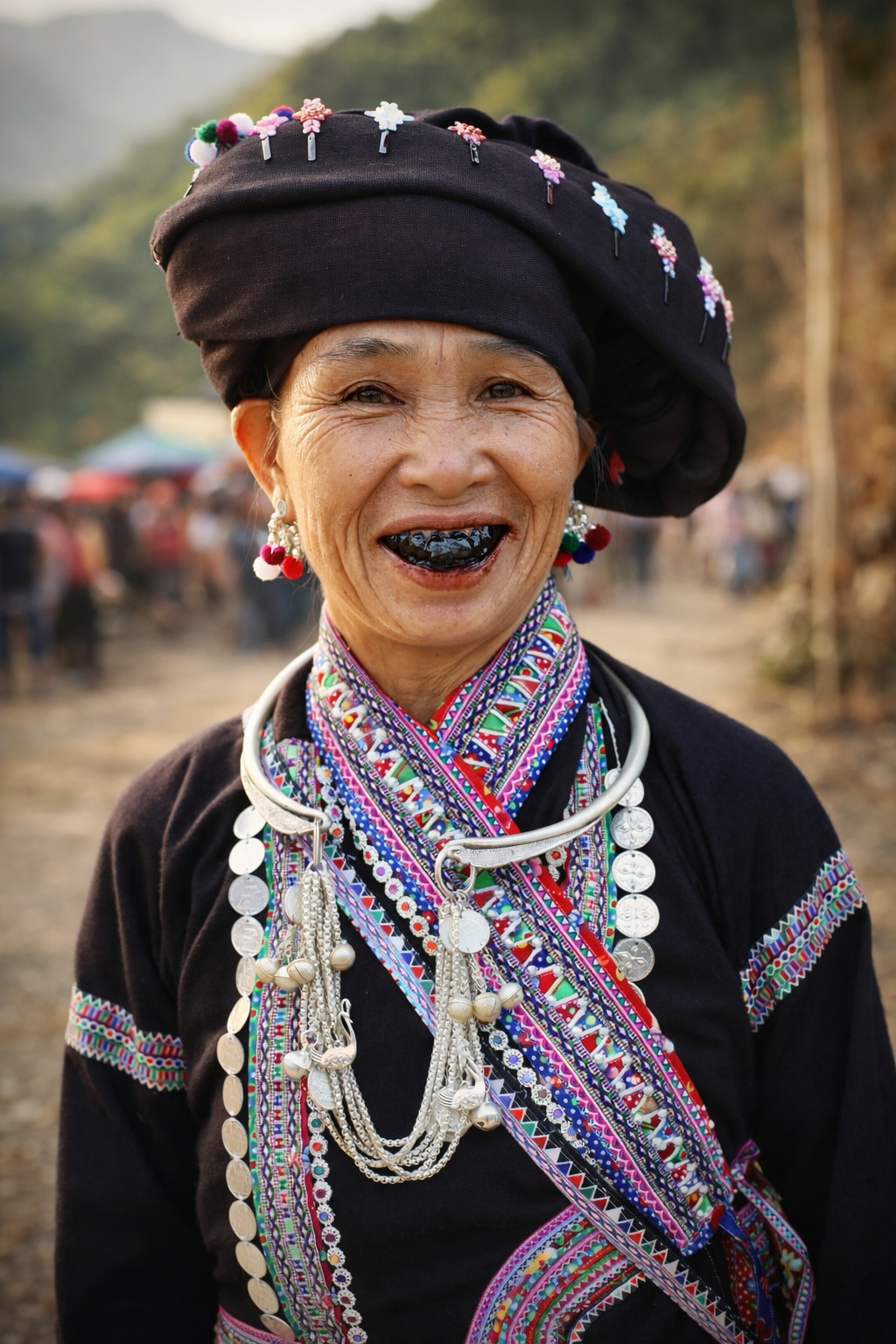
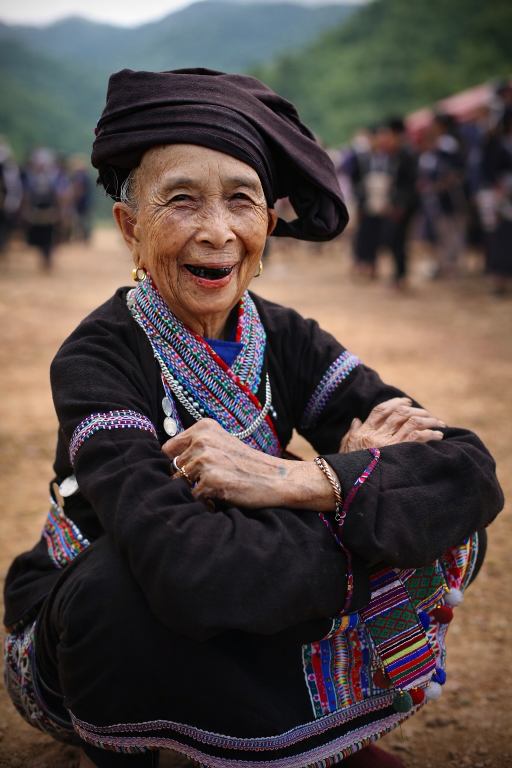
Among the Lao, traditions of beauty and identity continue to hold quiet significance. Practices such as betel chewing and teeth blackening, particularly among older women, are not relics of the past but markers of maturity, dignity, and cultural distinction. Blackened teeth are seen as a sign of beauty and humanity, setting people apart from animals and affirming their place within the social and spiritual world.
These customs, like the festival itself, reflect a worldview in which identity is expressed through continuity, through the preservation of practices that carry meaning beyond the visible.

A Festival That Binds Generations
Bun Vốc Nặm is, above all, a celebration of connection. It brings together families, neighbours, and neighbouring villages in a shared rhythm of ritual and joy. It honours the past while welcoming the future, creating a space where tradition is not preserved in isolation but lived, adapted, and shared.
In a world that often moves too quickly, the festival offers a different pace, one guided by the flow of water and the cycles of the land. It reminds us that renewal is not only a seasonal event but a collective act, rooted in care, respect, and belonging.
Travel with ETHOS and Walk Gently into Lao Culture
At ETHOS, we believe that travel should deepen understanding rather than simply observe difference. Our journeys into Lao communities from Sapa are shaped in collaboration with local families, ensuring that every experience is respectful, immersive, and mutually beneficial.
When you travel with us, you are not watching a festival from the outside. You are welcomed into homes, invited to share meals, and guided by those whose lives are woven into these traditions. You may find yourself learning to weave bamboo, tasting forest herbs you have helped gather, or standing beside a stream as laughter rises around you and water becomes a shared blessing.
These are not performances arranged for visitors, but living moments of culture, offered with generosity and trust.
If you feel called to experience the highlands in a way that honours both people and place, we invite you to join us. Let the rhythm of water guide you, and discover a festival where every gesture carries meaning, and every welcome is deeply felt.
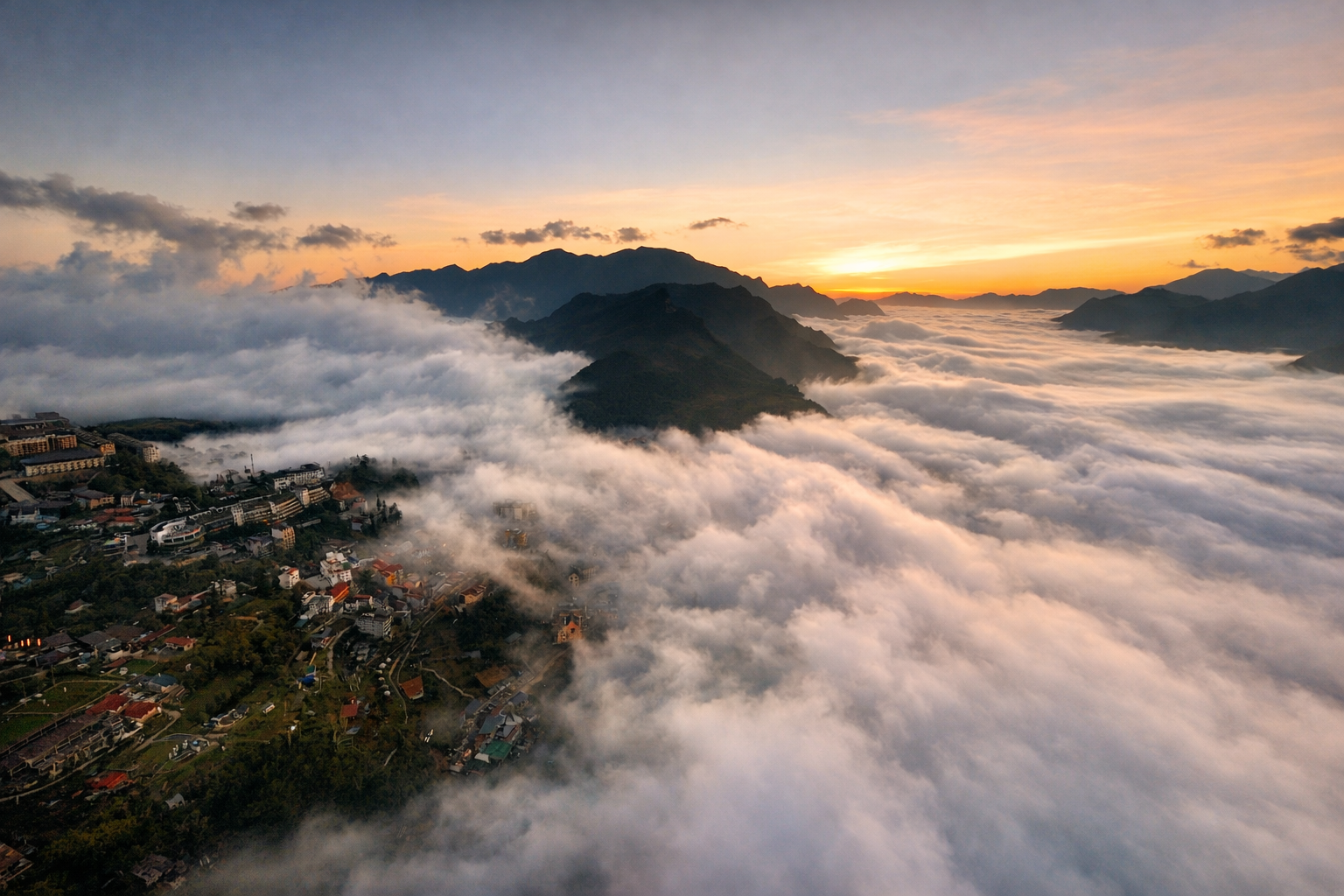
The Sapa Weather Forecast. Or Why the Mountains Rarely Read the Apps
Sapa weather has a mischievous streak. Forecast apps try their best but the mountains often have other ideas. Here is a light hearted yet practical look at Sapa’s climate through the year, why forecasts often struggle, and why the weather should never stop you exploring the culture and communities of northern Vietnam.
If you ask someone in Sapa what the weather will be like next Tuesday, you may notice a thoughtful pause followed by a gentle smile. That pause is not rudeness. It is experience. Anyone answering with certainty is simply guessing.
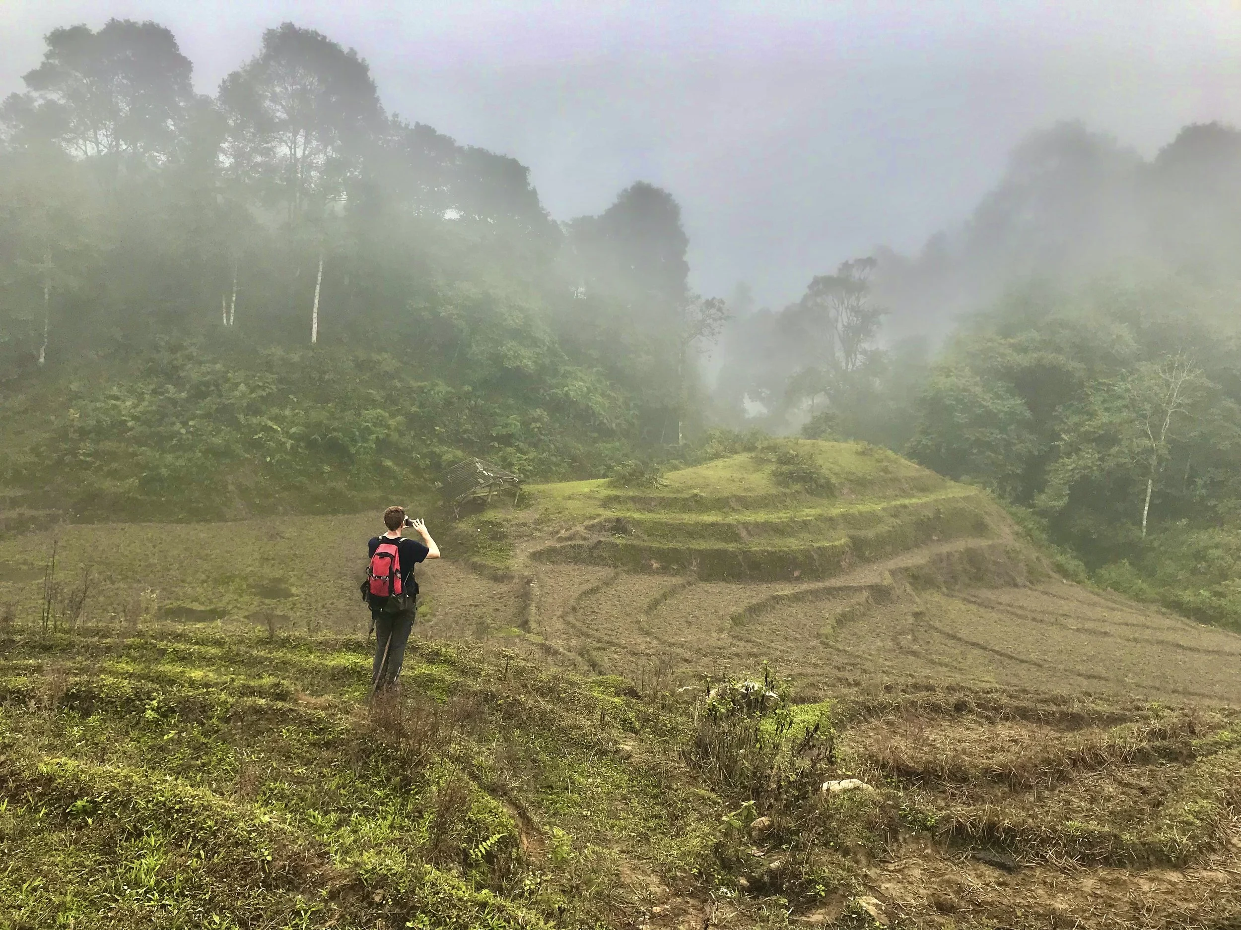
Mountain weather has a habit of doing exactly what it pleases, often changing its mind several times between breakfast and lunch. Bright sunshine can give way to drifting fog, while a gloomy morning sometimes opens into a warm and unexpectedly beautiful afternoon.
Another phrase you sometimes hear when discussing Sapa weather is that you can experience “four seasons in one day”. It is a charming saying and travellers repeat it often, but in truth it is not entirely accurate. Sapa does not genuinely cycle through spring, summer, autumn and winter before dinner. What does happen, however, is that temperatures and conditions can shift quickly and sometimes dramatically. A cool misty morning may warm into pleasant sunshine by midday, only for cloud and drizzle to drift back in during the afternoon. Strong sun can suddenly give way to fog rolling up from the valley, while a chilly morning might become surprisingly warm once the clouds lift. The mountains are simply very good at changing their minds, and visitors quickly learn that flexibility is far more useful than trying to predict the day too precisely.
Rather than worrying too much about the forecast, many travellers find it more helpful to understand the seasonal rhythms of the mountains. Planting season, harvest time, cooler winter months and lush summer landscapes each bring a different character to village life.
If you are curious how Sapa changes through the year, our guide to the seasons explores what is happening in the fields, forests and communities each month.
In 2016 we decided to conduct a slightly nerdy experiment. For twenty days we carefully followed the forecasts provided by Accuweather and Windy, two widely respected weather apps that are used by travellers, outdoor enthusiasts and professionals around the world. Each day we compared what the apps predicted with what actually happened in Sapa. Over those twenty days the forecast was wrong sixty two percent of the time. Not slightly off, but catagorically incorrect!
One morning promised clear skies but delivered dense fog thick enough to hide entire mountains. On another day the forecast warned of rain from morning until evening yet we spent most of the afternoon walking through villages under pleasant blue skies. Curious to see whether technology had improved the situation, we repeated the same experiment in late January 2026. The results were remarkable in their consistency. For thirteen consecutive days the forecast failed to match the conditions we experienced on the ground.
None of this is really the fault of the forecasting apps. Predicting weather in complex mountain terrain is notoriously difficult, and the landscapes around Sapa present a perfect storm of variables that can confuse even sophisticated meteorological models.
When One Valley Has Fog and the Next Has Sunshine
Another peculiarity of mountain weather is that conditions can change dramatically over very short distances. In Sapa it is entirely possible for one valley to sit beneath a thick blanket of fog while the ridge above enjoys bright sunshine and clear skies. Walk two kilometres uphill and you may emerge from cool, damp cloud into warm blue sky, sometimes with temperatures ten degrees Celsius higher than the valley floor you just left behind. The reverse can happen just as easily. This constant interplay between altitude, wind and cloud means that the weather you experience in one village may bear little resemblance to conditions in the next valley. It also explains why forecasting for the region can feel a little like trying to predict the mood of the mountains themselves.

Aerial shot of Sapa town showing sunset on the mountain peaks and valleys covered in dense fog.
Weather and Climate. Two Very Different Things
When travellers ask what the weather will be like on a particular date, they are usually thinking about the short term conditions that might greet them on arrival. In scientific terms this is weather, which refers to the atmospheric conditions we experience over hours or days.
Climate, on the other hand, describes the long term patterns that develop over decades. It reflects how temperature, rainfall and seasonal shifts generally behave in a particular region.
Weather can change quickly and dramatically, especially in mountainous terrain where wind patterns, altitude differences and local geography can influence conditions from one valley to the next. Climate tends to move more slowly and reveals broader trends that are far more reliable when planning travel.
In practical terms this means that asking about the exact weather on a particular day is often pointless. Even the most advanced forecast models struggle to predict mountain conditions more than a few days in advance, and even then the results should be taken with a generous pinch of salt.
Climate patterns, however, give us a useful framework for understanding the rhythms of the year in Sapa.
El Niño, La Niña and a Climate That Is Becoming Harder to Predict
Even those longer climate patterns are now facing new layers of complexity. Large scale global systems such as El Niño and La Niña influence weather across the entire Pacific region, including much of Southeast Asia.
El Niño occurs when sea surface temperatures in the central and eastern Pacific Ocean become warmer than usual. This seemingly distant shift in ocean temperature alters atmospheric circulation patterns across the tropics, often leading to drier conditions in parts of Southeast Asia while bringing heavier rainfall to other regions.
La Niña represents the opposite phase of this cycle. During La Niña events the same areas of the Pacific become cooler than average, which strengthens trade winds and can bring increased rainfall and cooler conditions across large parts of Southeast Asia.
These cycles typically occur every few years and can significantly influence seasonal weather in Vietnam. In some years they may intensify rainfall during the wet season or extend periods of dry weather, while in other years they shift the timing of seasonal transitions in ways that are difficult to predict.
As if this were not complicated enough, climate change is adding further variability to the system. Rising global temperatures are influencing ocean currents, atmospheric circulation and the distribution of rainfall across the planet. Scientists are observing that extreme weather events are becoming more common in many regions, while seasonal patterns that were once relatively stable now show greater variation.
In mountainous environments like Sapa the effects can feel particularly pronounced. Slight changes in regional climate patterns can translate into significant shifts in local weather, especially when altitude, steep terrain and complex wind flows are already involved.
All of this means that forecasting conditions in the mountains has become even more challenging than it once was.
Sapa Through the Seasons. A Month by Month Overview
Autumnal scenes in Sapa

Snowfall in the Hoang Lien Son Mountains, Sapa.
Misty weather during one of Sapa’s lunar new year festivals.
Although daily weather remains unpredictable, the overall rhythm of the year in Sapa follows a fairly consistent climatic pattern that reflects the broader seasonal cycles of northern Vietnam.
January is typically the coldest month of the year, with crisp daytime temperatures and nights that occasionally approach freezing in higher villages. On rare occasions frost forms across the hillsides and ice may appear on exposed surfaces.
February often remains cool and can be quite misty, with clouds drifting slowly through the valleys and giving the landscape a quiet, atmospheric feeling.
March gradually marks the arrival of spring as temperatures begin to climb and farmers start preparing their fields, although periods of cloud and light drizzle are still common.
April is widely considered one of the most comfortable months to visit, as mild temperatures combine with increasingly green landscapes while rainfall remains relatively moderate.
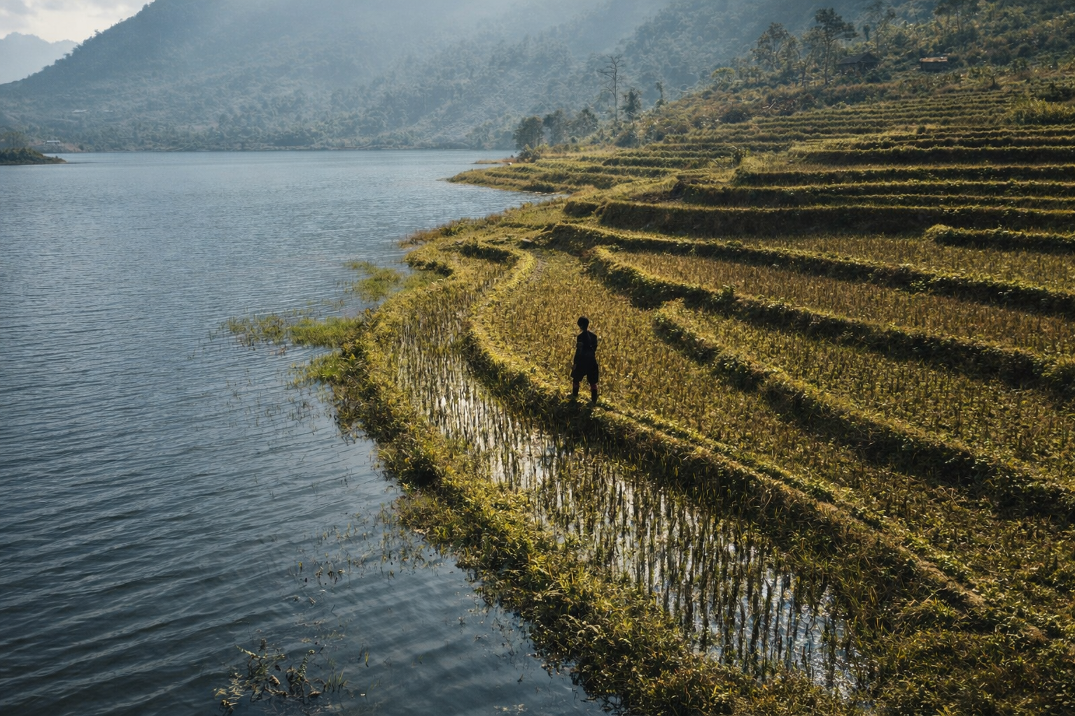
May introduces the early stages of the warmer season. Rice planting begins across the terraces and the countryside becomes lively with agricultural activity as occasional showers start to appear.
June brings warmer and more humid conditions as the growing season gathers momentum. Rain becomes more frequent but the landscape turns intensely green as the terraces fill with young rice.
July continues this warm and humid pattern with regular afternoon showers, although sunny mornings are still common and the countryside remains lush and vibrant.
August can feel quite tropical at times, with humid days and occasional thunderstorms that usually pass quickly, leaving behind clear air and dramatic cloud formations.
September is often one of the most visually striking months as the rice terraces turn golden ahead of harvest and temperatures begin to ease slightly after the height of summer.
October frequently delivers some of the clearest skies of the year, creating excellent trekking conditions as cooler air arrives and harvest activities fill the valleys.
November becomes cooler and quieter once the harvest is complete, with misty mornings often rolling across the hills before giving way to calm afternoons.
December brings crisp mountain air and increasingly cool nights as winter slowly returns to the region.
Yet despite these broad patterns, it is worth remembering that any month could still surprise you with brilliant sunshine or damp fog.
That is simply the nature of mountain weather.
Why the Weather Might Not Matter
While most travellers hope for blue skies and perfect visibility, the real magic of Sapa has very little to do with the colour of the sky.
What makes this region truly special is the people who call these mountains home. Hmong, Dao and other communities have shaped these landscapes through generations of farming, artistry and cultural tradition, and their daily lives continue regardless of whether the day brings sunshine, mist or gentle rain.
Many of our most memorable journeys with travellers have taken place during weather that was far from ideal. Treks through drifting cloud can feel mysterious and peaceful, while a light rain often adds atmosphere to the terraces and forests.
Some of our strongest reviews were written by guests who visited during conditions that might have worried them before arrival. Once they experienced the warmth of village hospitality, shared meals with local families and learned about farming traditions and crafts, the weather became little more than a background detail.
When the focus shifts from scenery alone to culture, connection and learning, every season has something valuable to offer.
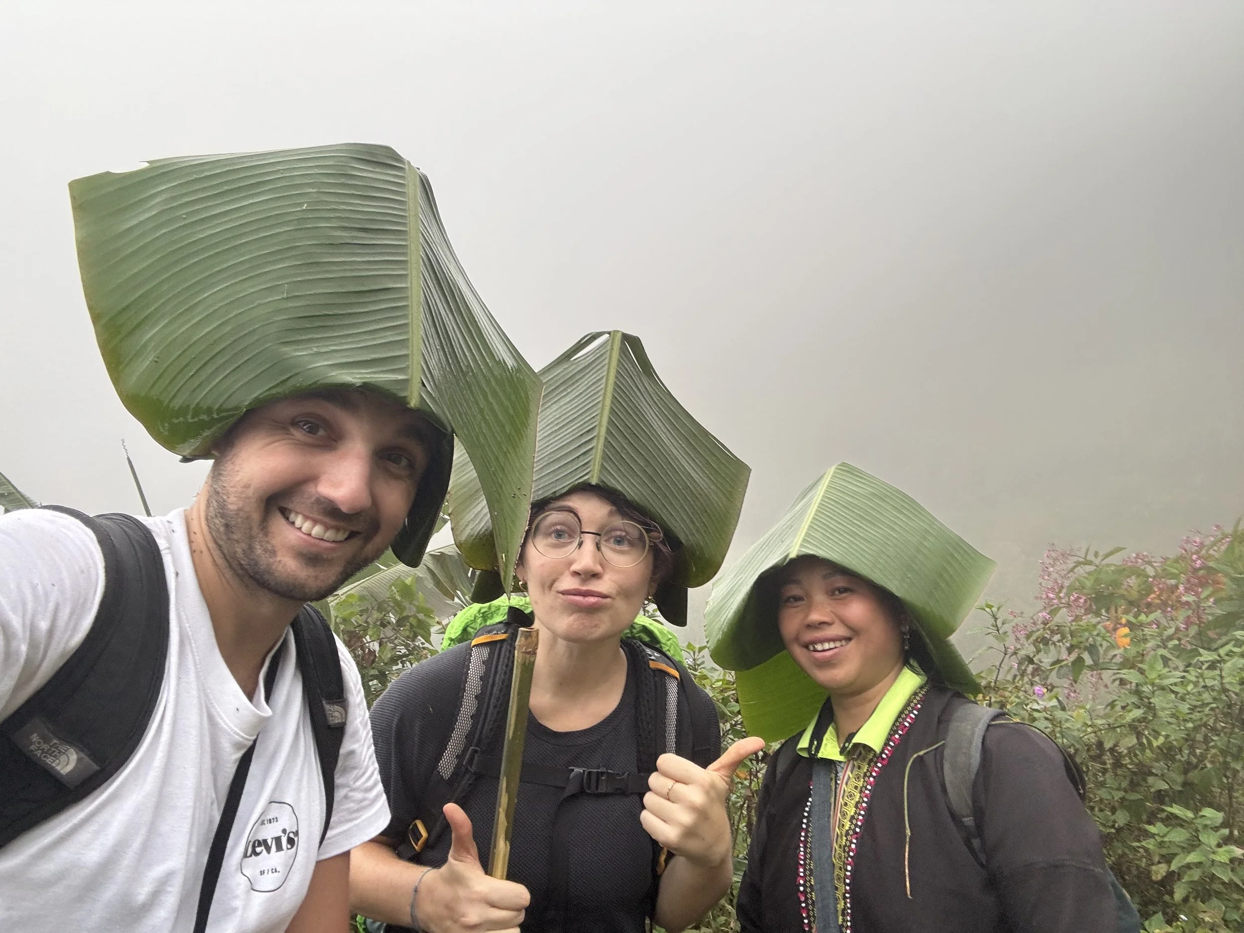
Impromtu rain hats

Rainy day trek
The misty mountain in Sapa
Summer trek through the rice terraces
Mountain Extremes and Curious Choices
That said, the mountains do occasionally remind us that they deserve respect.
A warm and humid day in August can feel almost tropical as the terraces glow with deep shades of green, while a January morning in the high villages may bring biting winds and temperatures that flirt with freezing.
One winter day we watched a long line of visitors waiting to board the cable car to Fansipan. At the summit the temperature had dropped to minus twelve degrees, yet several travellers were dressed in short skirts and light jackets.
They seemed far more concerned with capturing the perfect photograph than with staying warm, while the mountain quietly demonstrated that it was not particularly interested in fashion.
Morning mist over Sapa town
Fog over the Sapa forests
Sapa Rice terraces in June
Curious About the Best Time to Visit Sapa?
If you would like a deeper look at how the landscape changes through the year, including rice planting, harvest seasons and the quieter months in the mountains, we have put together a detailed guide that explores Sapa month by month. It looks beyond the daily forecast and focuses on the seasonal rhythms that shape life in the hills.
You can explore the full guide here:
https://www.ethosspirit.com/sapa-through-the-seasons
It offers a more detailed look at what is happening in the fields, forests and villages throughout the year, helping you choose a time that suits the kind of experience you are hoping to have in the mountains of northern Vietnam.
Layers, Preparation and a Sense of Humour
The secret to enjoying the mountains is simple preparation. Layers allow you to adapt quickly as temperatures change, and comfortable walking shoes together with a light waterproof jacket will handle most situations you might encounter.
Fortunately Sapa also offers a practical solution for travellers who arrive slightly under prepared.
Outdoor clothing can be surprisingly inexpensive here. It is not unusual to see Patagonia style puffer jackets for a few dollars or North Face hats and gloves available in the market stalls. They might not survive a full ski season in the French Alps but they are more than capable of keeping you comfortable during a trek through the hills of northern Vietnam.
In the end there is a simple principle that experienced travellers tend to follow.
There is no bad weather. Only bad preparation.
If you arrive with suitable clothing, a flexible mindset and a sense of humour, the mountains will reward you with experiences that go far beyond whatever forecast appeared on your phone.
Learn what to pack for a Sapa visit.
Plan Your Trek in Any Season
Plan Your Trek in the Mountains
Weather in Sapa may change its mind, but the mountains, villages and people are here all year. If you would like to experience the region on foot with local Hmong and Dao guides, explore our trekking journeys and community experiences. Every season offers something different, and every walk is shaped by the people who call these hills home.
Tet in Northern Vietnam: What to Expect, When to Travel, and How to Prepare
Tet shapes travel, family life, and village celebrations across northern Vietnam. From red envelopes and homecomings to crowded roads and post-Tet festivals, here is how to plan a thoughtful journey around Tet 2026.
Each year, as winter softens its hold on the Hoàng Liên mountains and the first plum blossoms open along stone walls and village paths, Vietnam moves into its most meaningful season. Tết Nguyên Đán, the Lunar New Year, marks a time of renewal, homecoming, and intention.
In the northern highlands of Sapa, Ha Giang, and the wider border regions, Tet shapes the rhythm of daily life, travel, and community celebration. For visitors, understanding this period allows journeys to unfold with greater care, respect, and connection.
When Is Tet in 2026?
In 2026, Tet begins on Tuesday 17th February, marking the start of the Lunar New Year.
Although the official holiday lasts several days, preparations begin weeks in advance and the effects continue well beyond the celebration itself. Travel patterns, accommodation availability, and village life are influenced for up to three weeks around Tet.
What Is Tet and How Is It Celebrated?
Tet marks the beginning of the lunar calendar and a turning point in family, agricultural, and spiritual life. Across Vietnam, people return to their ancestral homes, clean and repair houses, and prepare food that carries memory, care, and meaning.
Altars are refreshed with kumquat trees, peach blossom branches, incense, and offerings. Kitchens fill with the slow scent of simmering broths and sticky rice wrapped in banana leaves. The first days of the new year are spent visiting relatives, offering good wishes, and resting after a year of work.
One of the most visible customs during Tet is the giving of lì xì, red envelopes containing small amounts of money. These are given primarily to children, but also to elders and unmarried adults, as a symbol of good fortune, health, and prosperity for the year ahead. The red envelope itself carries meaning, representing luck and protection, rather than the monetary value inside. For children, receiving lì xì is a moment of excitement and joy, often accompanied by blessings for growth, strength, and happiness.
In the mountains, Tet aligns with a pause between farming cycles. Fields rest, tools are set aside, and time is made for family gatherings, storytelling, and preparation for the celebrations that follow.
What Tet Means for Travel in Vietnam
Travelling during Tet requires thoughtful planning and realistic expectations.
In the days leading up to and following the New Year, transport networks become extremely busy as families return home. Buses, trains, and flights often sell out far in advance. Many small, family-run businesses close for several days so that owners and staff can spend time with their families.
For travellers, preparation makes a significant difference. Booking accommodation early, allowing extra time for journeys, and accepting a slower pace can turn disruption into an opportunity to witness daily life at a meaningful moment in the year.
The Ha Giang Loop After Tet
The Ha Giang Loop is one of northern Vietnam’s most iconic journeys, and Tet brings a sharp rise in visitor numbers.
From around two days after Tet, the Loop becomes extremely busy. Homestays and hotels fill quickly and often reach full capacity. Roads see heavy traffic from tour groups, motorbikes, and domestic travellers returning from holiday.
For approximately ten days after Tet, riding conditions can feel congested, and accommodation options are limited. Those planning to travel during this period should book well in advance. Travellers seeking quieter roads and a more spacious experience may prefer to arrive before Tet or wait until later in the season.
Sapa During and After Tet
Sapa follows a similar rhythm.
From the second day after Tet, the town and surrounding valleys experience a significant increase in visitors. Hotels fill, trekking routes become busier, and transport costs may rise.
This period of heightened activity usually lasts around ten days, after which the region gradually returns to a calmer pace. Travellers hoping for quieter trails and deeper village engagement may wish to plan their visit outside this window.
Village Festivals After Tet in Hmong and Dao Communities
After the main Tet celebrations each spring, villages around Sapa begin to host their own cultural festivals. These gatherings are deeply rooted in local tradition and follow village-specific calendars rather than national schedules.
Festivals typically begin early in the morning and continue through the day. Larger villages host especially lively celebrations, drawing neighbouring communities together. Events include a wide range of cultural activities and folk games that emphasise health, strength, and skill. Physical ability is highly valued, as agriculture remains central to daily life in the highlands.
Music, dancing, shared meals, and rice wine are all part of the day. Perhaps the most anticipated moment comes with the unveiling of newly handmade traditional clothing. Months of winter are spent preparing these garments, using indigo-dyed organic hemp and intricate silk embroidery. Each piece reflects patience, identity, and pride in craftsmanship passed down through generations.
Alongside these traditional garments, some young women choose modern fabrics and bolder styles, often affectionately referred to as the “glitter girls”. Their presence adds humour, creativity, and a living sense of fashion to the celebrations.
Hmong New Year festivals mark the end of the harvest and the beginning of a new year in the Hmong calendar. They are a time for honouring ancestors, strengthening community bonds, exchanging small gifts, and reflecting on the year that has passed while setting intentions for the one ahead.
For visitors, these festivals offer a rare opportunity to witness culture as it is lived, not staged. Respectful behaviour, local guidance, and patience are essential, as these gatherings remain first and foremost for the communities themselves.
Planning Your Journey Around Tet
Tet can be a rewarding time to travel in northern Vietnam when approached with awareness and care.
Accommodation should be booked early, particularly in Ha Giang and Sapa. Flexible itineraries allow room for transport delays and business closures. Travellers who align their journeys with local rhythms often find deeper connection than those moving too quickly.
At ETHOS, our experiences are shaped in close collaboration with Hmong and Dao partners, following the seasonal cycles of land and village life. Some travellers arrive before Tet to experience quiet mountain days. Others choose to come later, when village festivals bring colour, movement, and shared celebration back to the valleys.
Listening to the people who live here remains the foundation of meaningful travel, whatever the season.
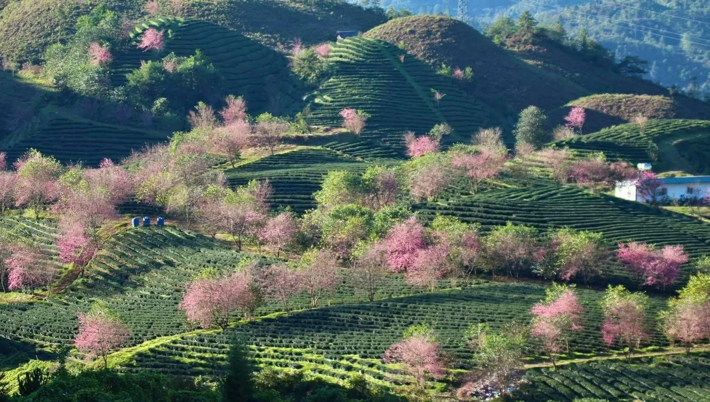
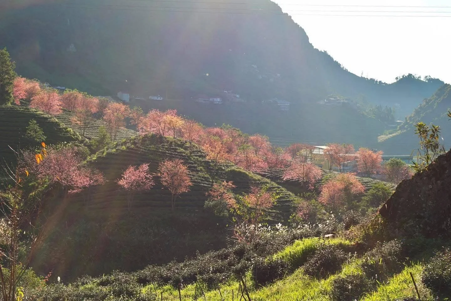
Cherry Blossom Season in Sapa: When the Highlands Turn Pink
Each December, Sapa’s cold highlands briefly turn soft pink as wild cherry blossoms bloom across the tea hills. It is a quiet, beautiful winter moment not many travellers expect.
A Winter Transformation in the Sapa Highlands
There is something very special about cherry blossom season in Sapa. Each year in December, for around fifteen days, the highlands change completely. Cold air settles over the mountains, winter winds sweep across the valleys, and suddenly the landscape glows with soft shades of pink.
Against the grey skies and misty hills, the blossoms feel even more striking. The contrast between winter’s chill and the gentle flowers makes this season short, calm and deeply memorable.
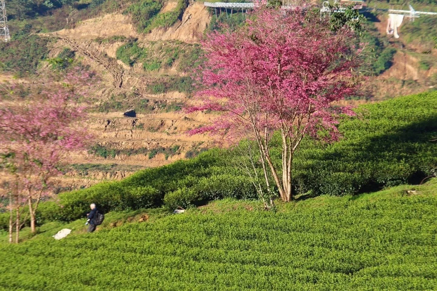
A Landscape Painted in Pink
During this brief period, hillsides that are usually green or quiet become lively with colour. Walking through Sapa at this time feels like stepping into a different world, where nature slows down and invites you to stop and look more closely.
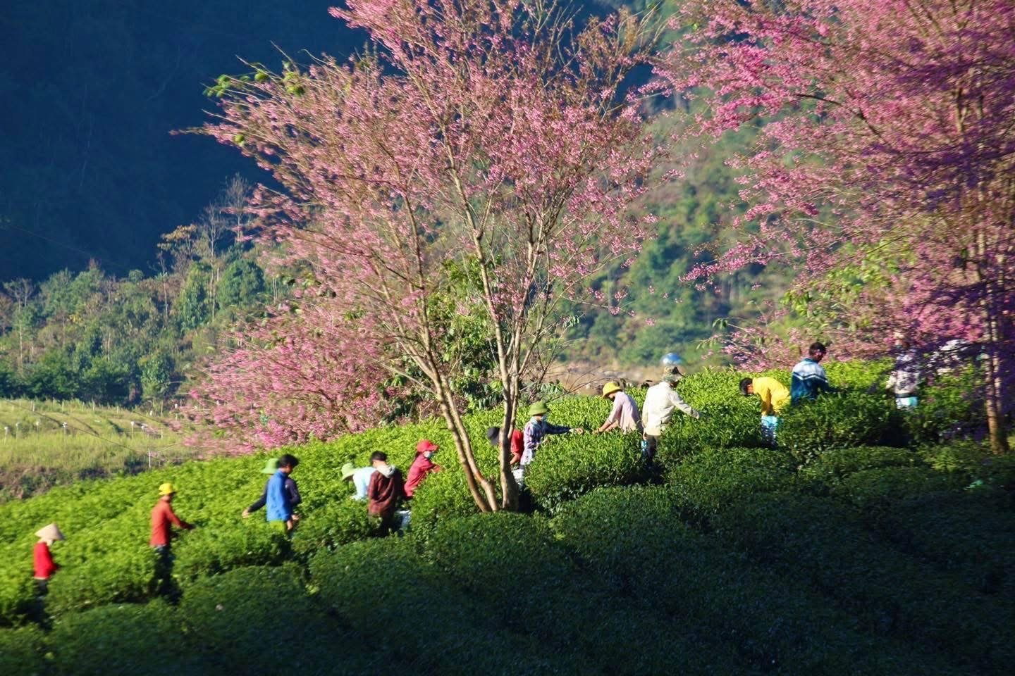
Wild Himalayan Cherry Blossoms Explained
The blossoms seen in Sapa are wild Himalayan cherry trees, known scientifically as Prunus cerasoides. They are sometimes called sour cherry and are native to Southeast Asia.
Where These Trees Grow
These cherry trees grow only in temperate climates at elevations above 1,200 metres. Their natural range stretches from the Himalayas through to northern Vietnam, making Sapa an ideal home for them.
Planted along tea hills, the trees bloom just once a year, which is why the season feels so precious and fleeting.
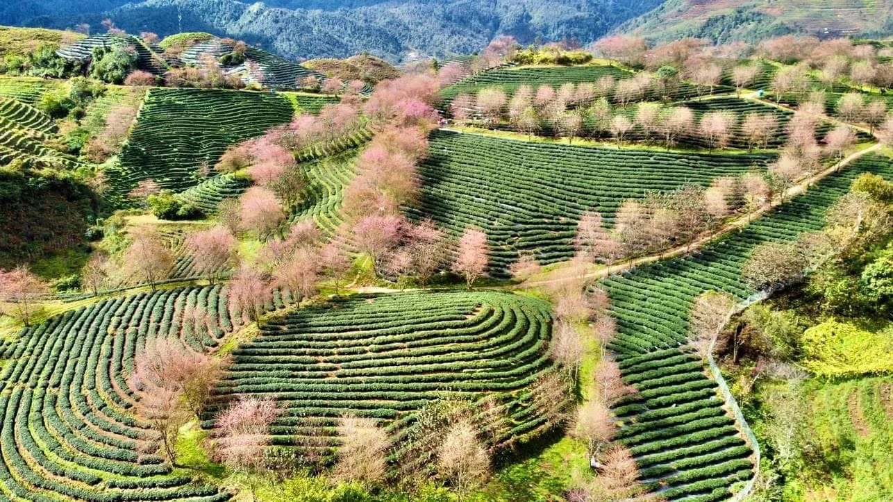
The Best Place to See Cherry Blossoms in Sapa
O Long Tea Hill and O Quy Ho
The best place to see cherry blossoms in full bloom is O Long Tea Hill in the O Quy Ho area, about 8 km from Sapa Town. Here, rows of tea plants sit beneath flowering cherry trees, creating a peaceful and unforgettable scene.
Early mornings are especially beautiful, when mist drifts through the hills and pink petals glow softly in the cold winter light.

Snow in Sapa. Truth, myth and the quiet magic of a rare winter
A rare snowfall in Sapa transforms the highland landscape and reveals a quieter side of the mountains. In this honest guide we explore the difference between frost and true snow, share verified historical snowfall records from 1990 to the present day and explain why these fleeting winter moments hold such meaning for the communities who live here.
Winter in the Highlands. Mist, Frost and Quiet Days
Winter in the northern mountains of Vietnam arrives gently. It drifts into the terraced valleys on slow banks of mist, settles in the hollows of bamboo forests and chills the ridge lines of the Hoang Lien range with a sharp, crystalline breath. At this time of year, life for Hmong, Dao and Tay families becomes more reflective. Fires burn low in earthen hearths, animals are sheltered, and preparations begin for the new agricultural cycle that follows the Lunar New Year.
In this subdued season the highlands reveal a quieter beauty. Frost rims the grasses at daybreak and thin ice patterns appear on still water. Yet none of these common winter signs can prepare you for the rare and gentle arrival of real snow.
Sorting truth from trend. Snow, frost and the digital mirage
Over the last decade, social media has woven a complicated tale around Sapa and the prospect of a winter snowfall. Photographs of icy railings on Fansipan or frozen bamboo at O Quy Ho Pass are often shared under bold claims that the town itself has been blanketed in white. Visitors arrive with high hopes, sometimes shaped more by digital imagery than by the lived realities of the local climate.
These icy scenes have their own beauty, but they are usually frost or rime. Frost forms when moisture freezes onto cold surfaces. It can create a sparkling, sculptural landscape that feels almost otherworldly, especially on Fansipan where temperatures regularly dip below freezing. These frost events occur several times every winter above about 2,800 metres and they are a natural part of life on the mountain.
Snow is different. Snowflakes form in the cloud itself. They fall, gathering on rooftops, footpaths and terraces. Snow transforms the world with softness rather than sharpness. It also happens infrequently in Sapa town, which is why many frost events are mistakenly promoted as snowfall. At ETHOS we believe that honesty honours both the mountains and the people who call them home. When snow truly arrives, it deserves to be understood in the context of how rare and precious it is.
Genuine snow in Sapa town. Four real events since 1990
Once we strip away frost events, sleet, cold mist and the noise of tourism marketing, the list becomes far more modest. Only four snowfalls have been verified in Sapa town since 1990. These are supported by the Vietnam National Centre for Hydro-Meteorological Forecasting, by climate logs and by the memories of families who live and farm here.
What follows is a clear record of those events, along with detail on how long the snow fell and how long it lasted.
1. March 16, 2011. A brief and gentle snowfall at around 1,600 metres
This was a short, late-season event that surprised many residents. Snow fell for about an hour in the late morning and lightly dusted the roofs and shaded corners of Sapa town. With the sun still strong in mid March, the snow melted entirely before the afternoon had passed. Although delicate and short lived, this was a genuine snowfall, confirmed by official observers.
2. December 15, 2013. A moderate and memorable night of snow
On this cold winter night, snow formed in the early hours and continued until sunrise. Between three and five centimetres settled across the town centre, while the road towards Thac Bac at around 1,900 metres received seven to ten centimetres. Children woke to a world softened by white. Most of the snow faded away by early afternoon, although hollows and forest edges held onto their pale covering for a little longer. This was the longest lasting town snowfall since 1990.
3. February 19, 2014. A short lived but authentic winter moment
This was another verified snowfall, although very light. Between half a centimetre and one centimetre gathered on cars and rooftops before melting almost immediately. The snow fell for less than forty minutes. It is sometimes confused with the frost and residual ice that appeared on nearby passes that same week, but the snowfall in town was real, if fleeting.
4. January 24 to 25, 2016. The largest modern snowfall in Sapa town
This was a remarkable winter event driven by a strong cold surge from the north. Snow fell for many hours through the night and into the morning. In the town centre eight to twelve centimetres settled. Higher regions above 1,900 metres saw more than twenty centimetres. Sapa town kept its winter coat for around thirty six to forty eight hours. North facing areas held snow until the morning of 27 January. This is one of the very few moments in living memory when Sapa experienced genuine snow cover that lasted more than a single day.
These are the only four events in over three decades that meet all the conditions of genuine snow. Tested against community knowledge, confirmed by meteorologists and visible in photographs that show clear snowfall and accumulation within Sapa town itself, they form a quiet and honest history.
Fansipan. A mountain that keeps its own winter story
The story changes dramatically as you climb. Fansipan rises to 3,143 metres, which places its summit in a climate zone entirely different from that of Sapa town. Here, temperatures fall below freezing much more often. Clouds wrap themselves around the ridge lines with icy intensity. Proper snow, not just frost, falls several times a decade.
When we remove frost events and retain only verified snowfall, the historical pattern becomes clearer.
Confirmed Fansipan snowfall years since 1990
Meteorological logs, summit staff reports and independent observations show genuine snowfall in the following years.
2013 to 2014 winter
Fansipan experienced several snowfalls between December and February. Accumulation typically ranged from five to fifteen centimetres and the snow often lingered for one to three days.
January 2016
This was the same cold surge that brought heavy snow to Sapa town. Fansipan recorded more than twenty to thirty centimetres of snow at the summit. Because daytime temperatures remained below freezing, the snow lasted several days.
December 2017
A genuine and heavy snowfall of around ten centimetres settled on the summit and remained for one to two days.
December 2020 to February 2021
This period brought multiple snowfalls. One early February event reached around sixty centimetres, thought to be one of the deepest recorded layers on Fansipan. Snow remained in shaded areas for two to four days.
December 2022 to January 2023
Two separate cold surges created light to moderate snowfall at the summit, with layers lasting between twelve and forty eight hours.
January 2025
A clear snowfall was recorded at the summit with a light to moderate layer lasting less than twenty four hours.
Although snow on Fansipan is not a daily winter occurrence, it is markedly more frequent than in Sapa town. The upper mountain sits in a cooler band where genuine snowfall happens often enough to form part of the mountain’s seasonal rhythm.
How long does snow really last
Even in strong winters, snow in Sapa town is a brief visitor. Most events melt within a few hours. Only the 2016 snowfall created a lasting layer that held for around two days. Fansipan is more resilient. Here, snow can remain for one to three days in most genuine events and longer in the heavier winters of 2016 and 2021. Frost, by contrast, can linger for many days, but frost is not snow and has a different feel entirely.
Why Sapa becomes so special when real snow falls
Snow and the Rhythm of Mountain Life
When snow does arrive in Sapa, the mountains take on a rare and delicate quiet. Terraces that for most of the year glow green or gold are softened with a pale blanket. The scent of woodsmoke drifts further in the cold air. Hmong and Dao families step outside to watch the sky, sometimes amused, sometimes reflective. Children gather snow into cupped hands and carry it indoors for a moment of delight. Daily tasks continue, yet with a lightness that comes from witnessing something so unexpected.
A More Reflective Way of Travelling
Snow softens the familiar and invites us to look again at the world we think we know. It encourages slower travel. Fireside meals become comforting rituals. Walks through the valleys feel more contemplative. A simple cup of warm herbal tea becomes a moment to savour. These are the things we hold close at ETHOS, because they reflect the lived wisdom of our community partners.
When is snow most likely to fall
Snow is always rare in Sapa town and should never be the sole reason to plan a journey. Travellers who arrive with that expectation risk disappointment because snowfall cannot be predicted reliably more than a day or two in advance. Still, some months hold more potential than others.
The Best Months for Snowfall
Snow in Sapa and on Fansipan is most likely between mid December and early February. These months mark the heart of the northeast monsoon, when cold air masses travel southwards and occasionally collide with moist air over the Hoang Lien range. If snow falls in the town at all, it almost always happens within this window. On Fansipan the same period brings the best chance of genuine snowfall, although frost appears regularly from November through February.
Travelling with the Right Expectations
The right approach is to travel for the culture, the landscapes and the generosity of the communities who welcome you. If the mountains choose to offer snow, consider it a gift rather than a guarantee.
Honest weather, honest storytelling
At ETHOS we believe that clarity helps deepen respect for the land and its people. Snow in Sapa is rare, beautiful and short lived. Frost and rime are part of the highland character and deserve their own appreciation without being mistaken for something else. Fansipan holds a wilder winter, but even there the whiteness arrives and fades on the mountain’s own terms.
These mountains do not need embellishment. Their truth is richer than any advertisement. Whether the terraces lie green, gold or white, the winter season in northern Vietnam invites travellers to slow down, look closely and connect with the communities who shape their stories among these hills.
If you walk with us, we will help you experience the mountains in their fullest honesty. Snow may fall, or it may not, but the warmth of a village hearth, the rhythm of a highland path and the spirit of the people who live here will always be waiting.
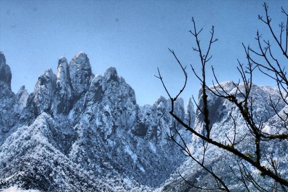
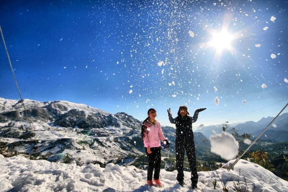

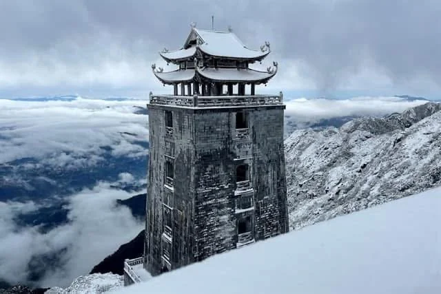
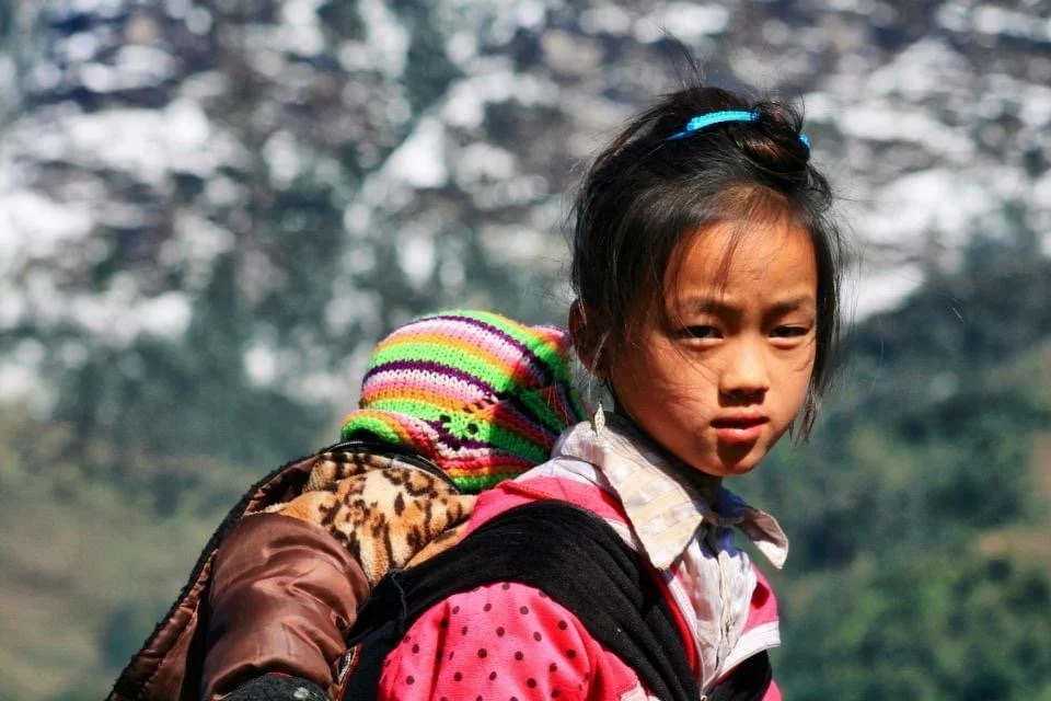
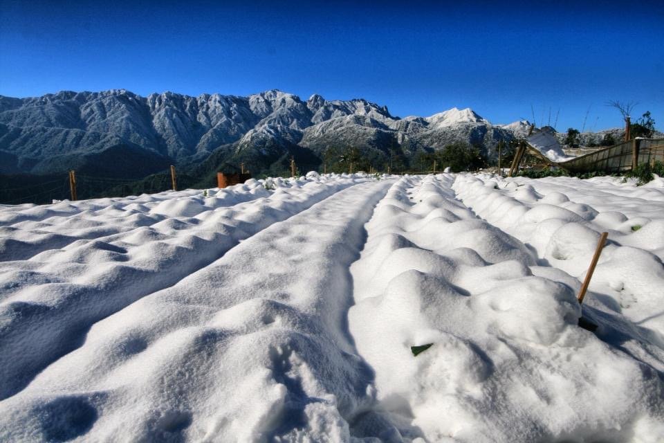
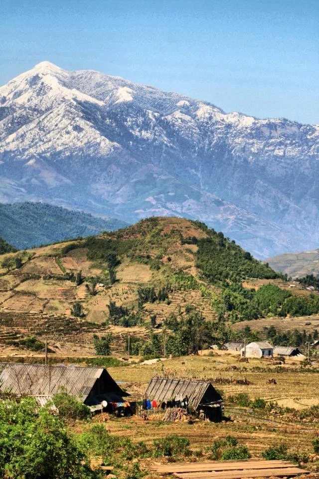


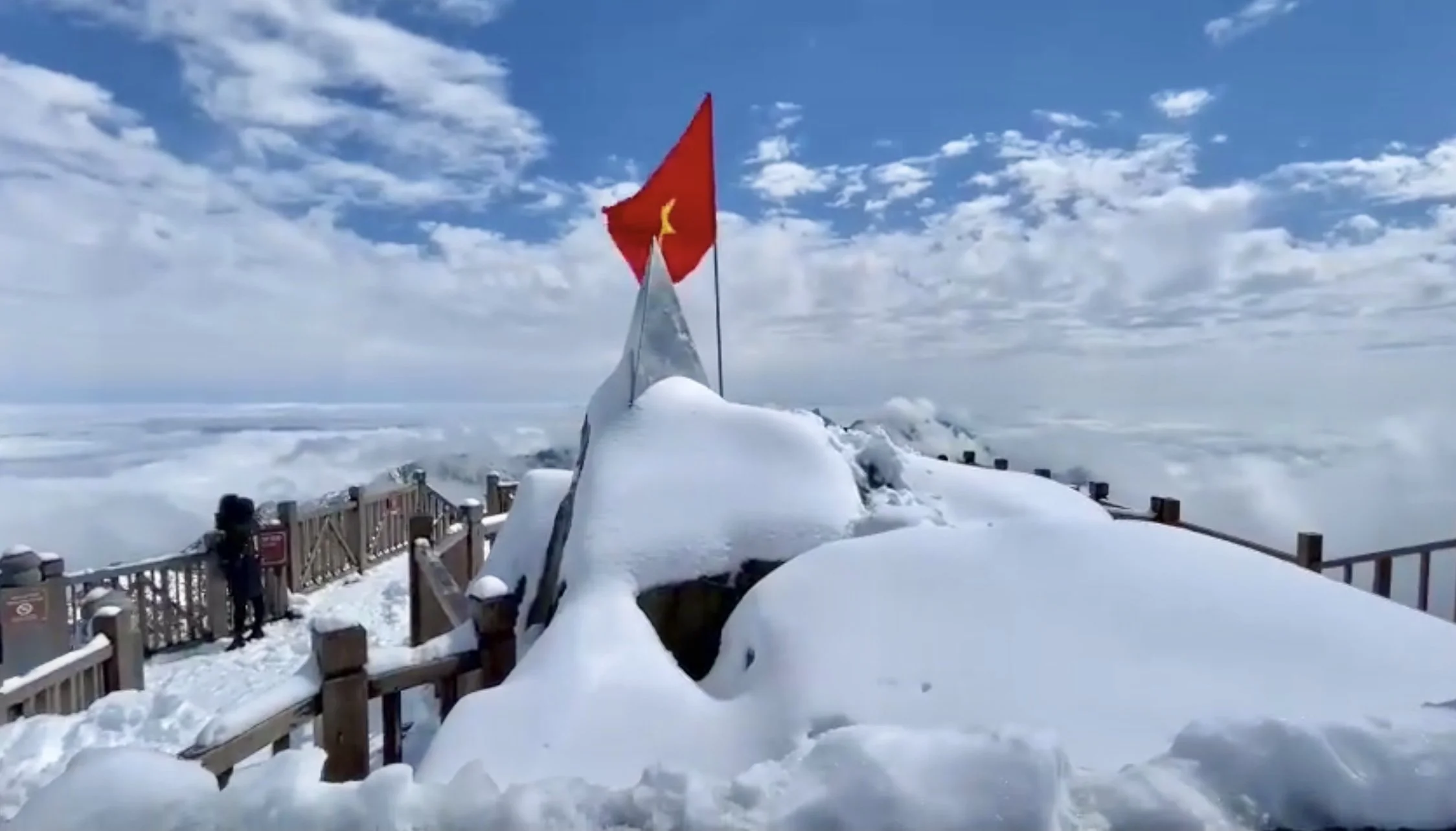

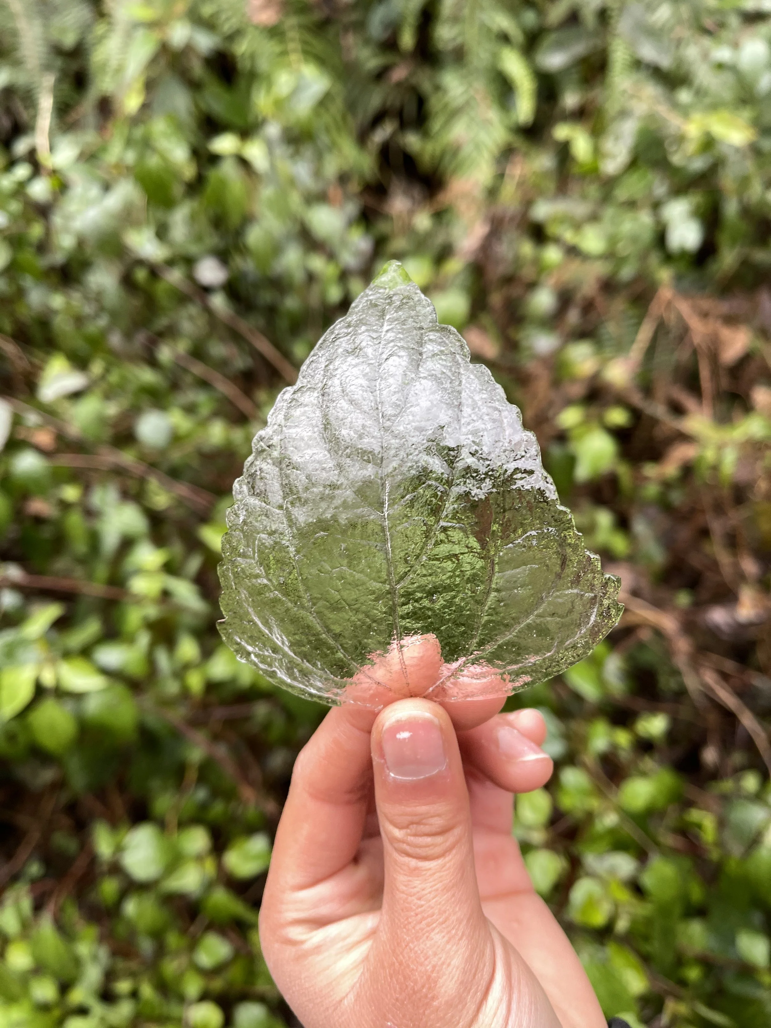
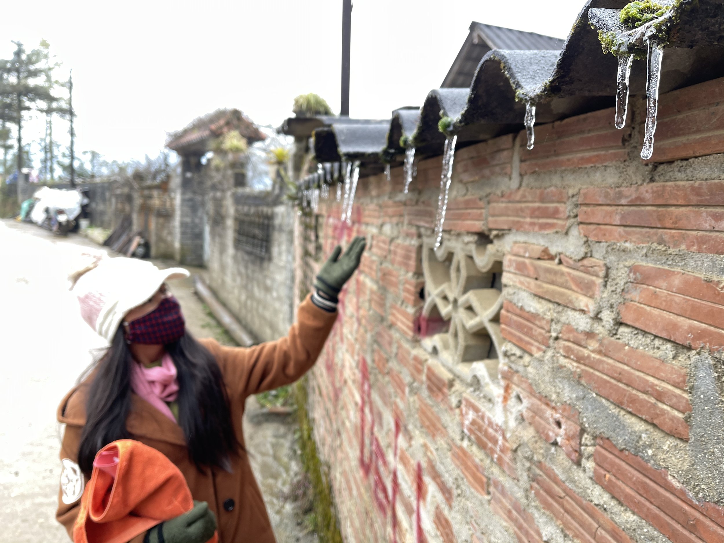
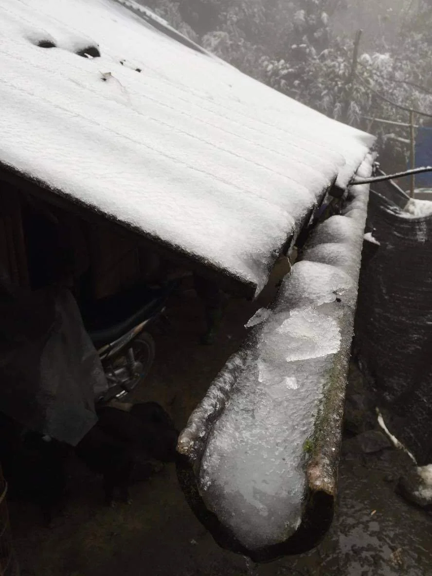
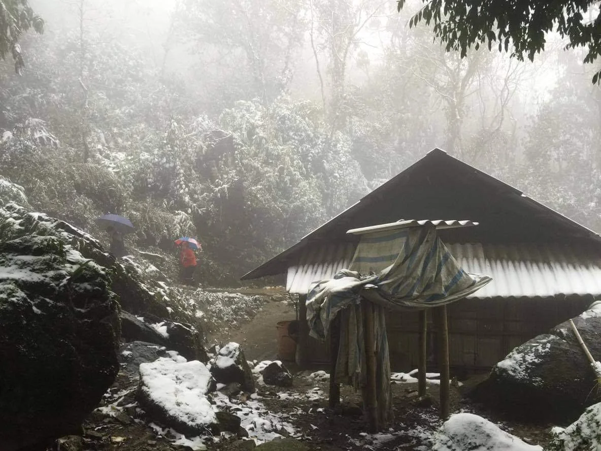
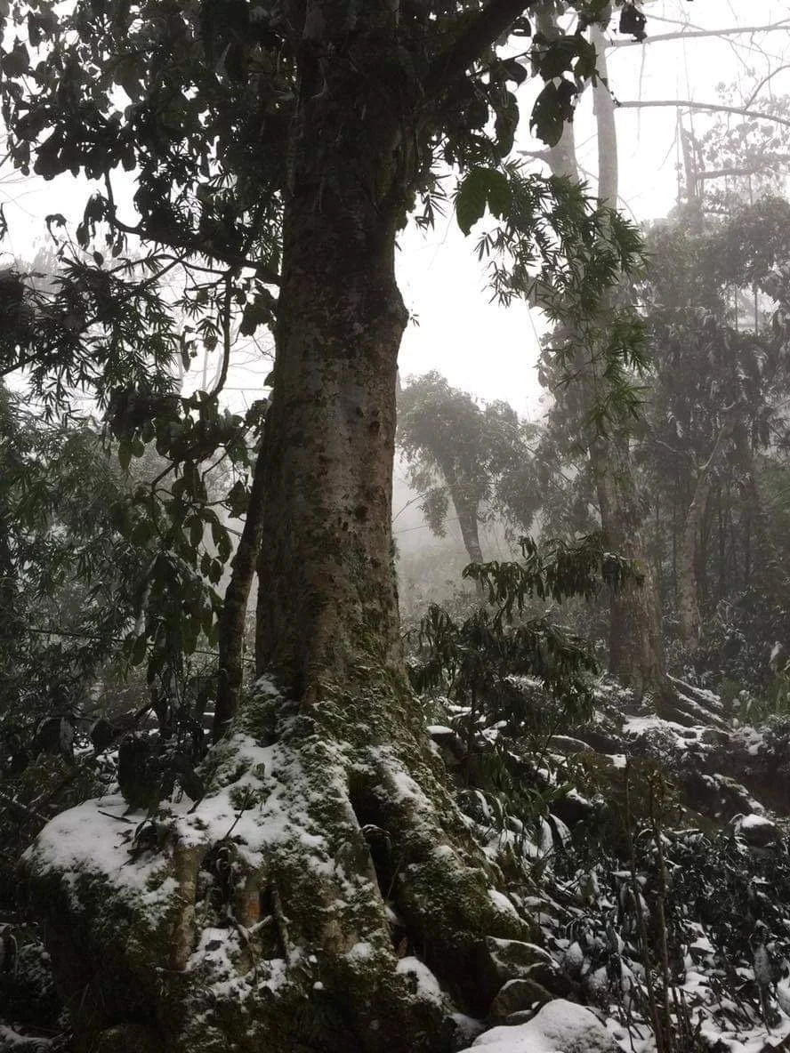
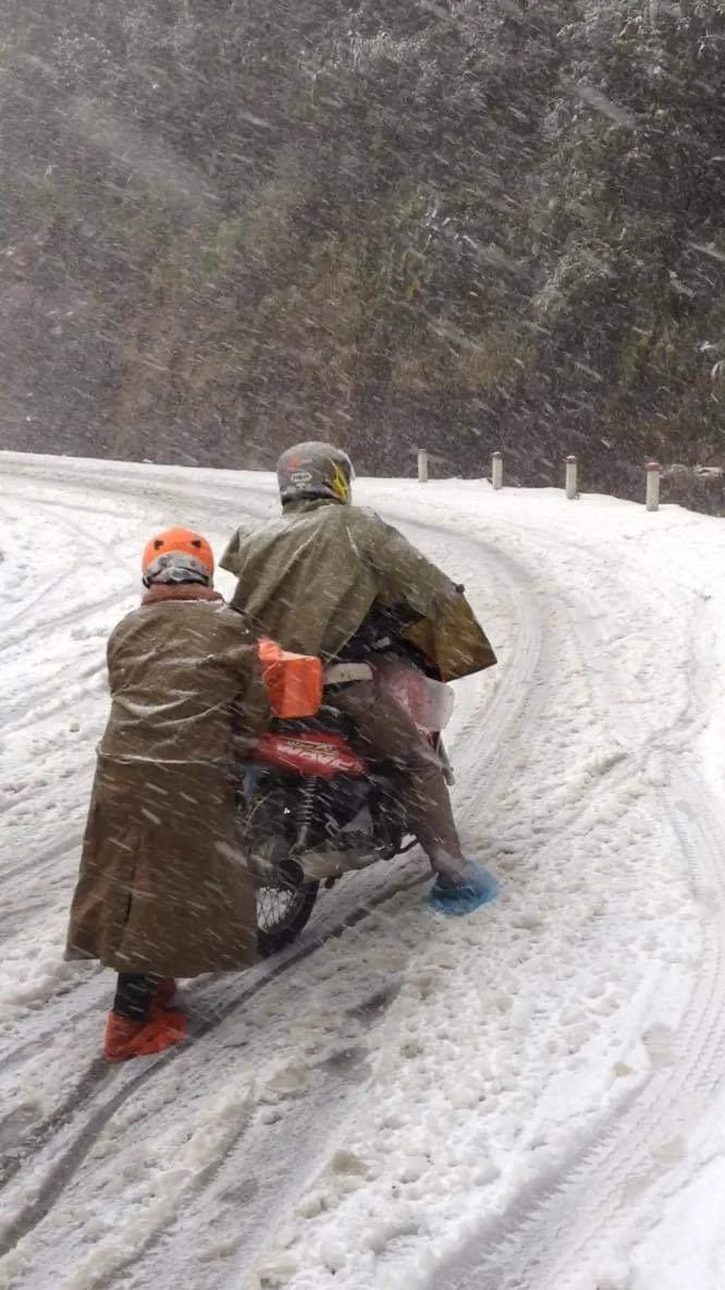
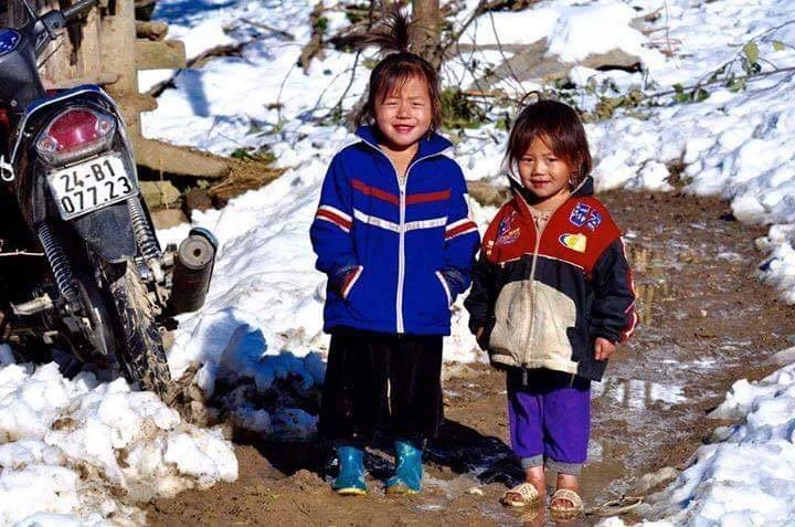
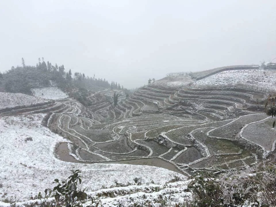
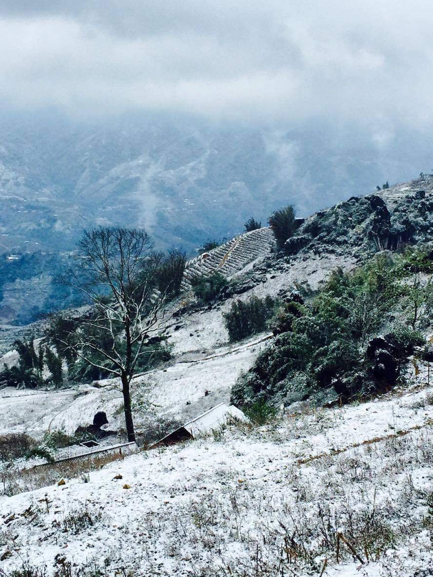
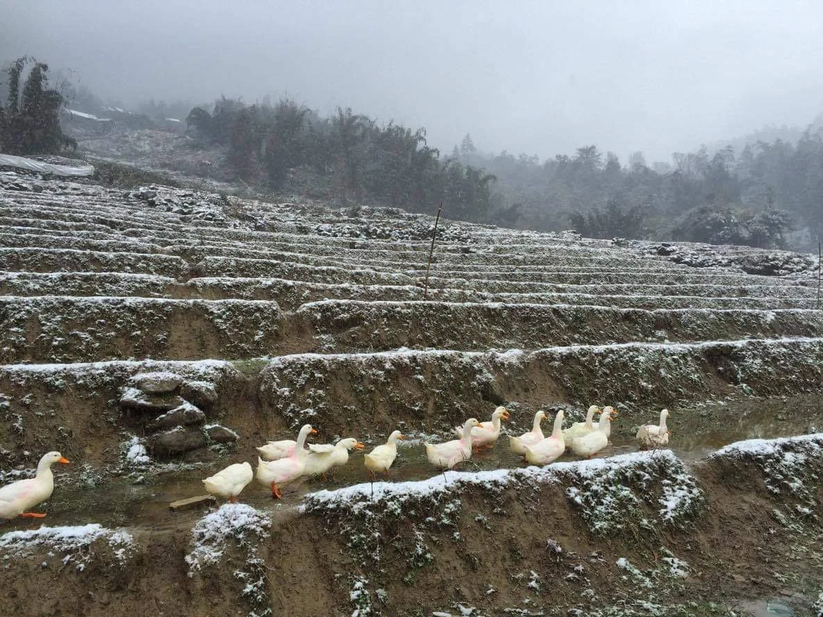
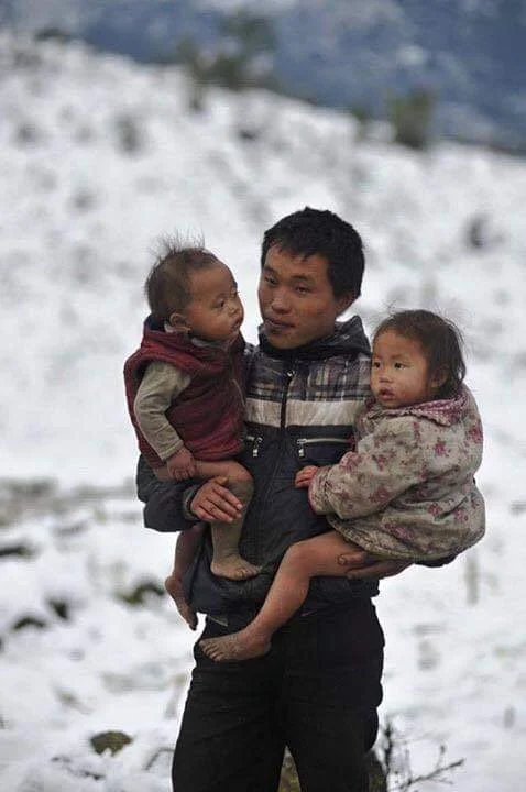

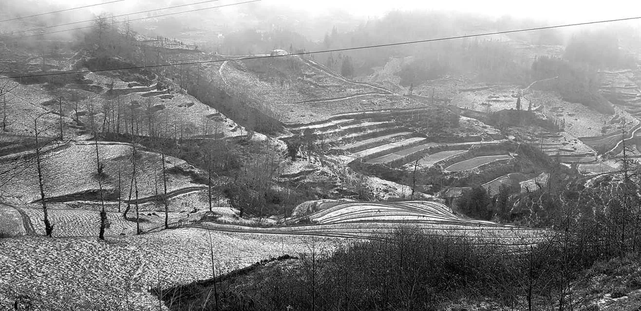
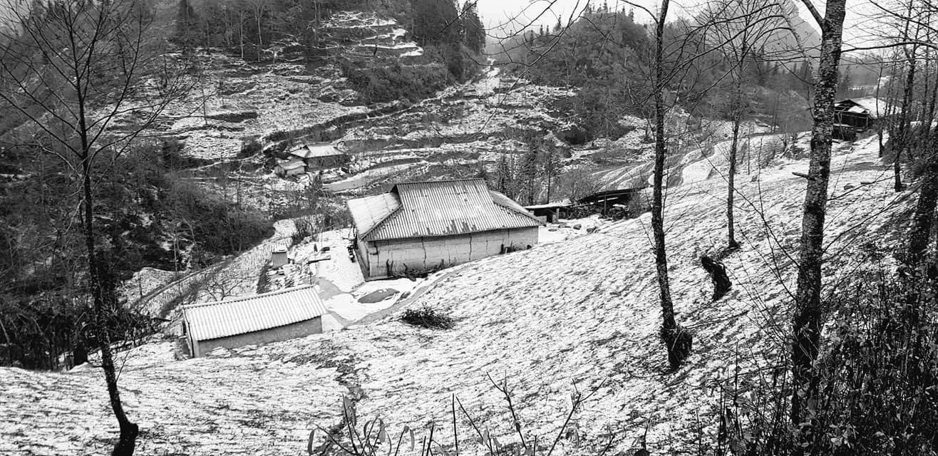
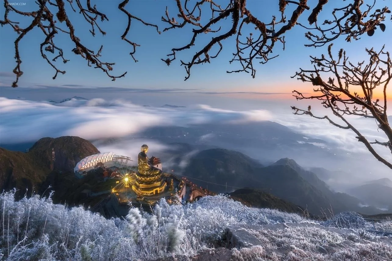
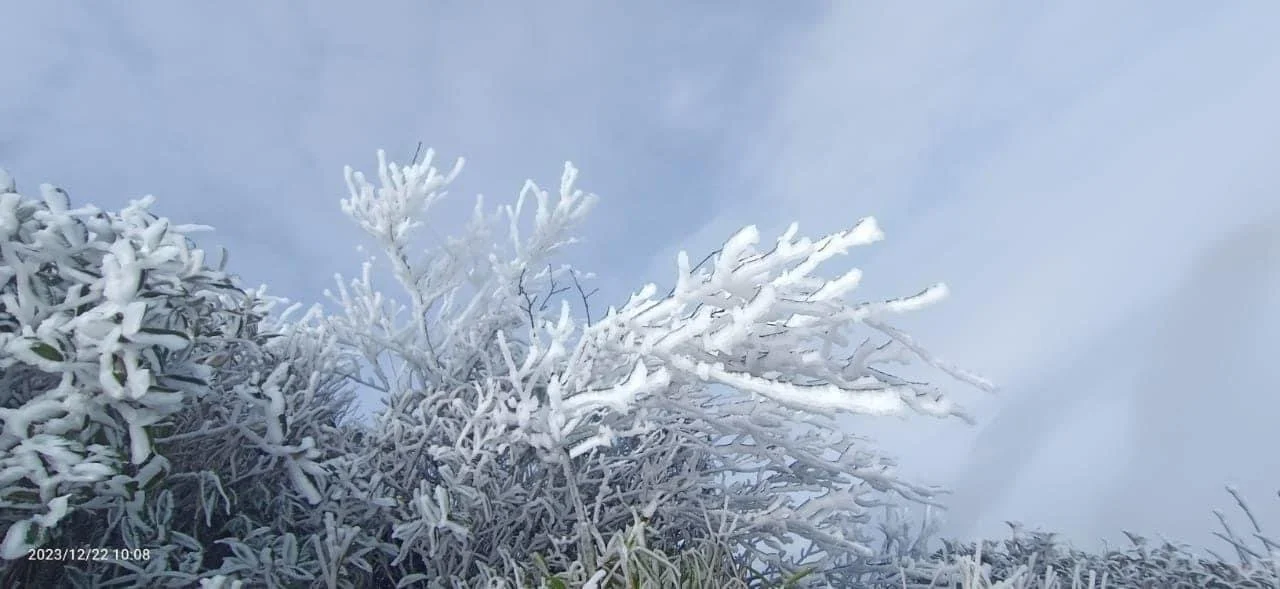
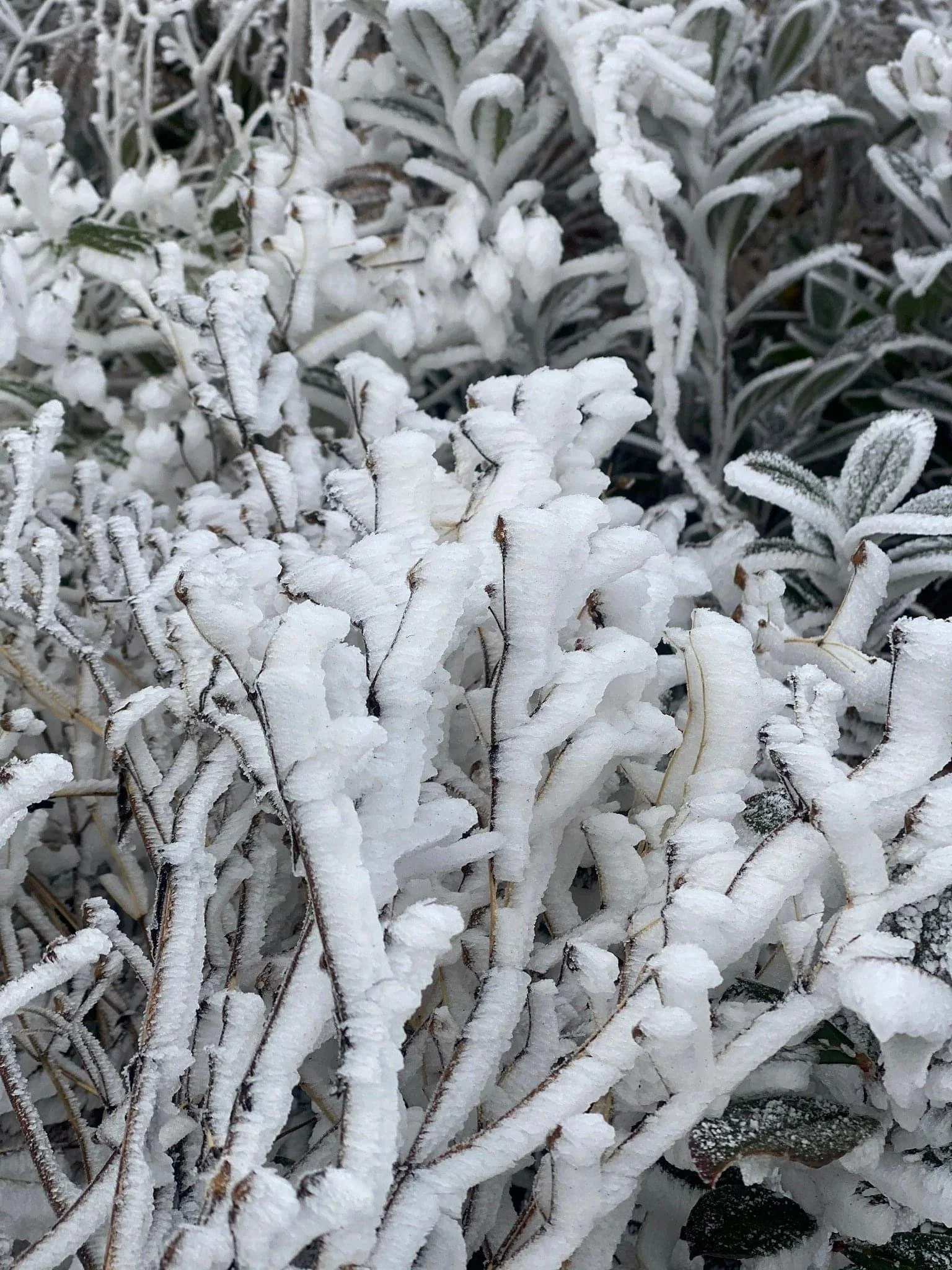
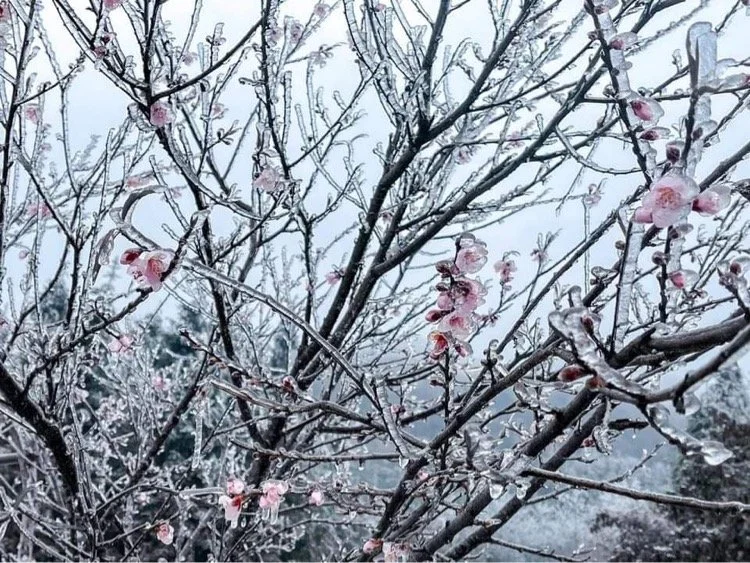
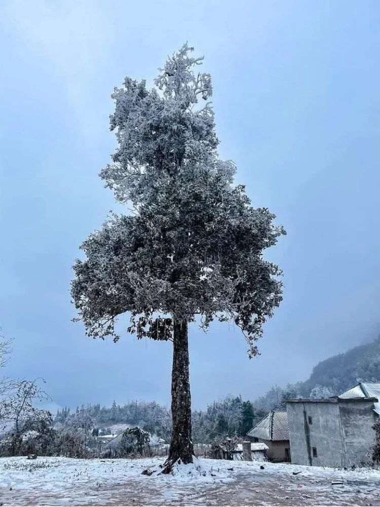
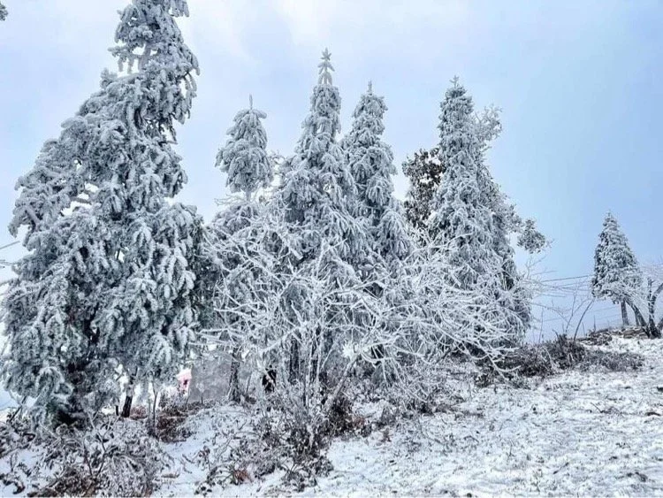

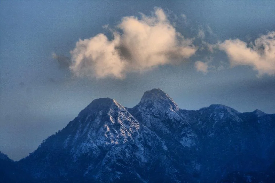
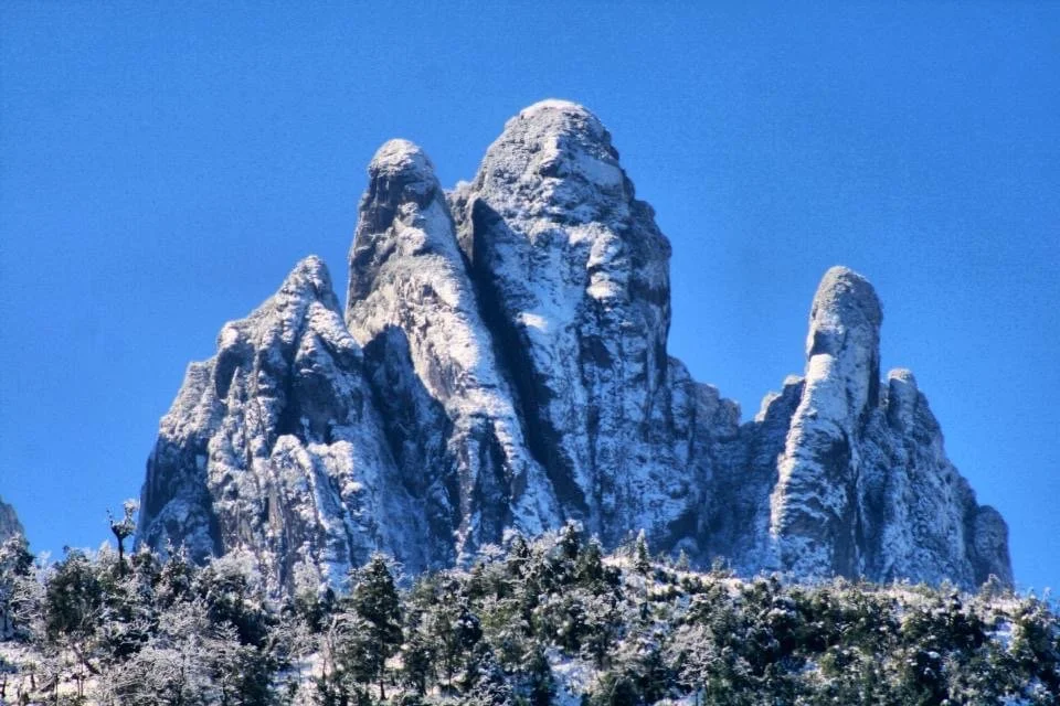
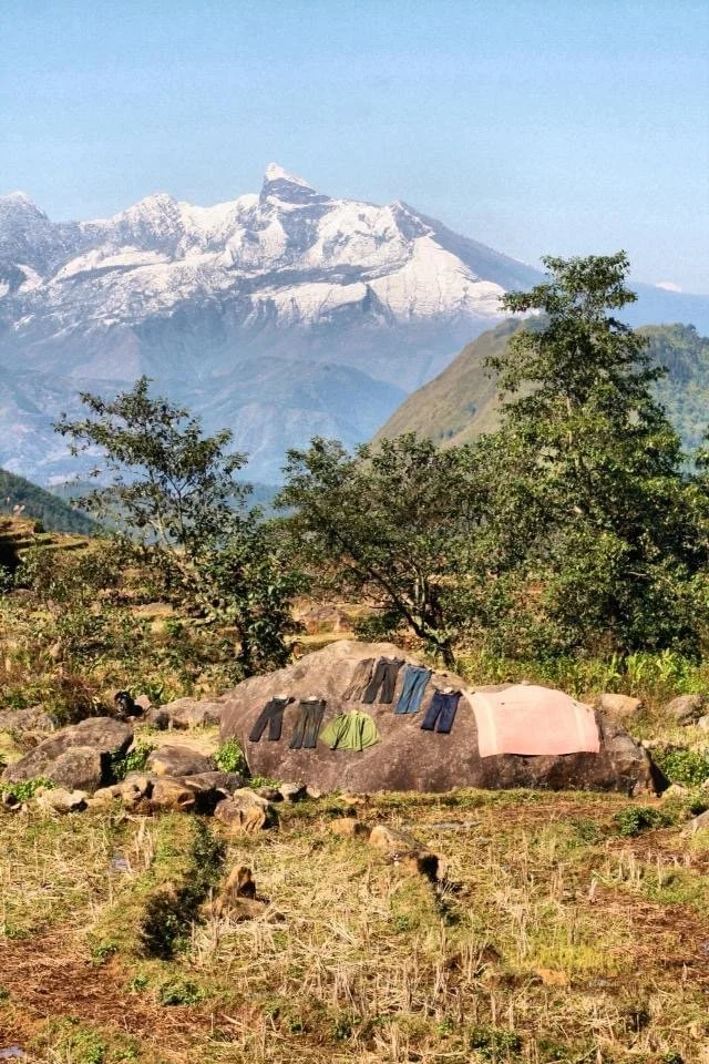
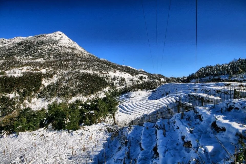
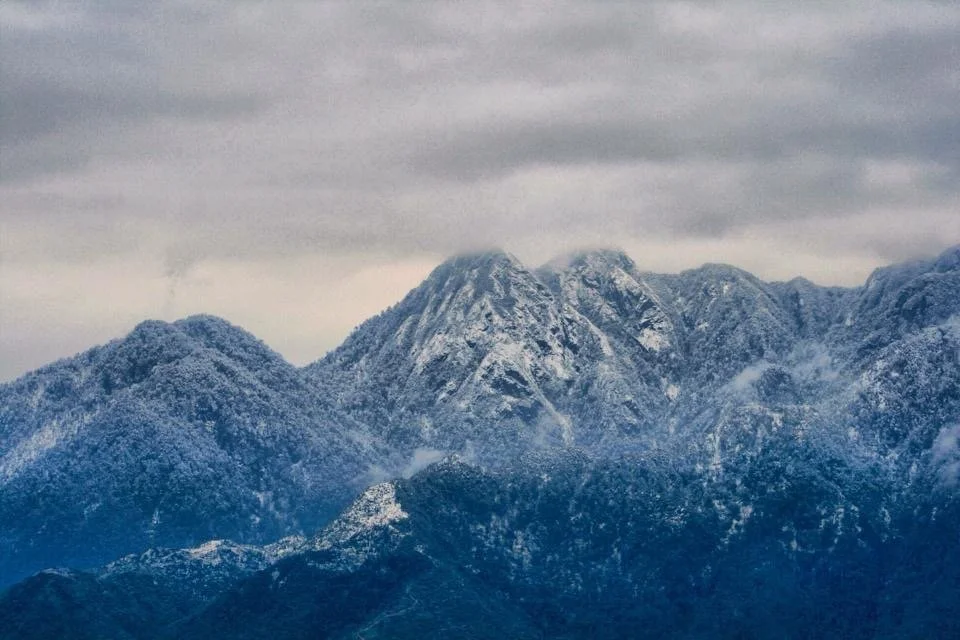
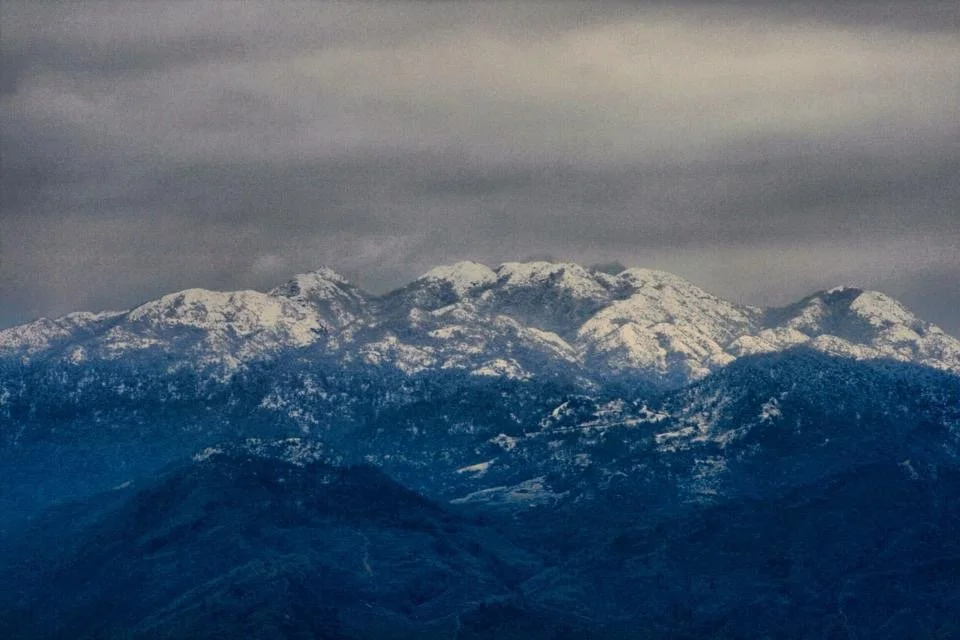
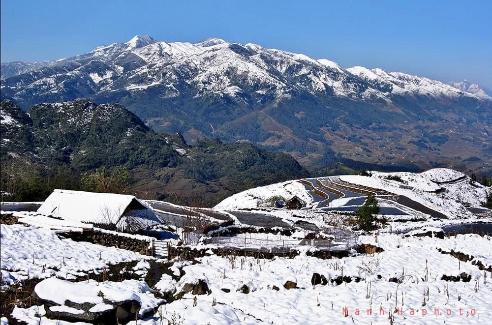

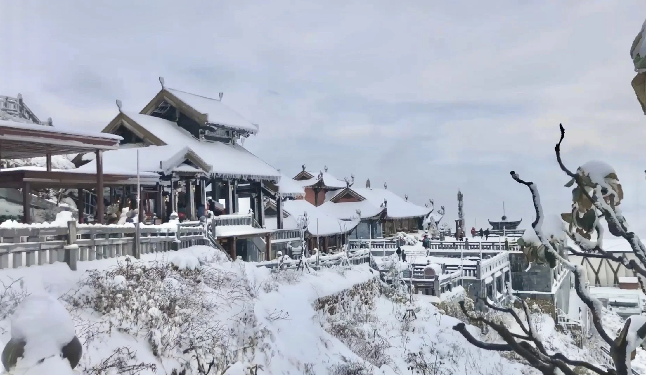
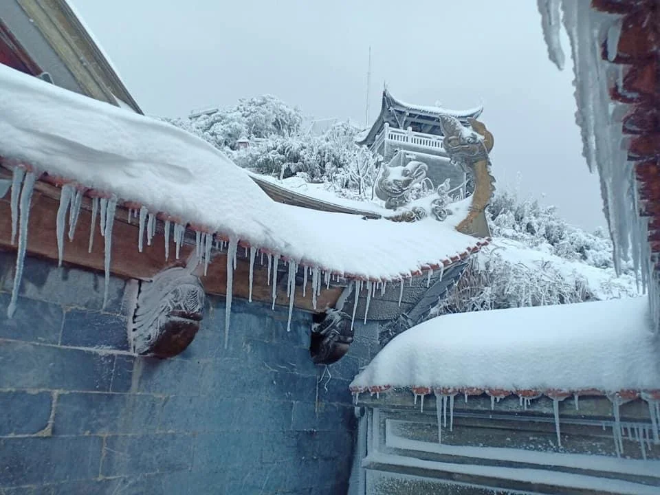
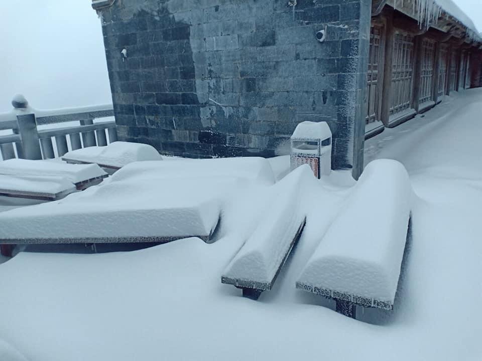
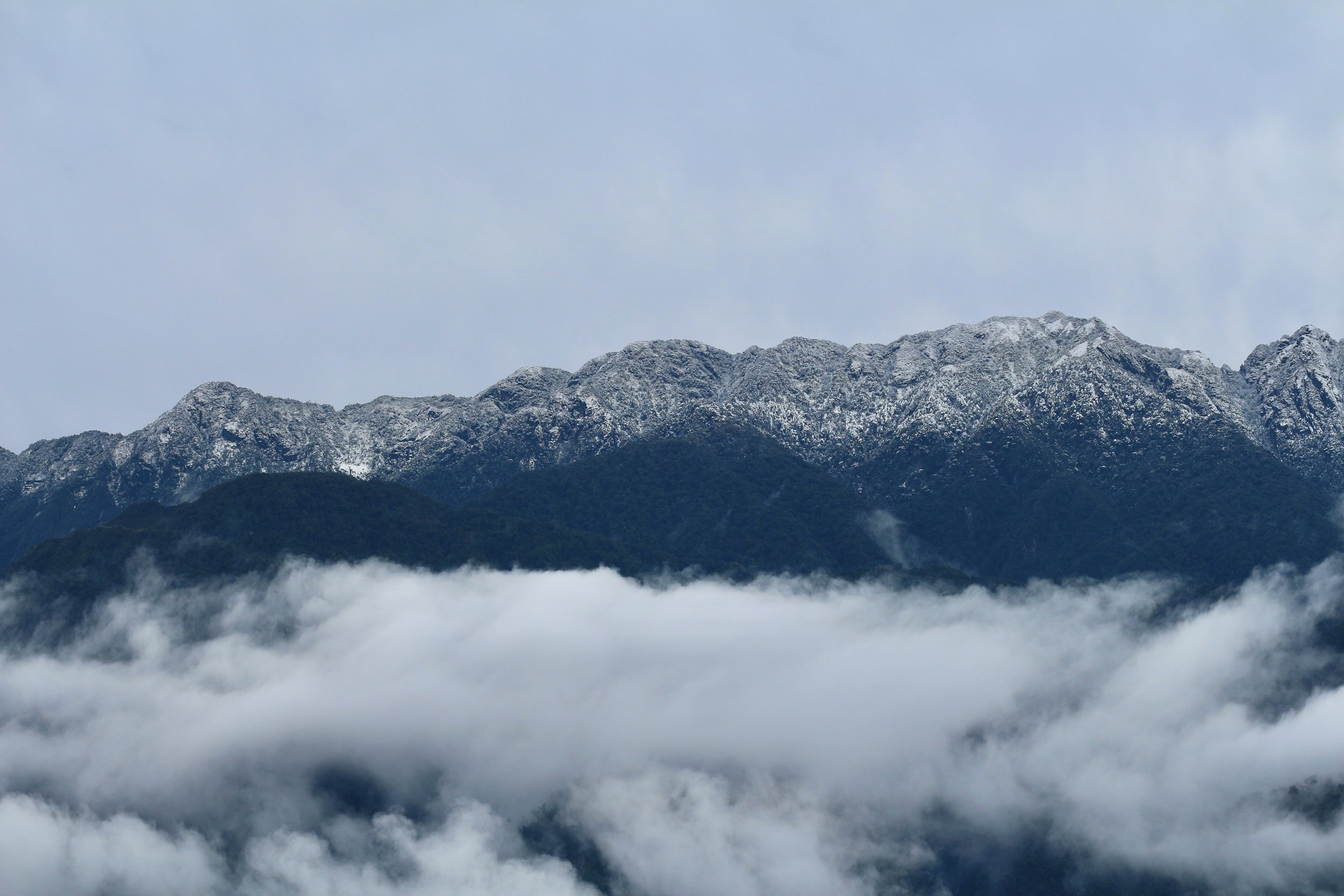
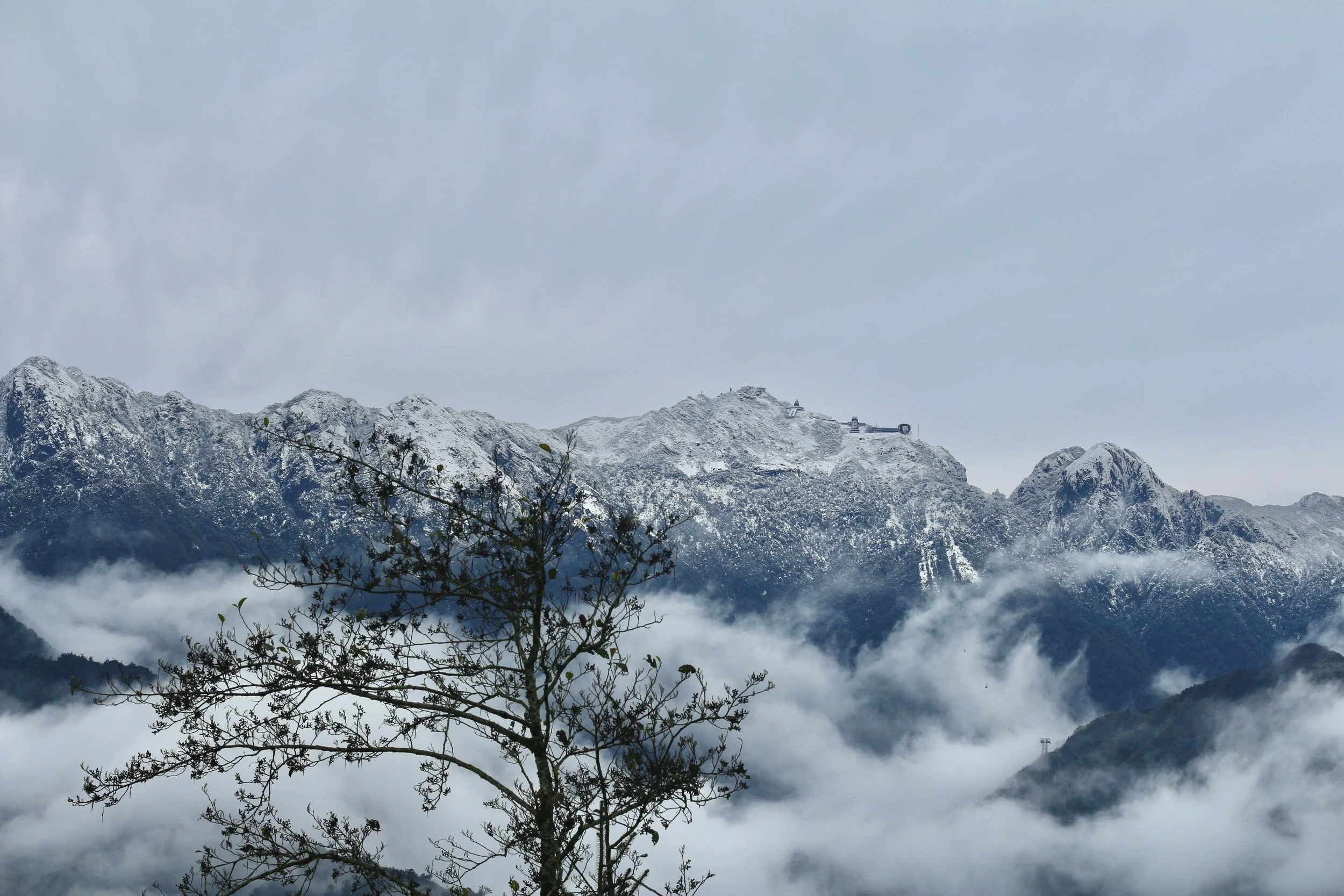


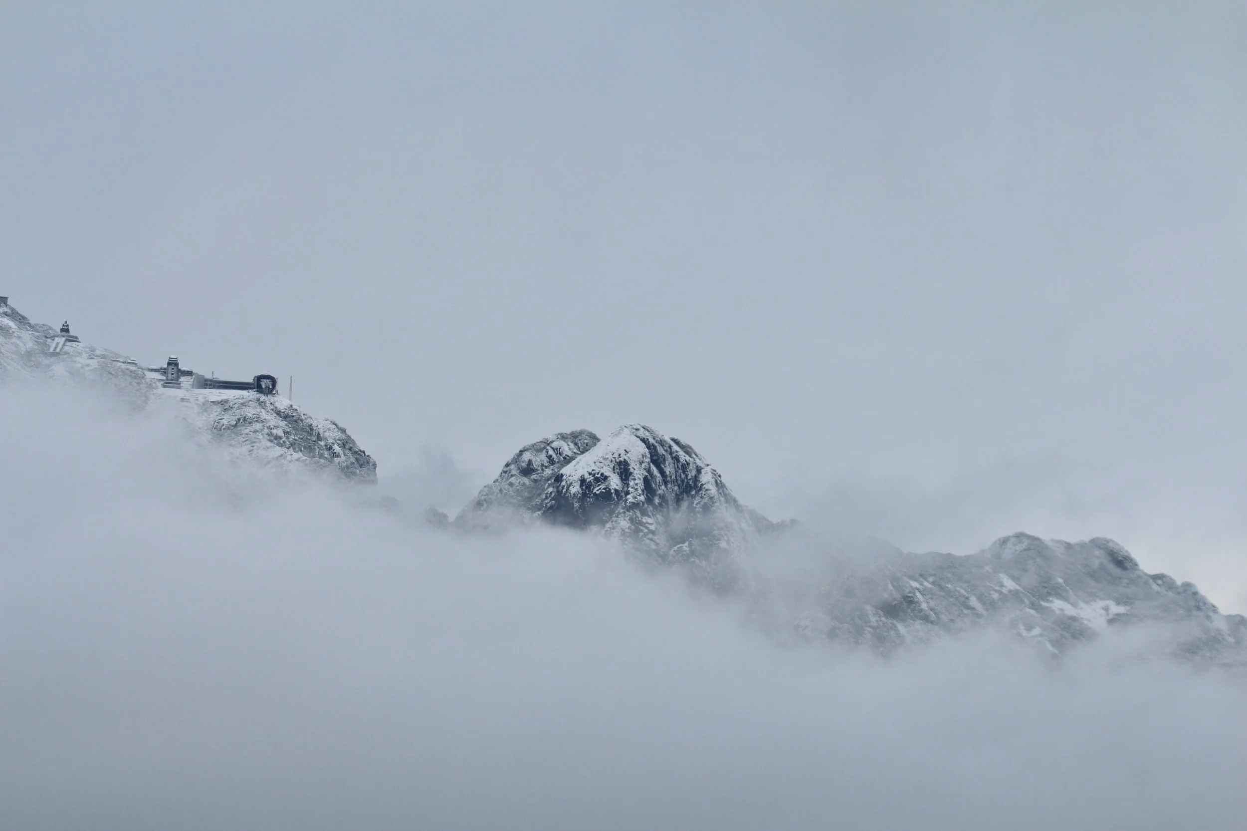
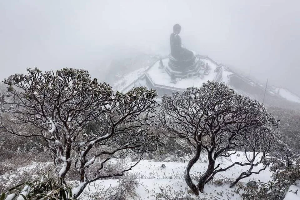
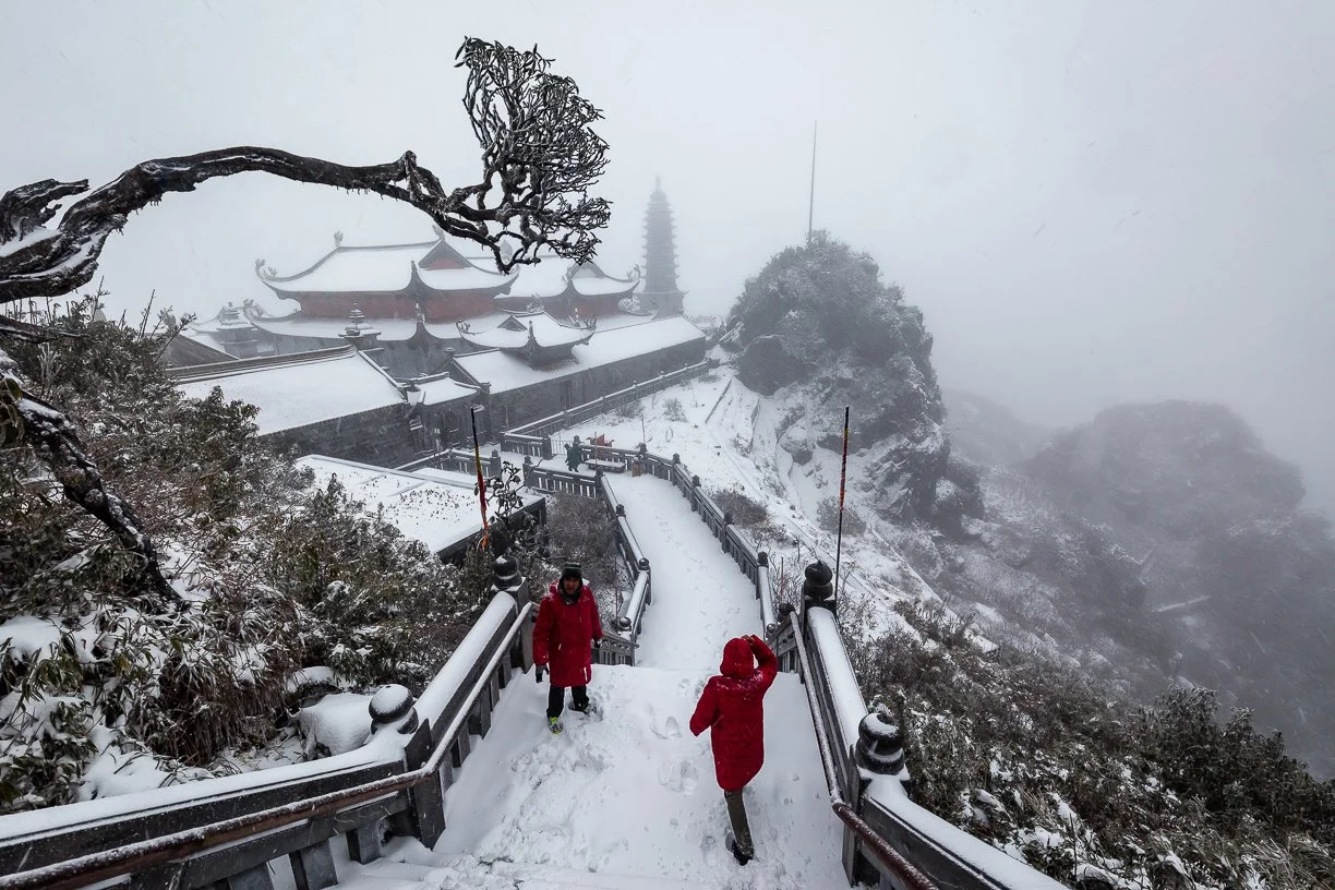

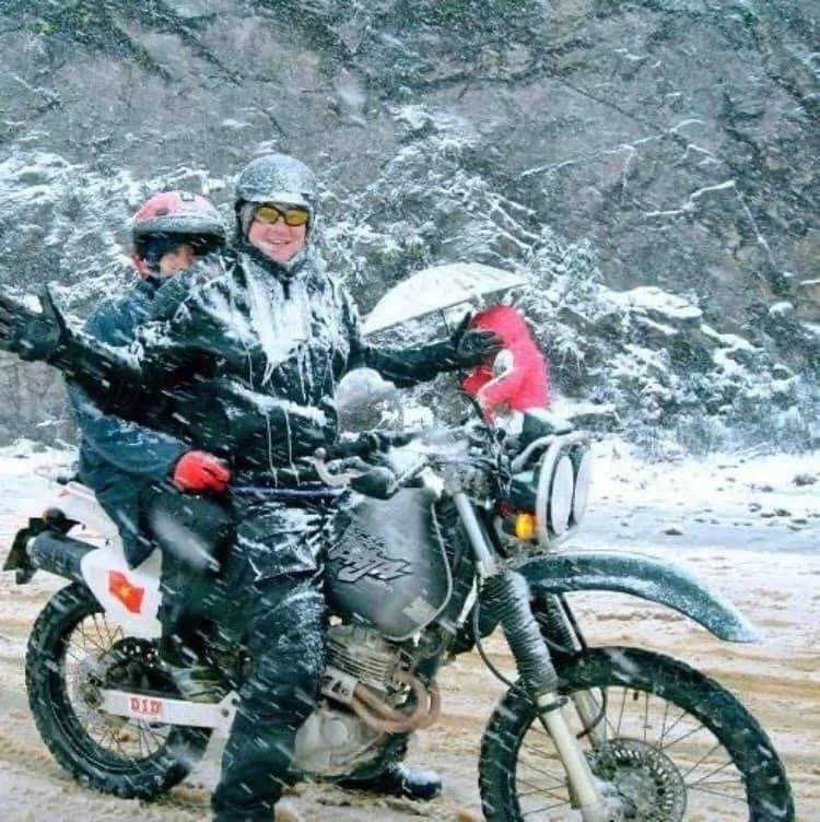
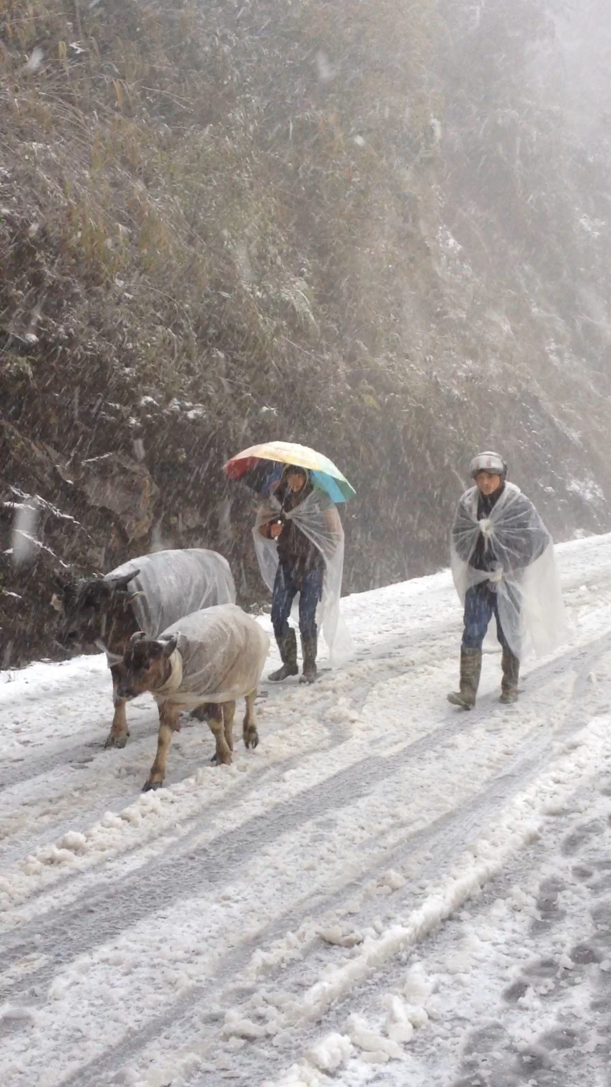
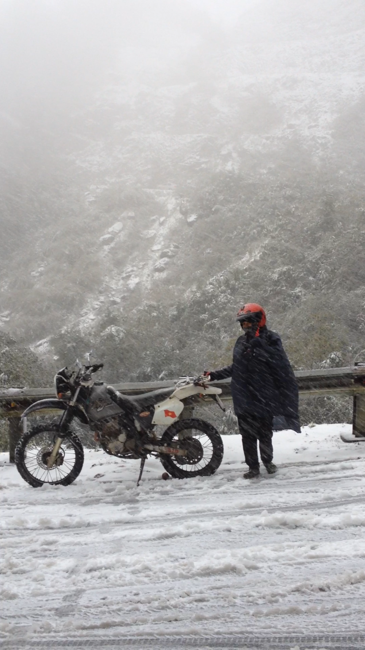
Sapa After Typhoon Matmo: Calm Skies and Open Roads
After dramatic headlines, many travellers are asking the same question: is Sapa affected by the typhoon? Here is the reality on the ground. With clear skies, open roads and normal transport services, Sapa remains peaceful and fully accessible for trekking, exploring and experiencing the mountains.
Sapa After Typhoon Matmo: What Travellers Need to Know
Was Sapa Affected by the Typhoon?
Many have seen dramatic headlines and assumed the worst, but here is the truth. The storm passed far to the north and Sapa was not affected. No flooding, no damage, no disruption. While the news focused on chaos elsewhere, the hills of Sapa remained calm.
Current Conditions in Sapa
The past week has been beautifully clear. Cool, dry air has brought crisp mornings and wide views across the valleys. Trails are quiet, the sky is blue and the rice terraces glow in the sun. It is one of the best times to be here.
Travel and Transport Are Running Smoothly
Roads are open, buses are operating as normal and motorbike loops are in full swing. Trekkers are setting off each morning and routes through the mountains are accessible.
If you were worried about cancelled plans, you can relax. Everything is moving as usual.
Life in the Villages
Workshops, homestays and local markets are all open. Families are cooking on wood fires. Children are walking to school. Life feels peaceful and grounded.
Travellers are being welcomed with smiles and hot tea, just as they always are in Sapa.
Should You Visit Now?
If you are travelling in Vietnam and wondering whether to include Sapa in your journey, the answer is yes. Do not let online rumours or overblown social media posts stop you from experiencing one of the most beautiful regions in the country.
Sapa is safe. Sapa is calm. Sapa is ready to welcome you.
Want to See It for Yourself?
If you would like a real glimpse of how Sapa looks right now, have a look at our latest video: https://youtu.be/ph3xV-8XEys?si=xsrPXkipq_cckyRP
And if you are dreaming of trekking through rice terraces, sharing meals with local families or exploring mountain roads on two wheels, we would love to guide you.
You can explore our experiences here: https://www.ethosspirit.com/create-your-experience

Sapa’s Golden Season: A Landscape Transformed
As summer fades, Sapa’s emerald terraces transform into waves of gold, a breathtaking reminder of harvest, patience, and the beauty of change.
From Emerald to Gold
In the misty highlands of Sapa, the rice terraces begin their quiet transformation. What was once a sea of emerald flowing in endless curves along the mountains ripens into waves of gold. Each step gleams under the sun, a natural masterpiece painted stroke by stroke in hues of harvest and hope.
The Beauty of Change
Every season carries its own beauty. Summer’s lush green gives way to autumn’s golden promise. The terraces are more than fields of rice—they are living reminders of patience, rhythm, and the timeless connection between people and land.
A Harvest of Abundance
To stand before Sapa’s terraces is to feel the earth’s poetry. Growth, change, and abundance unfold before your eyes, offering both the gift of food and the reminder that every ending is also a beginning.
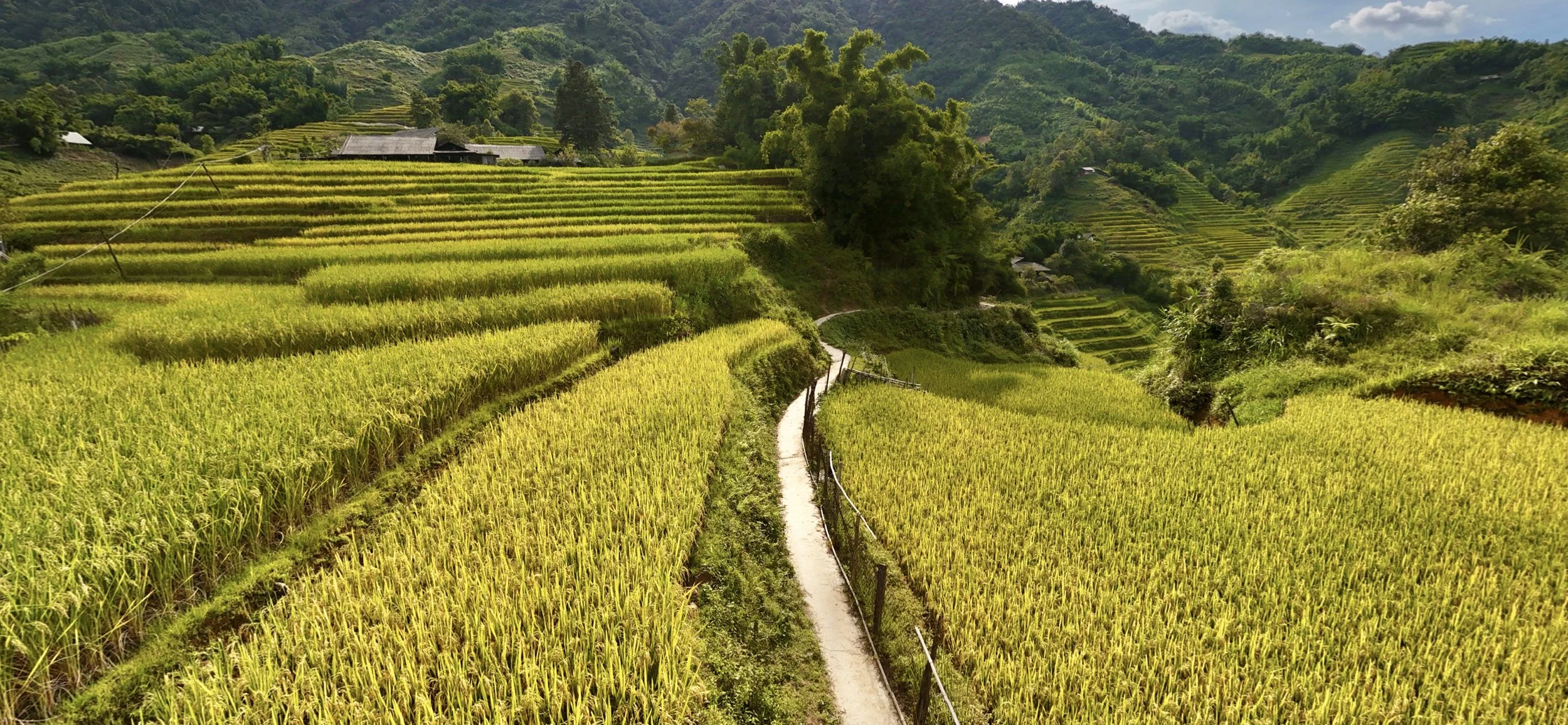

The Living Tapestry of Sapa’s Rice Terraces
Carved patiently into the mountainsides of northern Vietnam, the rice terraces of Sapa are both a landscape and a legacy. Built and tended over generations by the Hmong people, they transform rugged hills into sweeping steps of life, each curve holding the imprint of ancestral skill and devotion.
Golden Season in the Highlands
Golden season is calling. Will you answer? Carved patiently into the mountainsides of northern Vietnam, the rice terraces of Sapa are both a landscape and a legacy. Built and tended over generations by the Hmong people, they transform rugged hills into sweeping steps of life. Each curve holds the imprint of ancestral skill and devotion.
Colours of the Season
In summer, the terraces shift in colour as new shoots spread in vibrant green, soft and delicate. As autumn approaches, the rice ripens into gold, glowing in the sunlight and breathing with the rhythm of the sky. The hills are never still. They change daily, painted anew by light and shadow.
More Than Beauty
The terraces are not just a spectacle. They embody the spirit of community. Rice in Sapa is not grown only for nourishment but as a shared endeavour. Families and neighbours work side by side, guided by tradition and necessity. Every grain carries the wisdom of countless harvests and the touch of many hands.
A Story Still Being Written
For the Hmong people, rice is not only food but life itself. It sustains the body, strengthens bonds of family and community, and connects today’s work to the memory of those who came before. These terraces are not silent fields. They are a story of resilience, belonging, and collective care—still being written in earth, water, and time.