History of Sapa, Vietnam: Ethnic Traditions, French Legacy & Modern Tourism
The Beating Heart of the Highlands
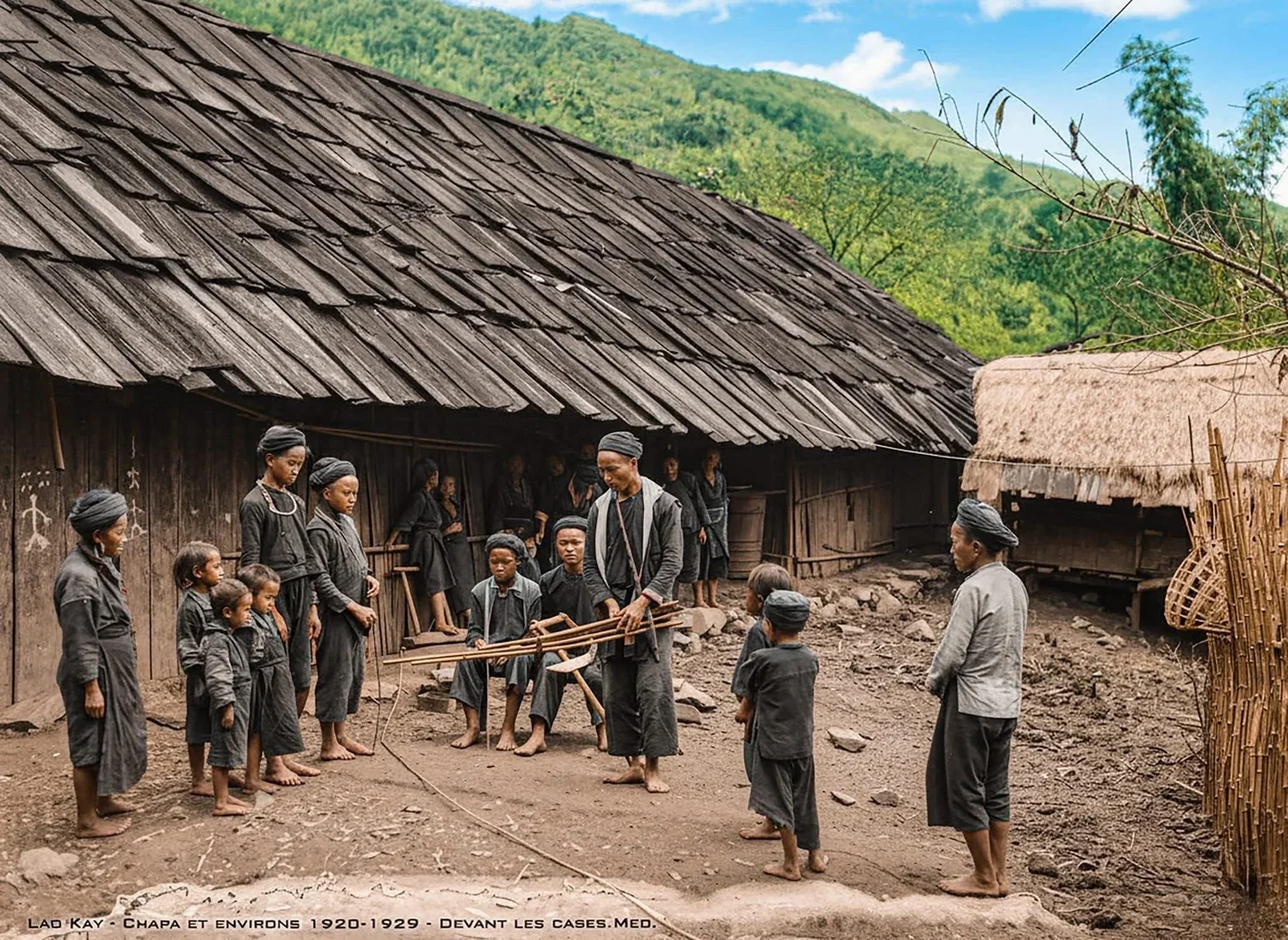
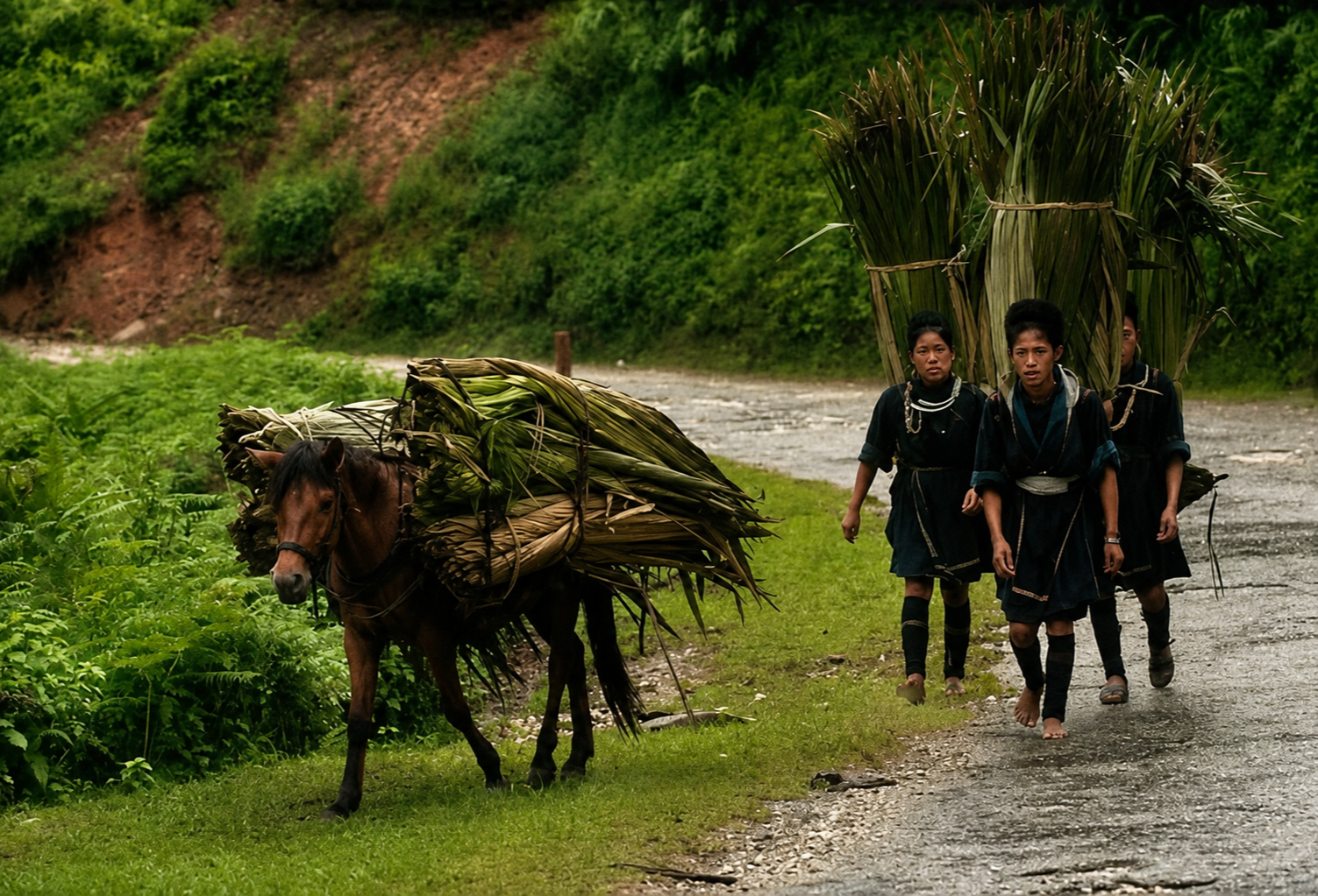
High in the northern mountains of Sapa, the story of this landscape cannot be separated from the people who have shaped it over generations. Long before colonial maps or tourism routes defined the region, Giáy, Tay, Hmong and Dao communities cultivated the mountain slopes, built villages along ridgelines, and established systems of trade, agriculture, and craft that continue to define the cultural fabric of the highlands today. Their presence forms a continuous thread through every period of Sapa’s history, steady and enduring despite waves of external influence and transformation. The rhythm of daily life, from planting rice in terraced fields to gathering at weekly markets, has long shaped both the economy and identity of the region.
These communities were never peripheral to Sapa’s development, nor were they passive observers of change. They were and remain farmers, traders, textile makers, herbalists, and storytellers whose knowledge of land and climate has sustained life in a challenging mountain environment. Some are now entrepreneurs and even guides too.
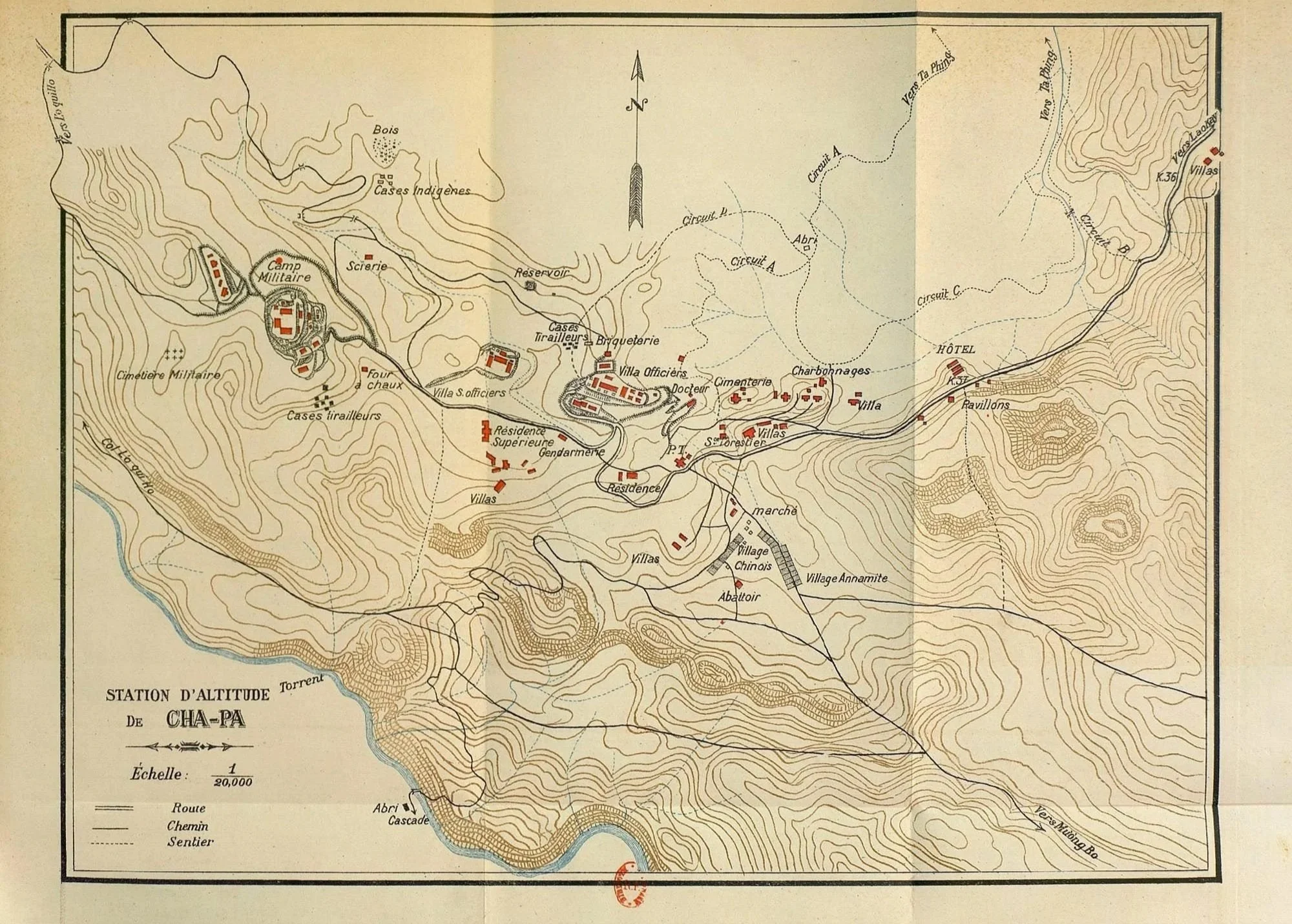
Old French map of Cha Pa.
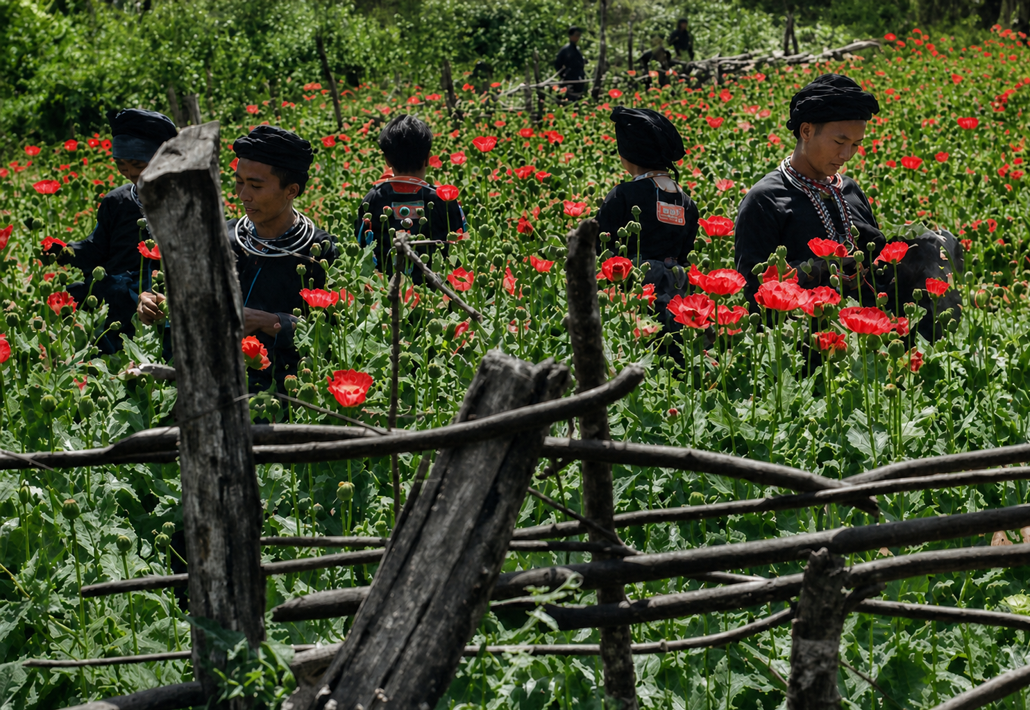
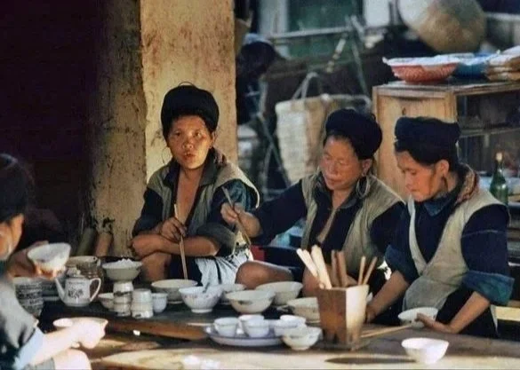
Recolorised photograph of ethnic minorities harvesting opium in Sapa.
Early Histories: A Layered Frontier, Not an Empty Landscape
Population history in Sapa is layered and complex, with different groups arriving at different times and settling according to ecological conditions. Tai-speaking groups such as the Giáy and Tay tended to inhabit lower valleys suited to wet-rice cultivation, while Hmong and Dao communities, arriving later, established themselves in higher elevations, practising forms of agriculture adapted to steep terrain and forest environments. The precise timelines of arrival remain debated, yet the strongest evidence suggests that Dao presence in northern Tonkin dates back at least to the early eighteenth century, while larger waves of Hmong migration occurred in the nineteenth century, often linked to broader movements from southwest China.
What emerges clearly is not a single moment of settlement, but a cumulative process shaped by migration, adaptation, and exchange. Markets were central to this world, functioning not only as economic sites but as places of social interaction, courtship, and cultural display. Trade networks carried salt, metals, textiles, livestock, and forest products, while Chinese merchants often dominated longer-distance exchange, connecting upland producers to wider regional economies.
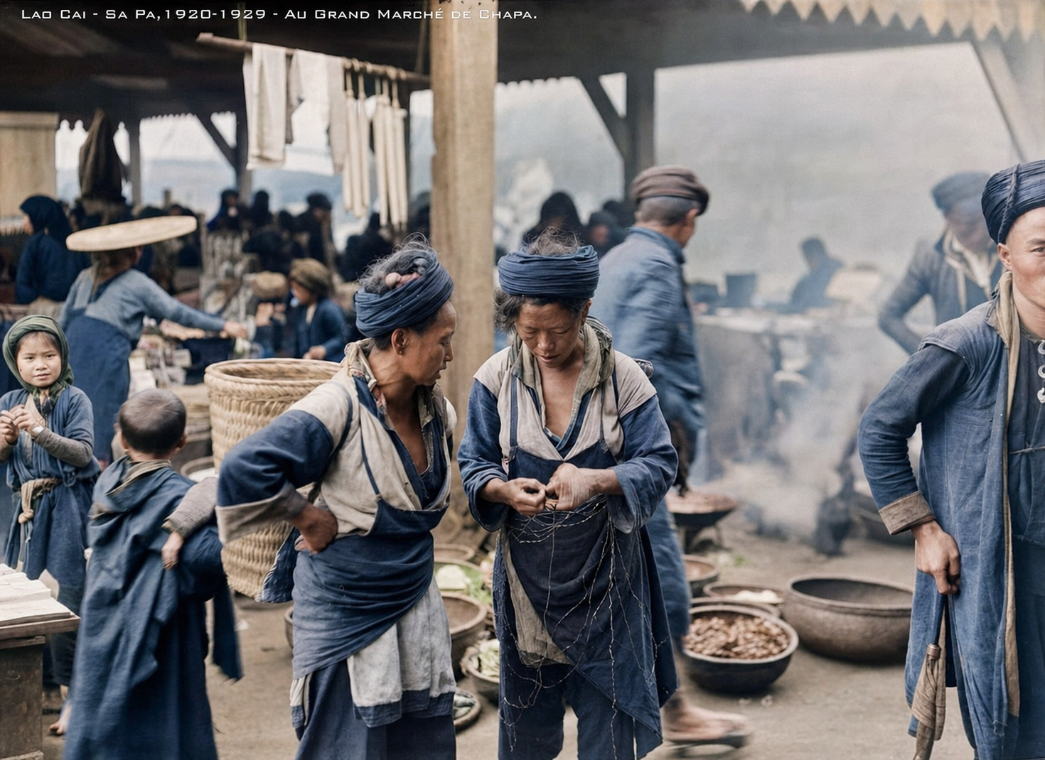
Recolorised photograph of Hmong people in Sapa market in the early 20th century.
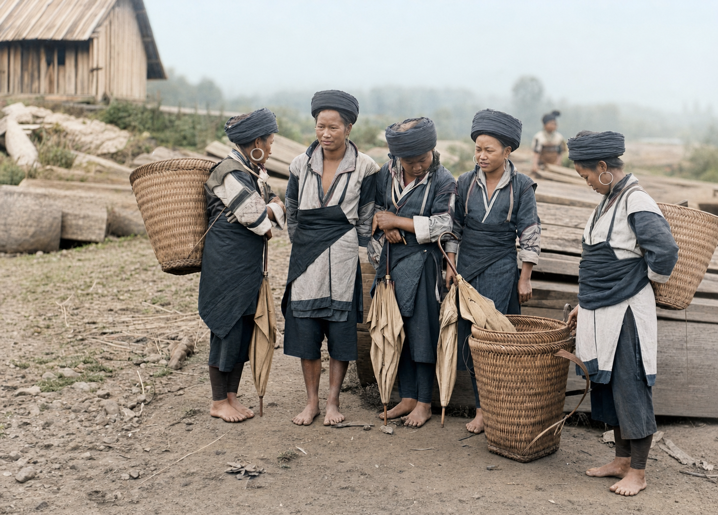
Recolorised photograph of Hmong women gathering on a Sapa street.
Colonial Mapping and the Creation of a Hill Station
French colonial interest in the region intensified towards the end of the nineteenth century, when scientific expeditions began surveying northern Vietnam’s upland populations. By 1898, French teams had reached Lào Cai, and by 1903 Sapa appeared on official maps for the first time. What had been a predominantly Black Hmong settlement became incorporated into a colonial framework that sought both strategic control and climatic advantage.
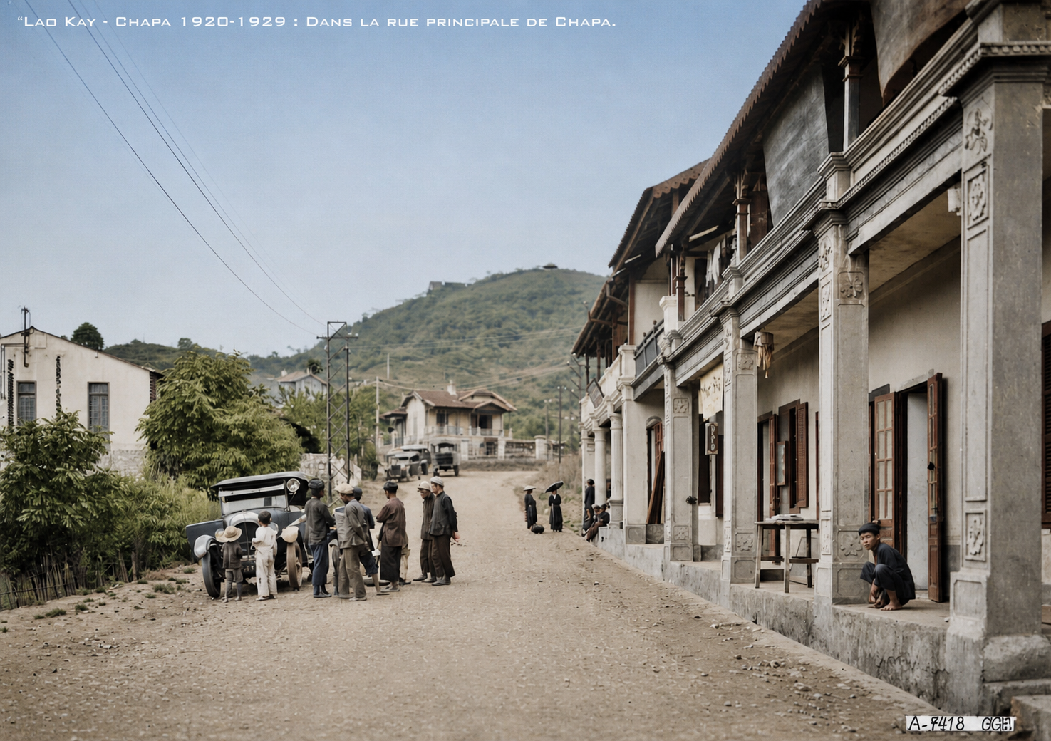
A military garrison was established in 1903, initially referred to as “Cha Pa”, a transliteration of the Hmong “Sa Pả”. Infrastructure soon followed, including roads and eventually the railway linking Hanoi to Lào Cai. The French transformed Sapa into a colonial hill station designed to serve the administrative, military, and climatic needs of European settlers, reshaping upland land use and local economies in the process. They were keen to promote its cool climate as a refuge from the lowland heat. By the early twentieth century, hotels, villas, and administrative buildings had been constructed, including the Hotel du Fansipan and other boarding houses along the main road. A sanatorium, opened in 1913, treated conditions such as malaria and respiratory illness, while the meteorological station established in 1915 connected Sapa to international scientific networks.
For many French officials and settlers living in Hanoi, the climate of the northern highlands became central to the appeal of Sapa. The cooler mountain air was framed as both restorative and medically beneficial in contrast to the heat, humidity, and disease associated with the lowlands. Colonial accounts increasingly portrayed Sapa as a refuge for exhausted administrators, soldiers, and wealthy residents of Indochina, reinforcing the development of sanatoriums, seasonal villas, and hotels throughout the early twentieth century.
By the 1920s and 1930s, Sapa had become one of the most prominent hill stations in French Indochina, attracting colonial elites seeking leisure and recuperation in the mountains. Yet this vision of Sapa as a place of escape existed alongside the realities of frontier administration and unequal labour structures, with Hmong and Dao communities continuing to supply much of the agricultural labour, trade, and local knowledge that sustained the colonial settlement itself.
By the early twentieth century, tourism infrastructure in Sapa was already beginning to emerge alongside the expanding colonial settlement. Most historical accounts identify the Cha Pa Hotel, also known as the Hotel de Chapa, opened around 1909 by Mr Meiville, as the town’s first civil hotel. The Hotel du Fansipan followed later, around 1924, as Sapa’s reputation as a mountain retreat continued to grow among French residents in Indochina. Larger hotels, including the Metropole in 1932 and the Hôtel du Centre in 1937, were constructed in the decades that followed, reflecting the steady expansion of colonial tourism in the highlands.
Despite these developments, the French civilian population remained small, never exceeding a few dozen individuals even at its peak. The majority of the population continued to be composed of Hmong, Dao, and other ethnic groups, whose labour and local knowledge underpinned both agricultural production and the functioning of the colonial settlement.
Recolorised photograph of Hotel du Fansipan on what is now Cau May Street.
Recolourised photograph showing some of Sapa’s many colonial villas.
Recolourised photograph of a Hmong home in 1920’s Sapa.
Colonial Frontier and Hill-Station Formation
The arrival of the French in the late nineteenth century did not mark the “discovery” of an empty mountain wilderness, as older colonial narratives often implied. The highlands around Sapa were already part of a socially and economically connected frontier shaped by Hmong, Dao, Giáy, and other upland communities through trade, farming, migration, and market exchange. What French colonialism introduced was not civilisation to an isolated region, but a new system of military control, taxation, extraction, and territorial administration.
From the 1890s onwards, the French consolidated authority across the northern frontier following the establishment of colonial rule in Tonkin and the formal demarcation of the border with China. Military expeditions, ethnographic surveys, missionary activity, and infrastructure projects unfolded together, all serving a broader effort to make the uplands more legible and governable to the colonial state. Understanding local leadership structures, trade routes, agricultural systems, and ethnic classifications was not simply an academic exercise, but part of a strategy for extending control into regions that had historically operated with relative autonomy.
Missionaries from the Société des Missions Étrangères de Paris became some of the earliest outsiders to document local customs and communities, while military surveyors mapped trade corridors and settlement patterns across the frontier. These records helped integrate the highlands into systems of taxation and administration that increasingly tied upland economies to colonial interests.
The transformation of Sapa into a hill station was deeply connected to this wider project. The French sought a cool mountain retreat where colonial officials and military officers could escape the climate and disease of Hanoi, but Sapa’s location near the Chinese border also gave it strategic importance. Roads, military posts, and eventually the railway linking Hanoi and Lào Cai extended colonial reach further into the mountains, allowing authorities to monitor trade routes and strengthen their presence along the frontier.
This expansion was financially underwritten in large part by the opium economy of French Indochina. During the early twentieth century, the colonial administration relied heavily on revenue generated through the state-controlled opium monopoly, known as the Régie de l’Opium. In some periods, opium accounted for a substantial proportion of colonial income, helping finance infrastructure, military operations, and administrative expansion across Indochina. The villas, roads, railway links, sanatoriums, and administrative buildings that reshaped Sapa emerged within this broader narcotics-financed colonial system.
The relationship between the highlands and opium was also more direct. Hmong and Dao communities across northern Vietnam had long cultivated opium poppies for medicinal, ritual, and trade purposes before French rule. Under colonial administration, these existing practices became increasingly regulated and incorporated into monopoly structures designed to generate state revenue. Upland communities were therefore drawn more tightly into systems of taxation and economic extraction that primarily served colonial interests rather than local needs.
Land itself was reorganised during this period. One Hmong settlement bearing the name Sa Pa was displaced as the colonial town expanded around military barracks and a sanatorium. By the 1910s and 1920s, villas and administrative residences spread across the plateau, transforming the landscape into a seasonal enclave for colonial elites. Tourism developed quickly once transport links improved, and by the mid-1920s Sapa had hotels, a tourist bureau, and a growing reputation among French residents as a mountain retreat.
Yet this colonial version of Sapa remained highly unequal. F rench residents occupied the town seasonally, Kinh workers often filled permanent service and administrative roles, while Hmong and Dao communities largely remained in surrounding villages, participating in the colonial economy through labour, trade, taxation, and agricultural production without sharing equally in the wealth or power that flowed through the town itself.
Railways, Trade, and the Making of a Corridor
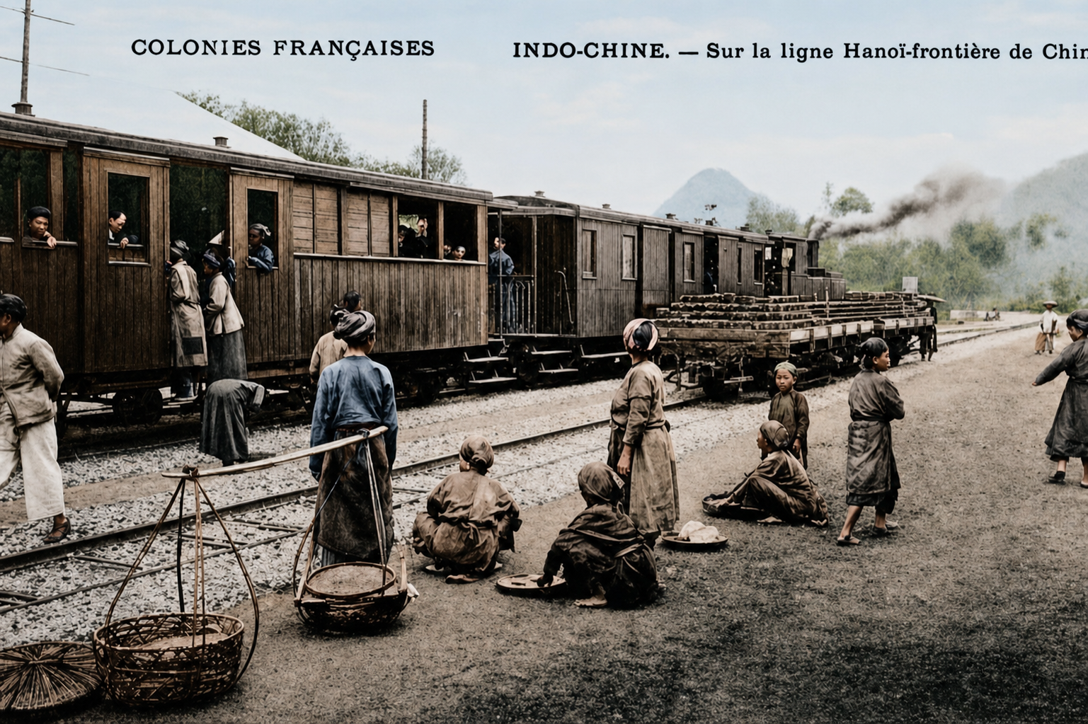
The transformation of Sapa cannot be separated from the wider transport networks that connected it to regional and global systems. The railway linking Hải Phòng, Hanoi, and Lào Cai, completed in stages between 1903 and 1910, was conceived as both a commercial and strategic corridor extending towards Yunnan in China. While the main station in Hanoi opened in 1902, the line toward the Chinese border at Lao Cai was constructed in segments beginning in 1903. The entire 296km line from Hanoi to Lao Cai was officially completed and put into operation in 1906. This railway transformed access to the highlands, reducing travel time significantly and enabling the movement of administrators, goods, and visitors into the region.
Before the railway, commodities such as opium, timber, and forest products moved slowly along the Red River by boat. Rail infrastructure compressed travel times and integrated the northern highlands more tightly into colonial trade networks and systems of extraction. The new line moved goods and reshaped the spatial logic of the frontier, turning Lào Cai into a gateway and positioning Sapa as its climatic and administrative counterpart. Trade intensified, particularly in commodities such as opium, timber, and forest products, while imported goods flowed into upland markets. The railway played a role similar to later infrastructure projects, reducing travel time and integrating the highlands more closely into external economies. Rather than replacing existing geographies, it reoriented them, making Sapa increasingly accessible while also embedding it within larger systems of control and exchange.
The expansion of colonial infrastructure was closely tied to the opium economy moving through the northern frontier. By the late nineteenth and early twentieth centuries, the wider Lào Cai region had become an important centre within the French colonial opium system, with highland communities across northern Vietnam cultivating opium poppies for local use, trade, and taxation. Colonial authorities increasingly sought to regulate and profit from this trade, treating opium as one of the most valuable sources of revenue in French Indochina.
The people of Sapa became commercial producers of opium made possible by the railway and Sapa’s position within a wider upland zone where poppy cultivation existed across parts of Lào Cai and neighbouring provinces. The town’s growing importance therefore cannot be separated from the broader frontier economy developing around it. Roads, military outposts, and transport corridors did not simply support tourism and administration; they also strengthened colonial oversight of highland economies increasingly tied to narcotics revenue and cross-border trade.
Recolourised photograph of a wooden train travelling the Hanoi to Lào Cai railway route during the French colonial period in northern Vietnam.
War, Disruption, and Abandonment
The mid-twentieth century brought significant disruption. During the conflict between French forces and the Viet Minh, Sapa suffered extensive damage, particularly between 1947 and 1952 when fighting led to the destruction of many colonial buildings, including villas, the governor’s residence, and the sanatorium. By the early 1950s, the town had been largely abandoned.
The collapse of French Indochina also brought the destruction of much of colonial Sapa itself. In 1952, as conflict intensified before the defeat of French forces at Điện Biên Phủ, French bombing campaigns damaged large parts of the hill station, including administrative buildings and private villas. Many residents fled, and the town entered a prolonged period of decline and abandonment.
The 1979 Border War and the Isolation of the Highlands
The Sino-Vietnamese War left a deep mark on the northern frontier, including the mountains surrounding Sapa and the wider Lào Cai Province region. Although the heaviest fighting took place closer to the border itself, particularly around the city of Lào Cai, the conflict reshaped life across the highlands for years afterwards through militarisation, economic disruption, and prolonged isolation.
When Chinese forces crossed into northern Vietnam in February 1979, the frontier became one of the most heavily contested regions in the country. Roads, railways, and transport links that had once connected the mountains to wider trade networks were damaged or cut off entirely, including the historic railway corridor linking Hanoi, Lào Cai, and Yunnan. The movement of goods and people slowed dramatically, while the border itself became increasingly securitised in the years that followed.
For communities in the mountains around Sapa, the impact was felt less through large-scale battles within the town itself and more through the atmosphere of uncertainty and hardship that settled across the region during the 1980s. Tourism had long disappeared, cross-border trade collapsed, and many villages returned once again to rhythms shaped primarily by subsistence farming and local exchange. Military presence became more visible throughout the frontier, while economic opportunities remained extremely limited in a period already marked by national hardship and postwar recovery.
The Secret War, Reunification, and the Isolation of the Northern Highlands
The wider region was also affected by geopolitical tensions beyond Vietnam’s borders. During the Vietnam War era, many Hmong, particularly in neighbouring Laos, were recruited into American-backed operations in what became known as the Secret War. Their roles included guiding air operations, gathering intelligence, and supporting military logistics, often at great personal cost. Following the end of the war in 1975, these associations led to suspicion and hardship, with many families facing displacement and long-term socio-political consequences.
In Sapa itself, the decades following reunification were marked by isolation and economic difficulty. Tourism disappeared, and local communities focused on subsistence and rebuilding, maintaining agricultural practices and cultural traditions largely outside the view of the wider world. For decades afterwards, tourism continued to suffer, and much of the colonial architecture that once defined Sapa fell into ruin beneath vegetation and time. The forests and mountains that travellers now experience as peaceful and expansive carried a different atmosphere during those years. Trails that today lead trekkers through rice terraces and bamboo groves once sat within a tense frontier landscape shaped by restricted movement, political suspicion, and the lingering fear of renewed conflict. Families throughout the highlands lived through decades in which the outside world felt very distant, with the mountains functioning less as a destination and more as a buffer zone along a fragile border.
Hmong women gather foder during the post war abandoment period.
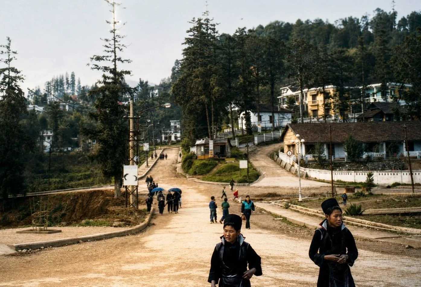
Image of Sapa town centre in the early 1990’s. Photo: Nguyen Tri Dung
Colonial Heritage and the Remains of French Sapa
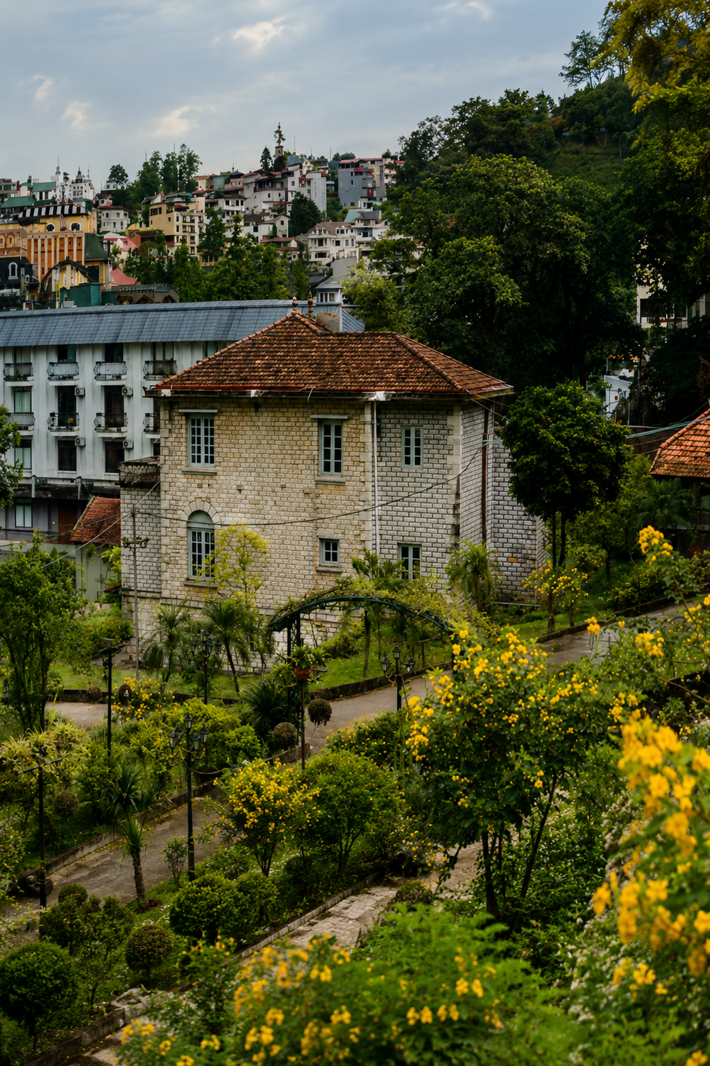
The French colonial period in Sapa was tumultuous, unequal, and in many respects deeply forgettable for the communities who lived through its systems of extraction, displacement, and frontier control. Despite this difficult history, the physical remains of the colonial era still form an important part of Sapa’s architectural and historical landscape. These buildings are not simply relics of nostalgia, but material records of a period that reshaped the town and connected it to wider political and economic forces across Indochina.
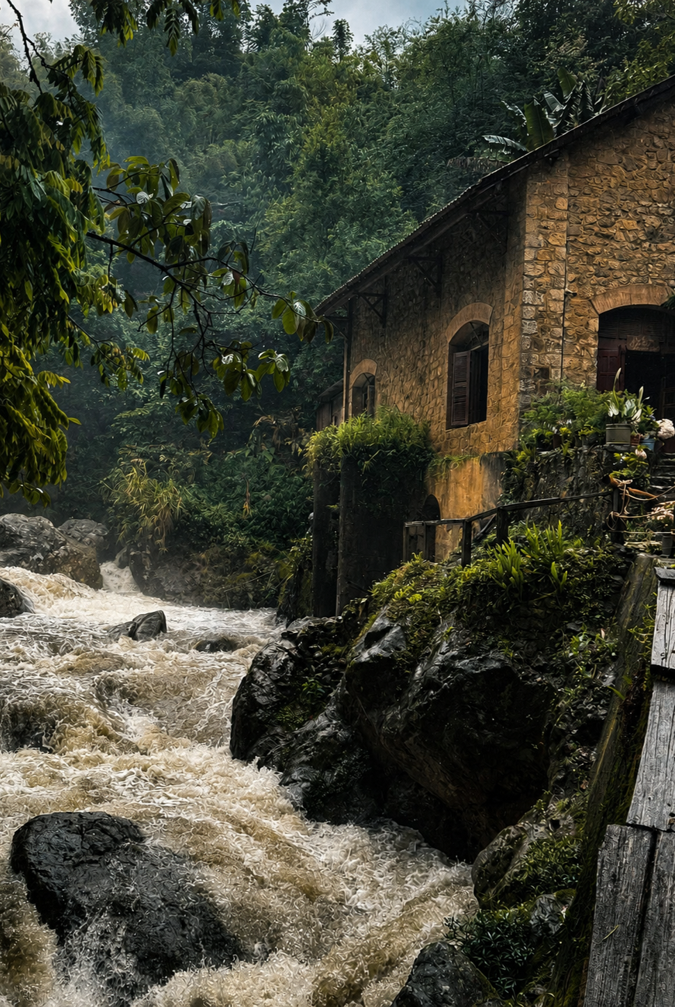
Although much of colonial Sapa was destroyed during the conflicts of the mid-twentieth century, traces of the period remain scattered throughout the town and surrounding valleys. The most recognisable is the Sapa Stone Church, constructed between 1926 and 1935 at the foot of Hàm Rồng Mountain. Built in a Roman-Gothic style using locally quarried stone, the church remains one of the clearest surviving examples of French colonial architecture in the northern highlands and continues to function both as a parish church and a central landmark within the town.
Elsewhere in Sapa, fragments of the colonial hill station survive more quietly. The old meteorological station established by the French in 1915 still operates today, reflecting the colonial administration’s scientific interest in the climate and geography of the highlands. Nearby, the former district office from the colonial era now houses the Tourist Information Centre, while several surviving villas remain tucked behind the church and within the grounds of older hotel properties. Some of these villas, originally built for colonial officials and wealthy residents escaping the heat of Hanoi, still retain fireplaces, shuttered windows, verandas, and stone walls characteristic of French hill-station architecture. Others sit partially obscured beneath vegetation, their deterioration mirroring the collapse of the colonial world that created them. Around town, overgrown staircases, moss-covered walls, and isolated masonry structures occasionally emerge between newer hotels and cafés, reminders of a period that attempted to remake the mountains according to colonial ideals.
Beyond the town centre, the ruins of the Tả Phìn monastery stand as one of the most haunting remnants of this era. Constructed in 1942 for a community of Cistercian nuns, the abandoned stone structure now sits roofless and weathered among the hills, its empty arches and collapsing walls reflecting both the ambitions and fragility of colonial expansion in the highlands.
The Cát Cát Hydroelectric Plant, built in 1925 to power the colonial settlement, also survives as an important industrial relic from the French period. Originally constructed to support the growing hill station, the plant later became part of the town’s tourism landscape after ceasing operation in the 1990s.
These buildings remain historically significant not because they represent a golden age of Sapa, but because they reveal how profoundly the colonial period reshaped the town’s landscape, infrastructure, and identity. They stand alongside Hmong and Dao villages, markets, and agricultural terraces as part of the layered history of the highlands, reflecting both the endurance of local communities and the lasting imprint of colonial power on the mountains.
Photograph of a colonial villa in Sapa taken in 2026
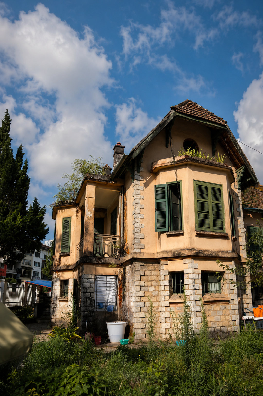
Photograph of a colonial villa in Sapa taken in 2026
Photograph of a colonial hydroelectric station taken in Cat Cat in 2026
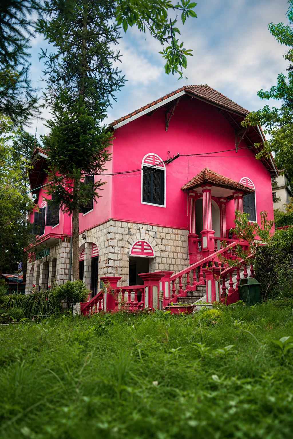
Photograph of a colonial villa in Sapa taken in 2026
Reopening and the Rise of Modern Tourism
By the time international travellers began arriving again in the 1990s, Sapa was emerging from nearly half a century of upheaval stretching across colonial conflict, the wars of Indochina, and the tensions of the northern frontier. The rapid transformation that followed makes far more sense when viewed against this recent history of isolation and hardship, because within living memory Sapa was not a tourism centre at all, but a remote mountain town shaped by survival, resilience, and recovery.
The transformation of Sapa began in the early 1990s, following Vietnam’s economic reforms and increased international engagement. By 1993, Sapa had reopened to global tourism, and visitor numbers began to rise steadily. When international visitors began returning, Sapa was no longer the exclusive hill station of colonial elites. International travellers were often drawn by many of the same elements that had once unsettled and fascinated outsiders during the colonial period. The mountains around Sapa still felt remote and unpredictable, shaped by steep valleys, dense forest, rapidly changing weather, and narrow trails that disappeared into cloud and ridgelines. Long before paved roads and large-scale tourism infrastructure, the surrounding landscape demanded patience, endurance, and local knowledge to move through safely.
Part of this atmosphere survived in the stories that continued to circulate about the colonial era itself. Local folklore and traveller accounts often referenced French officers or soldiers disappearing into the mountains while hunting, patrols failing to return, or men becoming lost during sudden storms in the highlands. While these stories were frequently retold with a supernatural edge, they were rooted in a genuine historical reality. In the early twentieth century, the terrain around Sapa was extremely difficult to navigate, weather conditions could shift within minutes, and communication across the frontier remained limited. Isolation and uncertainty were ordinary features of life in the mountains rather than romantic inventions.
For the early generation of independent travellers arriving in the 1990s, this sense of remoteness became part of Sapa’s appeal. The region was still relatively undeveloped, with few hotels, limited transport, and trekking routes that passed through forests, rice terraces, and villages largely untouched by mass tourism. Adventure travellers were drawn by the dramatic topography and by the feeling of entering a landscape that still retained a strong sense of cultural and environmental depth.
The forests of the Hoàng Liên range, the steep agricultural terraces carved into mountainsides, and the presence of Hmong and Dao communities maintaining distinct languages, clothing traditions, and farming practices gave Sapa a character that felt markedly different from Vietnam’s rapidly urbanising lowlands. Travel at the time was slower and more uncertain, often relying on local guides, overnight trains, and extended periods spent walking between villages. Encounters were shaped less by curated tourism infrastructure and more by the realities of geography, weather, and human connection.
Early foreign travellers were often independent backpackers moving through Vietnam on limited budgets, staying in small guesthouses and travelling by overnight train from Hanoi. Tourism at this stage remained relatively modest compared to the rapid commercial expansion that would follow in the decades ahead. In many ways, what first drew adventure travellers to Sapa in the 1990s was not comfort or convenience, but the feeling that the mountains still held something untamed and difficult to fully know.
Investment in infrastructure followed, including the extension of electricity, improvements to roads, and the development of water systems. These changes enabled greater accessibility while also accelerating the integration of Sapa into national and international tourism networks. Terraced rice fields, cultural diversity, and trekking opportunities became central to the town’s appeal.
For Hmong and Dao communities, tourism created new economic opportunities through guiding, homestays, handicraft production, and agricultural experiences. At the same time, it introduced new challenges related to market access, cultural representation, and the distribution of economic benefits.
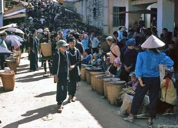
Sapa Market in 1992. Photo: Hans-Peter Grumpe
Sapa Market in 1992. Photo: Hans-Peter Grumpe
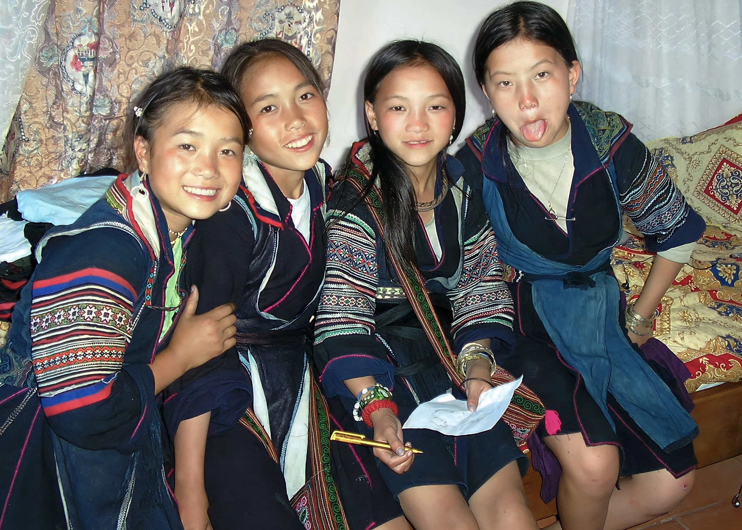
Hmong girls in Sapa in the late 1990’s
Hoàng Liên National Park, Conservation, and the Transformation of Fansipan
The mountains surrounding Hoàng Liên National Park have long shaped both the ecology and identity of Sapa. Rising along the Hoàng Liên Sơn range, these forests and ridgelines form one of the most biodiverse mountain regions in Vietnam, containing dense subtropical forest, high-altitude bamboo ecosystems, medicinal plants, and numerous rare species adapted to the harsh climatic conditions of the northern highlands. For generations, Hmong, Dao, and other upland communities lived alongside these forests, drawing from them not only food and materials, but medicinal knowledge, spiritual meaning, and seasonal rhythms that became deeply woven into everyday life.
As tourism and infrastructure expanded rapidly during the 1990s, concerns increasingly emerged around deforestation, biodiversity loss, and uncontrolled development in the Hoàng Liên Sơn range. In response, the area was first designated as the Hoàng Liên–Sa Pa Nature Reserve in 1996 before being formally established as Hoàng Liên National Park in 2002. The creation of the national park marked an important shift in how the mountains were understood by the Vietnamese state, no longer viewed only as frontier territory or agricultural land, but as a nationally significant ecological landscape requiring long-term protection.
At the centre of the range stands Fansipan, the highest mountain in Vietnam and Indochina at 3,147 metres. For decades, reaching the summit required physically demanding multi-day treks through dense forest, steep terrain, and rapidly changing weather conditions. Fansipan became especially significant within Vietnam’s emerging adventure travel culture during the 1990s and early 2000s, attracting trekkers drawn by both the physical challenge and the feeling of entering one of the country’s last truly rugged mountain environments.
This relationship between landscape, conservation, and tourism changed dramatically with the development of the Sun World Fansipan Legend cable car complex, opened in 2016 by Sun Group. The cable car system, stretching from the Mường Hoa Valley towards the summit of Fansipan, transformed access to the mountain almost overnight. What had once required days of trekking could suddenly be reached within minutes.
Supporters of the development argued that the project expanded access to the mountains for elderly visitors, domestic tourists, and those previously unable to experience the summit. The cable car also accelerated tourism growth in Sapa, contributing to rising visitor numbers and broader economic development across the region.
At the same time, the project became symbolic of the tensions increasingly shaping modern Sapa. Critics questioned the environmental impact of large-scale construction within a protected mountain ecosystem and argued that the commercialisation of Fansipan altered the character of a landscape once associated with remoteness, endurance, and ecological depth. The summit itself, now surrounded by temples, paved walkways, and tourism infrastructure, reflects a wider transformation taking place across Sapa, where accessibility and mass tourism increasingly reshape places that were once defined by difficulty, distance, and local knowledge.
The story of Hoàng Liên National Park therefore reflects a broader contradiction at the centre of modern Sapa. The mountains are simultaneously protected and commercialised, celebrated for their ecological and cultural significance while also being integrated ever more deeply into Vietnam’s tourism economy. As with so much of Sapa’s history, the question is not simply one of preservation or development, but of balance, and of whose relationship with the landscape ultimately shapes its future.

Tourists at the summit of Mount Fansipan enjoy spectacular views of the surrounding mountains.
Urban Transformation: Markets, Space, and Visibility
One of the most significant changes in Sapa’s urban landscape has been the relocation of its central market. Historically located in the town centre on Cầu Mây Street, the market served as a key site of exchange where ethnic minority women sold textiles, produce, and handmade goods directly to visitors and local residents.
Between 2010 and 2014, a new market complex was constructed at the northern gateway of the town, as part of a broader urban development strategy. The old market ceased operation in December 2014, and the new market officially opened shortly afterwards. Authorities justified the relocation in terms of urban planning, tourism development, and improvements to hygiene and infrastructure.
However, the impact on Hmong and Dao vendors has been well documented. Many were relocated to less visible areas within the new market, often on upper floors or in zones with lower foot traffic, resulting in reduced sales and increased costs. This shift altered the spatial dynamics of trade, favouring traders with greater financial resources and familiarity with formalised systems, while pushing some ethnic minority sellers back into informal street-based commerce or village-level trade.
The development of Sapa Lake reflects a similar pattern of layered urban change. It was already incorporated into planning documents by the early 2000s and has since undergone multiple phases of redevelopment. Today it functions as a central visual and recreational feature, reinforcing Sapa’s role as a tourist-oriented town.
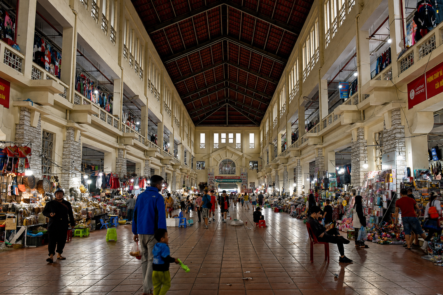
The “new” Sapa market is dominated by machine made toys, trinkets and textiles
Contemporary Sapa: Infrastructure, Acceleration, and the “Check-In” Landscape
The pace of change in Sapa has accelerated further in the twenty-first century through large-scale infrastructure and planning initiatives. The Nội Bài–Lào Cai expressway, completed in 2014, reduced travel time between Hanoi and Lào Cai from roughly nine hours to around five and a half, intensifying flows of visitors, goods, and investment into the region.
Proposals such as the planned Sapa airport, alongside national tourism-area strategies and year-round festival programming, reflect an ongoing effort to position Sapa as a major destination within both national and regional economies. These developments continue a longer historical pattern, in which successive forms of infrastructure, from railways to expressways, reduce distance and integrate the highlands more tightly into external systems.
Modern Sapa is increasingly shaped by how it is seen as much as by how it is lived. Alongside trekking and cultural travel, a more recent pattern has emerged in the form of “check-in” tourism, where certain locations are visited primarily because they are widely shared and easily recognisable. Purpose-built viewpoints, sculptural installations, and curated backdrops draw large numbers of visitors each day, not because of historical or cultural significance, but because they are recognisable. The experience becomes less about engaging with place and more about reproducing a familiar image, one that has already circulated widely across social media platforms.
This shift is not accidental. It is reinforced by what is repeatedly promoted, recommended, and shared, creating a feedback loop in which visibility defines value. Travellers are increasingly influenced by what they see others doing, to the point where visiting certain locations can feel less like a choice and more like an expectation. The result is a subtle but significant transformation in how Sapa is experienced.
The implications for cultural life are profound. When travel becomes centred on predefined viewpoints and repeatable images, the slower, less visible aspects of Sapa begin to recede. The knowledge held by Hmong and Dao communities, knowledge rooted in farming cycles, forest ecology, textile traditions, and oral histories, is not easily captured in a single photograph. It requires time, presence, and a willingness to move beyond the most accessible spaces.
In this context, culture risks being reframed as something to observe briefly rather than something to understand. Practices that were once part of daily life can become staged or simplified for quick consumption, while deeper forms of knowledge remain unheard. We wrote prviously about a “quieting” of local voices, not through deliberate exclusion, but through the overwhelming dominance of externally shaped narratives about what Sapa is and what it should look like.
The contrast between living culture and curated experience becomes increasingly clear. A weaving practice, for example, is not a performance designed for visitors, but part of an ongoing system of knowledge and livelihood. Farming terraces are not simply scenic viewpoints, but the result of generations of adaptation to land and water. When these elements are approached only as visual attractions, their deeper meaning becomes obscured.
At the same time, this shift reflects broader patterns within tourism development. As visitor numbers increase and competition intensifies, destinations often prioritise what is easily marketable and immediately engaging. In Sapa, this has contributed to the growth of attractions designed for rapid consumption, reinforcing a model of tourism centred on speed, visibility, and volume rather than connection and understanding. Yet beneath this layer, the core of Sapa remains unchanged. The Hmong and Dao communities continue to live, work, and create within these mountains, maintaining knowledge systems that cannot be reduced to a single image or moment. Their role in shaping Sapa has not diminished, even if it is less visible within dominant tourism narratives.
The challenge now lies in how Sapa is experienced and understood moving forward. Whether culture remains central or becomes peripheral depends not only on policy or development, but also on the choices made by travellers themselves. Meaningful engagement requires stepping away from what is most visible and allowing space for what is less immediately apparent, choosing to listen rather than simply to look.
In this way, the modern phenomenon of “check-in” tourism does not replace Sapa’s cultural foundation, but it does risk obscuring it. The mountains remain the same, and so do the communities who have long shaped them. What is changing is the lens through which they are seen.

The heart of Sapa town on a busy weekend in 2026

Street sellers enjoy a moment with passing tourists in 2025

Sapa lake in 2026
The Hijacking of Colonial Prestige
One of the clearest examples of this tension can be seen in the way parts of Sapa’s colonial history are now repackaged through luxury tourism branding. The Hotel de la Coupole Sapa – MGallery, for example, describes itself as a place where “Haute Couture Meets Hill Tribe Artistry”, combining imagery of French Indochina with stylised references to ethnic minority culture. Although visually striking, this version of history risks presenting colonialism as elegant, romantic, and culturally harmonious, while largely overlooking the realities that underpinned the colonial project itself.
Importantly, the hotel itself is not a preserved piece of colonial heritage, but a contemporary luxury development designed around an imagined aesthetic of “French Indochine”. Unlike surviving colonial villas, churches, or administrative buildings that physically connect to the historical landscape of Sapa, the property represents a newly constructed interpretation of colonial nostalgia rather than an authentic historical site. Its atmosphere is therefore less a continuation of lived history than a carefully curated commercial vision of what colonial Indochina is imagined to have looked and felt like.
French rule in the northern highlands was not simply an era of architecture, mountain retreats, and refined tourism. It was also a system built upon military expansion, frontier control, labour extraction, unequal land relations, taxation, and the opium monopoly that financed much of colonial Indochina. Highland communities were surveyed, classified, taxed, displaced, and incorporated into systems of governance designed primarily around colonial economic and strategic interests.
The romantic imagery now used in some tourism marketing often reflects less the historical reality of colonial Sapa than a contemporary fantasy of Indochine created for commercial appeal. In this version of the past, colonialism becomes aesthetic rather than political, reduced to curated interiors, couture references, and nostalgic atmosphere, while the violence, inequality, and disruption experienced by local communities fade into the background. What is presented as heritage can therefore risk becoming a form of selective memory, one that celebrates the appearance of colonialism while overlooking the structures of power that shaped life in the highlands for decades.
Continuity and Change in the Highlands
Across more than a century of transformation, from colonial expansion and war to mass tourism and rapid infrastructure development, the most constant element in Sapa’s history has been the presence and contribution of its ethnic communities. Political systems have changed, borders have hardened, railways and expressways have arrived, and tourism economies have repeatedly reshaped the mountains, yet Hmong and Dao communities have continued to adapt while maintaining strong connections to land, language, family, and tradition.
This continuity is visible throughout the highlands. Terraced rice fields still follow the contours of the mountains in patterns shaped by generations of agricultural knowledge. Indigo-dyed textiles, embroidery, silverwork, herbal medicine, and ritual traditions continue to be practised, not as static cultural displays, but as living parts of everyday life that evolve alongside changing economic realities. Markets may shift location, tourism may alter village economies, and younger generations may move fluidly between mountain communities and urban centres, yet cultural identity remains deeply rooted within the rhythms of the highlands themselves.
The history of Sapa is often told through the lens of outsiders, colonial administrators, travellers, investors, or tourism campaigns, but the deeper story is one of endurance and adaptation within local communities. Hmong and Dao families have lived through periods of colonial control, war, economic isolation, state restructuring, and rapid commercialisation, while continuing to reshape their own futures within changing conditions. Their role has never been passive. Communities have continually negotiated with outside forces, finding ways to preserve knowledge and identity while also engaging pragmatically with tourism, trade, education, and modern economic life.
Today, this resilience can be seen in the growing number of community-led tourism initiatives, local guides reclaiming cultural narratives, younger generations documenting oral histories and traditional crafts online, and families balancing ancestral knowledge with new opportunities. The future of Sapa will inevitably continue to change, as it always has, but there is also increasing recognition that the long-term strength of the region lies not only in its landscapes, but in the people who have sustained those landscapes for generations.
The pressures facing the highlands are real. Rapid tourism growth, environmental strain, changing land use, and the commercialisation of culture continue to reshape everyday life across the region. Yet the story of Sapa is not simply one of loss. It is also a story of survival, creativity, and continuity in the face of constant transformation.
Understanding Sapa therefore requires looking beyond the surface of tourism and recognising the depth of lived experience that continues to shape the mountains today. The forests, terraces, markets, and villages are not remnants of the past frozen in time, but part of an ongoing cultural landscape still being actively lived, negotiated, and reimagined by the communities who call these mountains home.

Young Hmong boy in Sapa in 2026
Hmong girls in Sapa in 2026

Hmong boys in Sapa in 2026
Walking Towards the Future
Sapa’s history is still being lived. Beyond the changing skylines, tourism projects, and shifting economies, the mountains remain shaped by the knowledge, labour, and resilience of the communities who have called them home for generations.
Understanding this region more deeply often begins with simply slowing down, walking further, and listening more carefully. At ETHOS, our experiences are created alongside Hmong and Dao communities who continue to shape everyday life across the highlands, offering a more grounded way to experience the landscapes and cultures of northern Vietnam.
The future of Sapa will almost certainly continue to be shaped by tourism, infrastructure, and outside investment, yet the long-term identity of the highlands will depend on whether development can remain connected to the communities, landscapes, and knowledge systems that have sustained this region for generations.
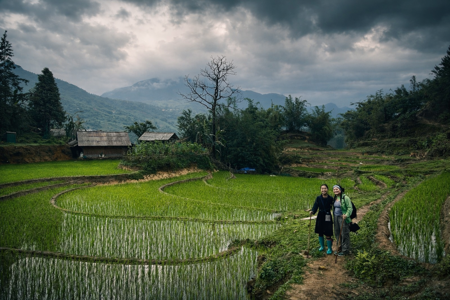
Trekkers experience the Sapa landscape while on an ETHOS experience. Photo: Scott Harbin